In the Adirondacks, spring is a tricky time of year to plan a backpacking trip. If you go too early. usually before May, lingering snow can leave unfavorable conditions. After the snow finally melts, mud season conditions leave the trails soupy. Wait too long, black flies harass you endlessly. Usually there is a brief window between the mud and black fly seasons. I hoped to find that window and put in a short backpacking trip during that time.
I chose the Lake George Wild Forest as my destination. I never visited the mountains surrounding Lake George. The photos of the area seem quite pretty with plenty of lake and mountain views. I always enjoy mountains that overlook bodies of water. There are numerous places within the mountains there that I wanted to visit. A good trail network allows the option to link together many of these highlights on the east side of the lake. Since more time than I wanted had passed since my last backpacking trip, I decided to put together a n overnight loop that visited many of the destinations I wanted to see on this side of Lake George.
 |
| Trail register |
Looking over my map of the Lake George area, I put together a loop just over 30 miles that visited, or passed nearby, many of the highlights of the region. My loop went over Black, Sleeping Beauty, and Shelving Rock Mountains, all which have views over Lake George. Buck Mountain, also known for its lake views, could be reached by a five mile roundtrip spur off of my loop. Shelving Rock Falls is easily reached from my loop. Several small backcountry lakes and ponds provided camping opportunities. Finally, I could also visit Erebus Mountain, one of the highest in the area. It isn't known for great views, but I could visit without diverging much from my loop.
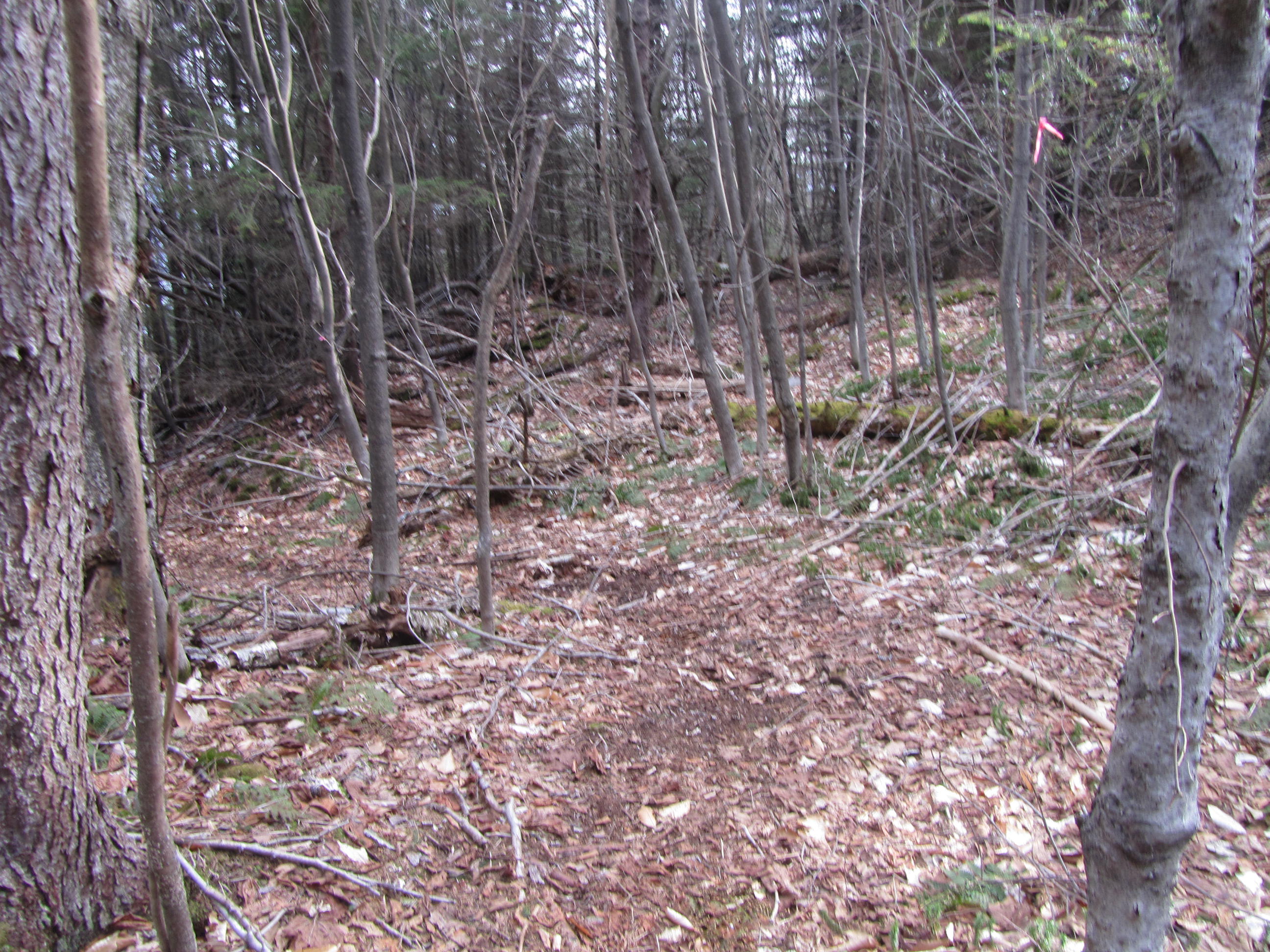
The forecast looked promising for May 5th and 6th, so I planned my trip for then. My hike began at the Pike Brook Trailhead below Black Mountain. I started my hike around 920AM on a lovely, cloudless morning . Despite being a fairly popular trailhead, no other cars were there when I arrived. The trail climbs fairly gradually as it makes its way toward Black Mountain, just 2.5 miles from the trailhead. At 2,665', Black Mountain was the high point of the trip as well as the highest mountain in the Lake George area. Although rocky at times, the trail is never too difficult. There was even a very small patch of lingering snow above 2,500'. An old firetower, now serving as a communications tower, stands at the summit as well as a small wind generator.
 |
| Trailhead sign |
 |
| Notice the lack of leaves this time of year |
 |
| Rocky stretch of trail |
 |
| First red eft of the season |
 |
| On my way to Black Mountain |
 |
| It rained the day before |
 |
| The last small pocket of snow |
 |
| Tower and wind turbine at Black's summit |
As promised, Black Mountain offered great views. A couple of open ledges provide a nice overlook to the east to the Green Mountains of Vermont. Most of northern end of Lake George can be seen from the higher outcropping. In the distance, I could still see lingering snow in the High Peaks.
 |
| View from ledge just below the summit |
 |
| Looking across a cliff near the summit |
 |
| Looking toward the High Peaks |
 |
Sugarloaf is the knob in the middle with
the Green Mountains of Vermont in the distance |
 |
| North end of Lake George |
The trail descended toward the south. Along the way I passed a couple more ledges with views. I got a good look to the south over the lake. At one point the view looks down onto the Black Mountain Ponds. Just a few hundred vertical feet above the ponds, I could hear the chorus of peepers from the ponds.
 |
| Just below Black Mountain |
 |
| Looking south over the lake |
 |
| Erebus Mountain |
 |
| Trailside cliffs |
 |
| Black Mountain Ponds |
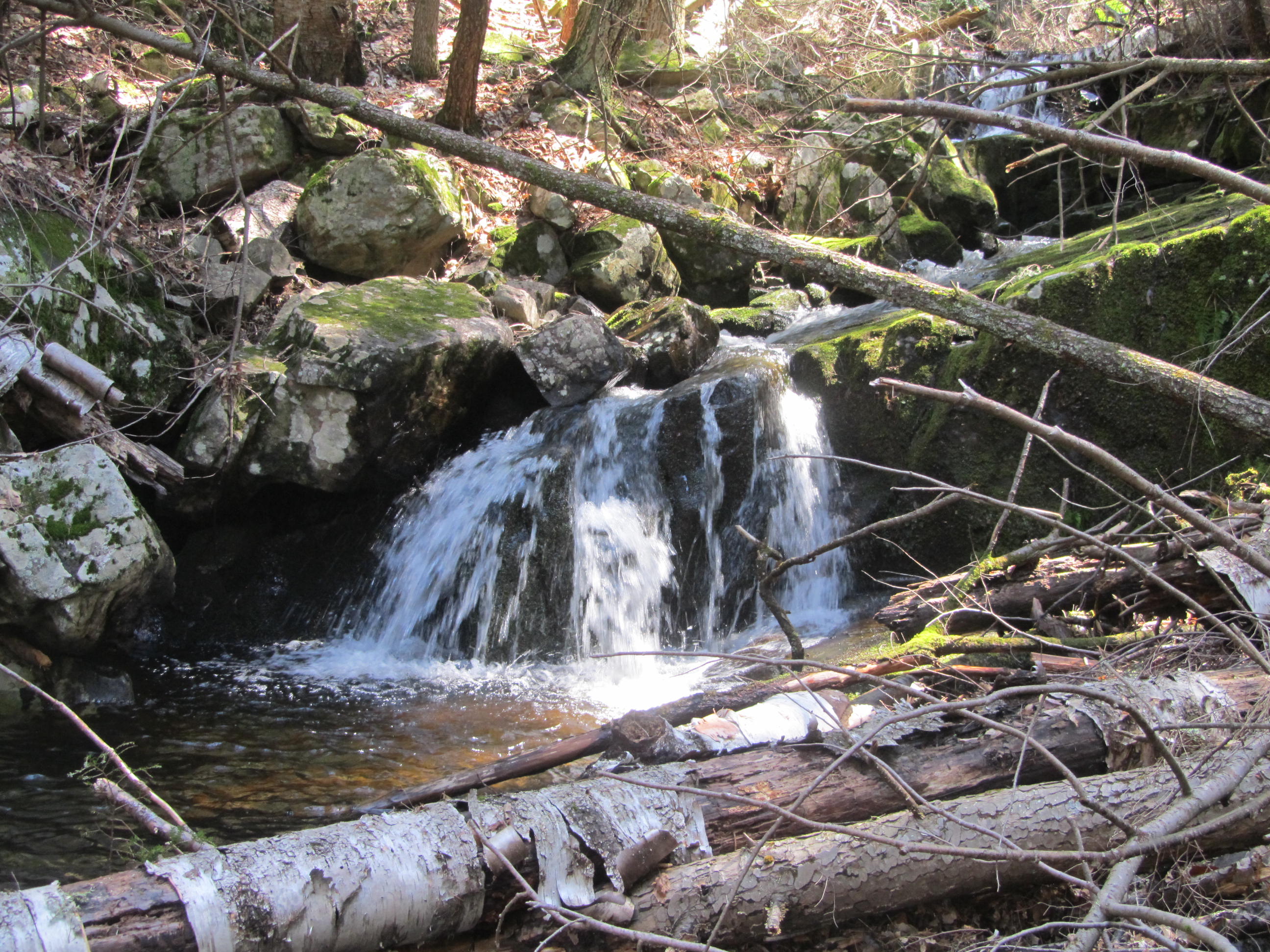
I reached a T. Left headed toward Black Mountain Ponds and a popular loop option for those hiking Black Mountain. Right descended to Lake George at Black Mountain Point. I headed toward Black Mountain Point. It became clear pretty that few people visited this trail. A fair amount of blowdown covered the trail. None of it was too thick fortunately. The trail drops some 2,300' in elevation from the summit of Black to the lake in less than three miles. The trail never really seems steep however. A small creek tumbles down the mountain close to the trail with numerous small cascades. I wandered off the trail several times to get a better look at the scenic, tumbling water, just out of sight from the trail.
 |
| Fair amount of blowdown |
 |
One of many little cascades on the
descent toward Black Mountain Point |
 |
| Little drop with two ribbons of water |
 |
| This stream was full of pretty little cascades |
 |
| I wandered off trail checking out the various falls |
 |
| Most were just out of sight from the trail |
 |
| I don't think many people explore this area |
 |
One last drop before the trail veered
away from the stream |
 |
| Hiking through conifers |
I soon reached Lake George. At roughly 320', this was the low point of the trip. For the next three miles, I would hike along the shoreline of the lake. Despite a nice wide path that runs essentially flat in this section, I'm not sure many hikers travel the length of the Lake Shore Trail. There isn't easy access by land. majority of the people that visit this area do by boat.
 |
| Lake George at Black Mountain Point |
 |
| Looking north from Black Mountain Point |
 |
| Looking south |
 |
| Tongue Range |
I reached the lake at Black Mountain Point. Black Mountain Point appears to be a day use picnic area for boaters on the lake. On a Thursday morning, early in the season, the place was abandoned. Pretty views up and down the lake can be seen from Black Mountain Point. As I hiked down the shoreline, I passed several tent platforms and campsites. I think these are by reservation and used mostly by boaters. There were no signs of life as I passed. The trail never ventures far from the lake and I passed a couple more picnic areas including Red Rock Bay and Commission Point. Other than one distant boat, I saw no other people along the Lake Shore Trail. Even though it's basically a carriage road, the frequent views over the lake made for a very pleasant hike.
 |
| Gentle trail along the lake |
 |
| It followed the lake about three miles |
 |
| Another clearing along the lake |
 |
| Tongue Range |
 |
| Black Mountain from a lakeside campsite |
 |
| An isolated cove along Lake George |
 |
| More mountain views |
 |
| Picnic area at Commission Point |
 |
| View at Commission Point |
 |
| The Tongue Range rising above an island |
After three miles I turned off the Lake Shore Trail and headed toward Shelving Rock Mountain. This trail must be taken to avoid crossing onto private property. I'm guessing by its condition, this trail sees little traffic. There is a fair amount of blowdown, at times quite thick. The blowdown was relatively short lived lasting less than a mile, ending by the next junction. I passed a couple of marked junctions before reaching the trail to Shelving Rock Mountain.
 |
| Turnoff from the Lake Shore Trail |
 |
| Thick blowdown |
Shelving Rock Mountain was reached by a short .6 mile spur off of my loop. The trail to the mountain follows another old carriage road as it winds its way to the summit. The 1,130' summit offers only partial views through the trees. Following the herd path beyond the summit leads a few hundred yards downhill to an open outcropping with excellent views to the west over Lake George.
 |
| Carriage road toward Shelving Rock Mountain |
 |
| Clearing just below Shelving Rock's summit |
 |
| Looking down the lake |
 |
| Looking toward Bolton Landing |
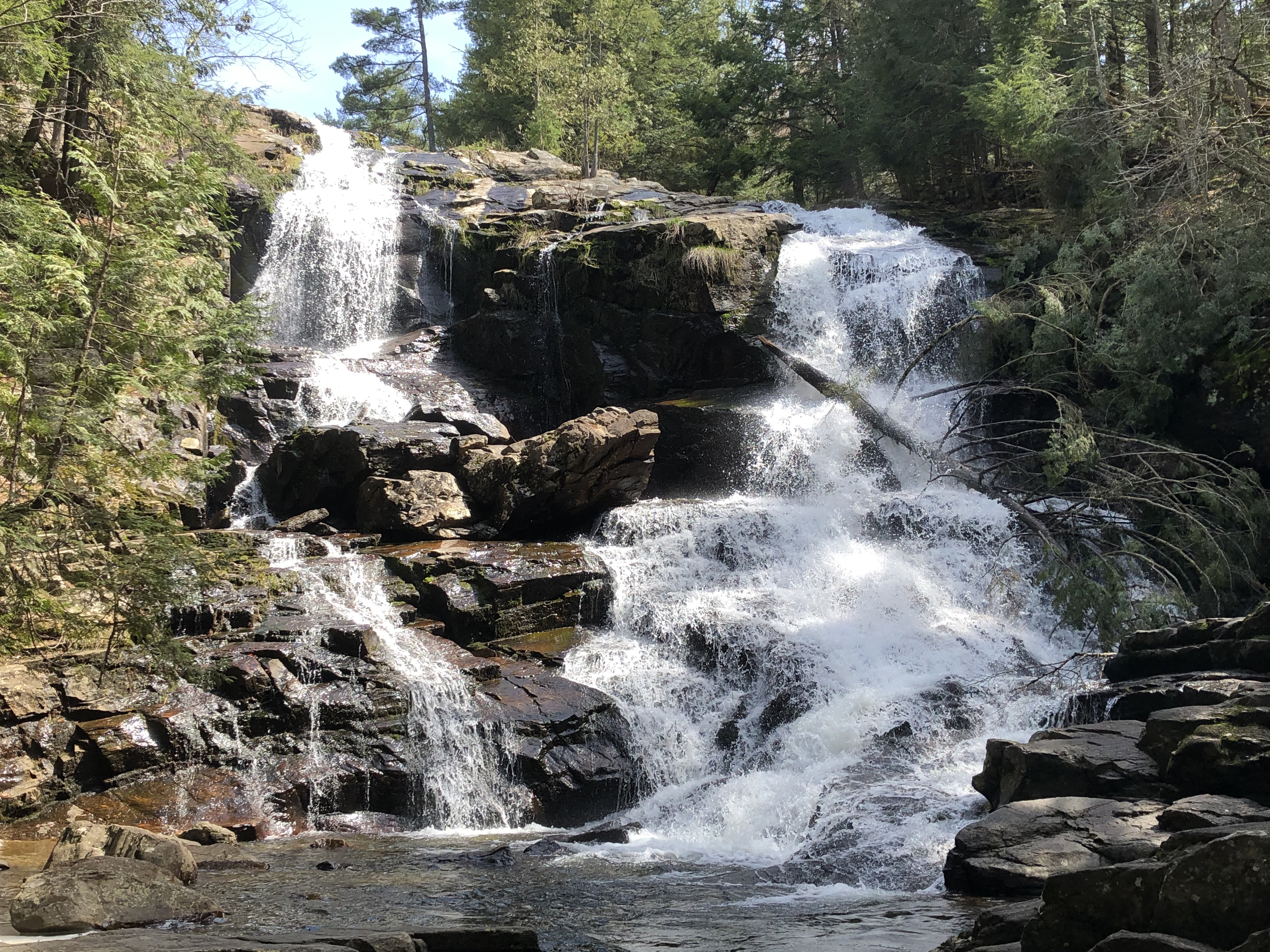
After enjoying the views, I returned back down the carriage road, following it to Shelving Rock Road. I followed the road a few hundred feet and turned onto a wide trail that led to Shelving Rock Falls. I saw photos of Shelving Rock Falls that looked impressive. I could hear the falls before I reached them.
Shelving Rock Falls exceeded my expectations. The falls were higher than I expected and flowing with a lot of water volume. Most sources list it at 50 foot tall, but it looks larger. I followed a path to the bottom of the falls to get a full view of it and take a few photos. The trail I came in on ended at the top of the falls with no obvious place to cross to the trail on the other side.
 |
| Shelving Rock Falls |
I returned back to the road for a short distance before rejoining a trail that headed toward Dacy Clearing. Although I eventually would end up at Dacy Clearing, I wanted to take a side trip to Buck Mountain. I could have reached Buck Mountain more directly by walking on Shelving Rock Road, but took the less direct route by hiking on the Big Bridges, Shortway, and Old Farm Trails.
I'm glad I avoided the road because the scenery along the trails ended up being rather scenic. The Big Bridges Trail and part of the Shortway Trail followed a nice mountain stream with several rocky riffles and a few waterfalls. I saw my first snake of the season along the water, a garter snake basking in the sun. I saw the first other people of the day about 12 miles into my trip on the Big Bridges Trail. The Old Farm Trail brought me back to Shelving Rock Road with a half-mile or so road walk to the start of the climb for Buck Mountain.
 |
Hiking along Shelving Rock Brook on
the Big Bridges Trail |
 |
| Shelving Rock Brook |
 |
This waterfall was a short bushwhack off
the Short Way Trail. I followed the sound. |
 |
Old Farm Road Trail, notice the lack of
leaves in early May |
Buck Mountain was reached from a spur off my main loop. Since I have never been to this area, I wanted to incorporate it into my hike. It's said to have good views. Buck Mountain is roughly 2.5 miles (distance varies depending on map or sign by a couple tenths of a mile) trail from Shelving Rock Road. The trail never seems to difficult as it gains 1100' in elevation over its length.
 |
| The start of my hike of Buck Mountain |
 |
| Open forest |
Buck Mountain's2,334' summit provides more nice views over the lake. Although not as wide open as the perch below Shelving Rock Mountain, the view took in more area with multiple view points. The middle of the lake toward the Bolton dominates the view from the main outcropping. A smaller outcropping, a short distance north of summit, gives a neat prospective of the Tongue Range and the Narrows on the lake.
 |
| The main viewing area on Buck Mountain |
 |
| Looking over the Tongue Range and the Narrows |
 |
| Montcalm Point off the Tongue |
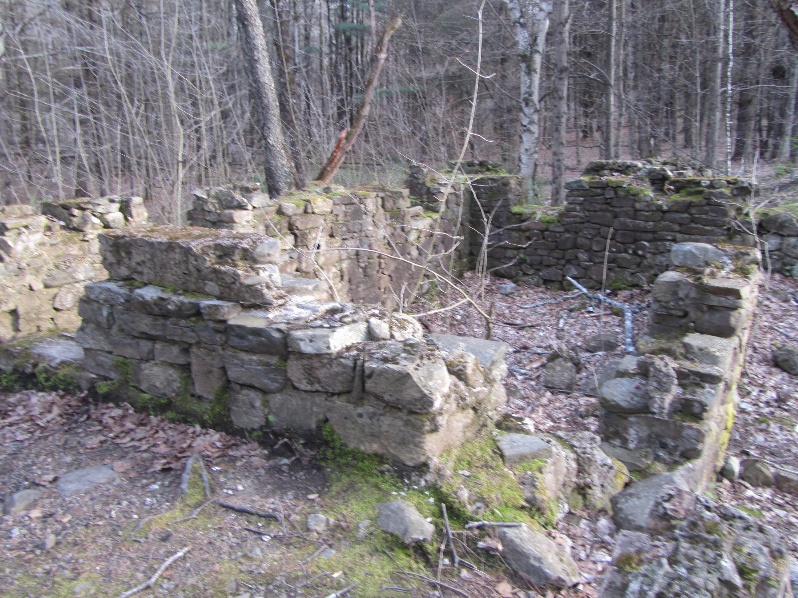
By the time I time I departed Buck Mountain, it was around 5PM. I was hoping to reach Bump Pond, 6-7 miles away. I ate a quick snack and retraced my way back to Shelving Rock Road. Originally I planned taking the Buck Mountain Connector Trail toward Dacy Clearing. Other than one marker, I didn't see any discernable tread or trail to follow. Rather than bushwhack to save a few tenths of a mile, I just followed Shelving Rock Road to the turnoff toward Dacy Clearing. The route to Dacy Clearing followed a narrow dirt lane past several campsites. Eventually it traveled passed a small stream with old remnants of the Dacy Farm. An old dam and foundations stood along the road before Dacy Clearing. From the Buck Mountain trailhead to Dacy Clearing, I traveled a between 1.5-2 miles on a dirt road, but never saw a vehicle.
 |
| Hiking the road to Dacy Clearing |
 |
| Old foundation along the road |
At Dacy Clearing, I began my climb to Sleeping Beauty Mountain. The trail to Sleeping Beauty climbs relatively gradually with some rocky sections. At times it travels under cliffs. By now the light was fading in the cover of the trees and thin clouds moving in the area. I reached the clearing near the summit of Sleeping Beauty around 720PM.
 |
| Dacy Clearing |
Like Black and Buck Mountains, 2,347' Sleeping Beauty is another mountain near Lake George known for its views. The scenery didn't disappoint. The vantage from Sleeping Beauty looks into most directions. The Green Mountains stretch out to the east. Buck Mountain stands out to the south. Endless mountains make up the western horizon, with the Lake George in the foreground. This view was further enhanced by the evening light and thin clouds.
 |
| Climbing toward Sleeping Beauty Mountain |
 |
| Looking down the ledges on Sleeping Beauty |
 |
| The Green Mountains of Vermont in the distance |
 |
| Lake George from Sleeping Beauty |
 |
| Clouds moving in over the lake |
 |
| Cliffs along Sleeping Beauty |
It was nearly 730PM when I left Sleeping Beauty. I only had about a mile to travel to Bumps Pond where I intended to camp. Sunset was after 8PM, so I figured I'd be okay reaching my destination. By 750PM I reached the pond and soon found the designated campsite after a 24+ mile day. I had enough light to finish all my evening camp chores, but ended up eating in the dark. While filtering my water in fading light, I saw a shooting star over the pond. I was serenaded by peepers for the evening.
 |
| Less than a mile left for the day |
The campsite at Bumps Pond sits just out of sight from the pond. The pond is the most southerly in a series of small backcountry ponds between Sleeping Beauty and the Black Mountain area. The pond sits relatively high in elevation for the area around 2,000', just 300' below Sleeping Beauty. An old rock chimney, once part of a hunting camp from many years ago, stands in the small clearing at the campsite.
 |
| Sleeping Beauty reflecting in Bumps Pond |
 |
| Old chimney from long gone hunting camp |
Shortly after laying down, I heard loud bang or gunshot. When it continued, I realized that I was hearing a nearby fireworks show. I was camped in a bowl surrounded by forest and had no view of the show however. After the fireworks I slept soundly. Thin clouds kept the temperature from dropping too low, but it was probably in the upper 30sF overnight.
 |
| Home for the night |
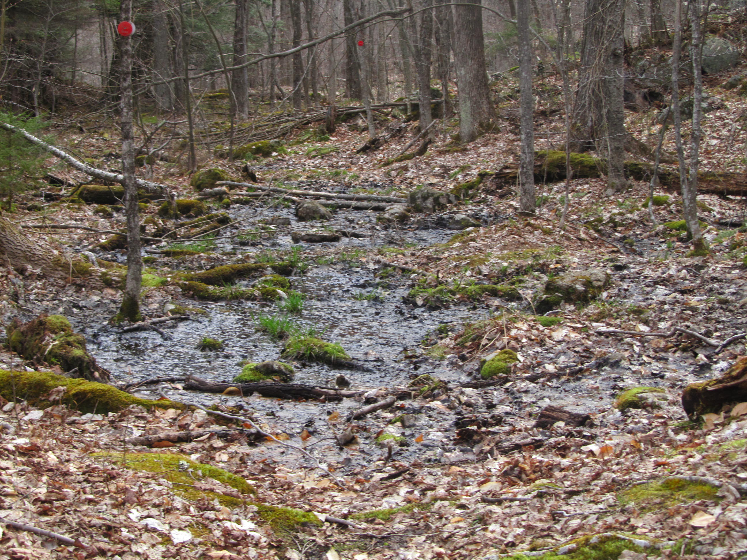
I woke up with the morning light and slowly got moving. After eating and breaking camp, I returned to the trail about 715AM. I began climbing toward Erebus Mountain. Although not known for its views, I wanted to hike deeper into the forest and visit one last mountain. The terrain rolled before finally making its way along the side of Erebus. Despite the leafless trees, the trail passed through pretty terrain as it worked its way around some boggy areas. Luckily it was still a little early for bugs. In another month, this area looked like it would be prime mosquito habitat.
 |
| My next destination |
 |
| Partial views in the leafless forest |
 |
I'm guessing this area would be thick
with mosquitos a month after my hike |
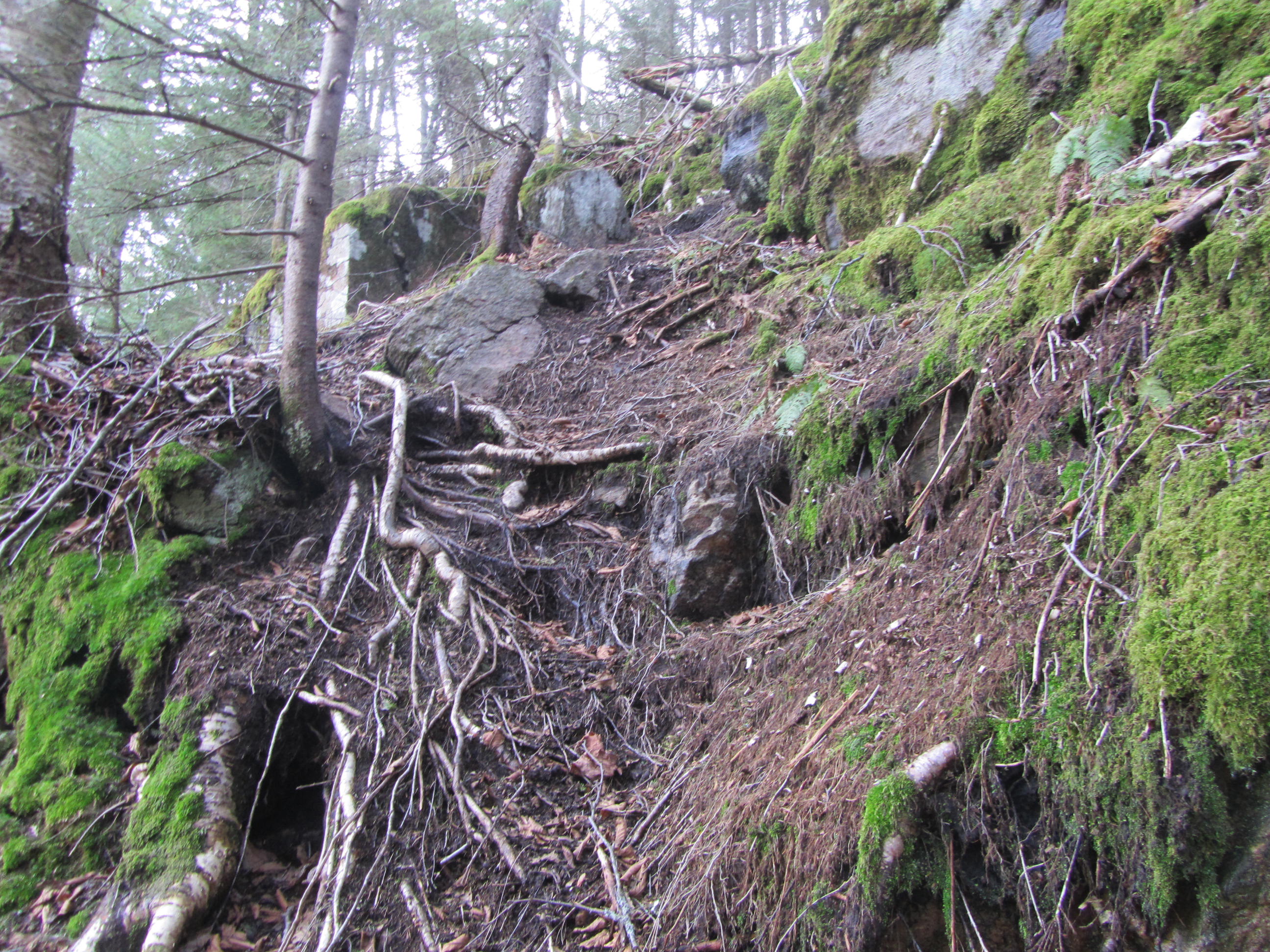
The trail doesn't pass over the summit of Erebus. A small cairn at the trail's highpoint marked the beginning of a faint herd path that worked its way to the summit. The herd path wasn't very well worn, but occasional flagging marks the way as well. The herd path gains a couple hundred feet through mostly hardwood forest and passes through a cliff band before reaching the 2,527' summit. Even with no leaves, the view was extremely limited. A small cairn marks the actual summit. My diversion to Erebus took about 20 minutes round trip.
 |
| Cairn marking herd path to Erebus |
 |
I think this sign marks the point you need to hike to on
Erebus to qualify for the Lake George 12ster hiking challenge |
 |
| Rough section enroute to Erebus |
 |
| The herd path wasn't always visible |
 |
| A faint tread on the herd path |
 |
The summit cairn, the canteen was already there
|
 |
| Red eft |
Back on the actual trail, I had a few peeks through the forest of Lake George and Black Mountain as I descended toward Fishbrook Pond. Fishbrook Pond is the largest of the backcountry ponds on my route and probably the most scenic. Trails go all around the pond but I stuck to the northern end. The trail often travels a few feet from the shore. Erebus Mountain rises above the pond, providing a nice backdrop. A couple of lean-tos sit along the lake and would make for a pleasant spot to spend a night. I also saw a bald eagle flying around the area as well.
 |
| Black Mountain visible through the trees |
 |
| Swampy trail |
 |
| Passing a boggy section |
 |
| First glimpse of Fishbrook Pond |
 |
| Hiking along the pond |
 |
| Erebus rising above the pond |
 |
| One of the lean-tos along Fishbrook Pond |
 |
| View from the lean-to |
 |
| Last look at the pond |
From Fishbrook Pond, the trail passes a web of trails. A snowmobile trail veers off the hiking trail. A separate marked, but unsigned trail, heads to Greenland Pond. Following the DEC markers to the left will keep you traveling north toward Millman Pond.
I continued north. I reached Millman Pond after a mile or so. Millman also offers a lean-to. A boardwalk allows you to travel out onto Millman Pond, but it was partially submerged at places. The trail travels along its shore before following its pretty outlet stream.
 |
| Trail following Millman Pond's shore |
 |
| Boardwalk to Millman Pond |
 |
| Near Millman Pond's outlet |
My next destination was Lapland Pond. The trail doesn't travel as close to Lapland as the other ponds in this stretch. It could be seen through the trees, but only with obstructed views. At a small stream crossing, I saw a faint path that led toward to the pond. The path ended at an official campsite that sat right on the shore of the pond. This would be a nice spot to camp. As I hiked away from the pond, I passed a junction that lead to a lean-to by the pond. It's also possible to visit the Black Mountain Ponds at a signed junction in this stretch.
 |
| Pretty cascade |
 |
| Thick forest ahead |
 |
| Lapland Pond |
 |
| This photo is from the tentsite right along the pond |
From Lapland Pond, I needed to travel about two more miles to my starting trailhead over easy terrain. I passed one last pond, an unnamed beaver pond with a nice view of Black Mountain. About a mile from Lapland Pond, I rejoined the trail that heads to Black Mountain. On a clear, comfortable morning, I passed a few groups headed toward Black. The last mile went by quickly. I reached the trailhead about 1015AM.
 |
| Cruising through the forest |
 |
| Small beaver pond |
 |
| Back into the open coniferous forest |
 |
| Bridge over beaver pond outlet |
 |
| Black Mountain reflecting in a beaver pond |
 |
| Last 1.2 miles |
My route, including side trips, totaled about 32.5 miles. Despite the modest elevations ranging between 300' and 2,600', my route managed to gain more than 7,800' of elevation. While there was a moderate amount of elevation gain, the trails were never too steep for very long compared to other parts of Adirondacks. A couple miles of this loop involved travel on dirt roads to add the side trip to Buck Mountain. Eliminating Buck Mountain would get rid of majority of the dirt roads.
Overall, I enjoyed this trip. Even though the mountains aren't anywhere near the highest in the Adirondacks, there was no shortage of views and nice scenery. I enjoyed my time hiking along Lake George. Even though Shelving Rock Falls outshined the other small cascades on the route, I found the tumbling mountain streams to be quite pretty. The smaller backcountry ponds on the latter part of my hike provided a nice wilderness feel. My timing worked out as far as avoiding bugs. I only had black flies bother me at one spot. Hiking before the summer tourist season and avoiding the weekend allowed me to have the forest almost to myself. I didn't see anyone for the first 12 miles. Even then the few people I saw were mostly near the higher mountains. I hope to travel back to the Lake George area to hike the Tongue Range in the future.
 |
My route highlighted in yellow
Click DEC Map for more detail
|
 |
| View from Sleeping Beauty |
If you enjoyed this post, check out and "LIKE" Tomcat's Outdoor Adventures on
Facebook where I post photos more often and revisit past adventures.


Awesome! Thank you!
ReplyDeleteThanks for reading. Glad you enjoyed.
DeleteYes, you really did a nice job documenting your hike. I will be doing the back country ponds in mid April. Your blog is a big help!
ReplyDelete