Over the past few years I have written about the backpacking trails in Pennsylvania. Although the state doesn't get much attention outside of the region as a backpacking destination, the state forests of Pennsylvania contain quite a few backpacking routes. Since moving back to the East, I enjoyed backpacking trips on the Loyalsock, Susquehannock, and Black Forest Trails. (You can read about these trips on this website by visiting the
Backpacking Page) Next on my radar was the Quehanna Trail (QT).
 |
| QT sign near a road crossing |
While not well known outside of the Pennsylvania backpacking scene, the QT travels over 70 miles on a loop through the Elk and Moshannon State Forests. Located in a part of the state known as the Pennsylvania Wilds, the area is among the most remote in the state. Much of its route it passes through the nearly 50,000 acre Quehanna Wild area, the largest Wild Area in the state. The trail sees relatively little traffic in a wildlife dense area. Besides the usual Pennsylvania wildlife, this region provides the opportunity to spot a wild elk.
I planned on hiking the QT on Memorial Day Week, but temperatures in the 90sF made that look less appealing. I finally settled on the week of June 13th. As the days drew closer, the forecast looked less desirable. The chance of rain increased and temperatures looked like they would be approaching the 90s again. Nonetheless, I decided to hike the QT starting June 13th.
Hikers typically begin a hike of the QT at Parker Dam State Park on the western end of the loop. Due to the remote nature of the QT and windy back roads that navigate the region, I chose to begin my hike on Wykoff Run Road. This saved me nearly an hour of driving time. Since the QT forms a loop, it wasn't essential I started at Parker Dam.
 |
| My starting/ending point |
A trail guide is available for the QT that comes with maps. Purple Lizard also makes a map of the area. I chose to navigate with the Pennsylvania Department of Conservation and Natural Resources (DCNR) map of the trail. This map is provided free by the DCNR and can be found at most major trailheads along the trail. I called the offices of Moshannon State Forest and they mailed me one before my hike. The DCNR map appears to be a well made topo map with everything you need to know for backcountry travel. This map doesn't contain turn by turn instructions or show camping spots. It does show the QT as well as any other trail you will encounter, roads of all sizes, water, and some mileages. This map seems to include any recent reroutes as of my hike. The mileage according to this map puts the QT at 71.0 miles. I had no problem determining my location or estimating distance with the DCNR map. The trail enroute is well marked with orange blazes. I never had difficulty following the trail, although some sections were brushy with thin tread. Other sources show the trail as long as 75 miles. The DCNR mileage seemed pretty accurate. If you are using another source than the DCNR map, mileages may slightly vary from my descriptions.
 |
| Orange blazes mark the route |
Day 1
Wykoff Run Road to Mix Run
14.6 Miles
Due to the long drive from the Adirondacks, I didn't begin my hike until around 2PM. My trip began climbing along Laurel Draft. (Draft appears to be a regional name for a small creek in the area.) My trailhead sat at roughly 1,100' (low point of the trail) in elevation and eventually climbed to nearly 2,000' as it slowly made its way along Laurel Draft. Near the draft, I passed through sections of trail that were heavily encroached by ferns and some parts with stinging nettle. The tumbling waters of the draft provide a soothing sound in the background. Occasionally the trail will follow the banks of the draft, at other times drafts are hidden by the dense brush. After a mile or two, the trail leaves the draft and crests on the Plateau where you pass through hardwood forests, mountain laurel, and the occasional open meadow.
 |
| The first stretch of mountain laurel |
 |
| Rock feature along the trail |
 |
| The trail skirting a clearing |
The geography of the area doesn't really have mountains. The Allegheny Plateau sits at roughly 2,000' in elevation. Over time, water has dissected the plateau, carving out ravines and hollows. At times, this results in a gentle hollow, other times larger streams cut small gorges with steep 1,000' changes in elevation. Hiking along the QT you transition between the Allegheny Plateau with long sections of relatively level walking and the dissections carved out by creeks and streams of varying sizes.
 |
| Ferns are a common sight |
 |
| Mostly grown over Little Fork Vista |
 |
| Ruins of an old structure |
 |
| Nice open forest |
 |
| Clearings like this were fairly common |
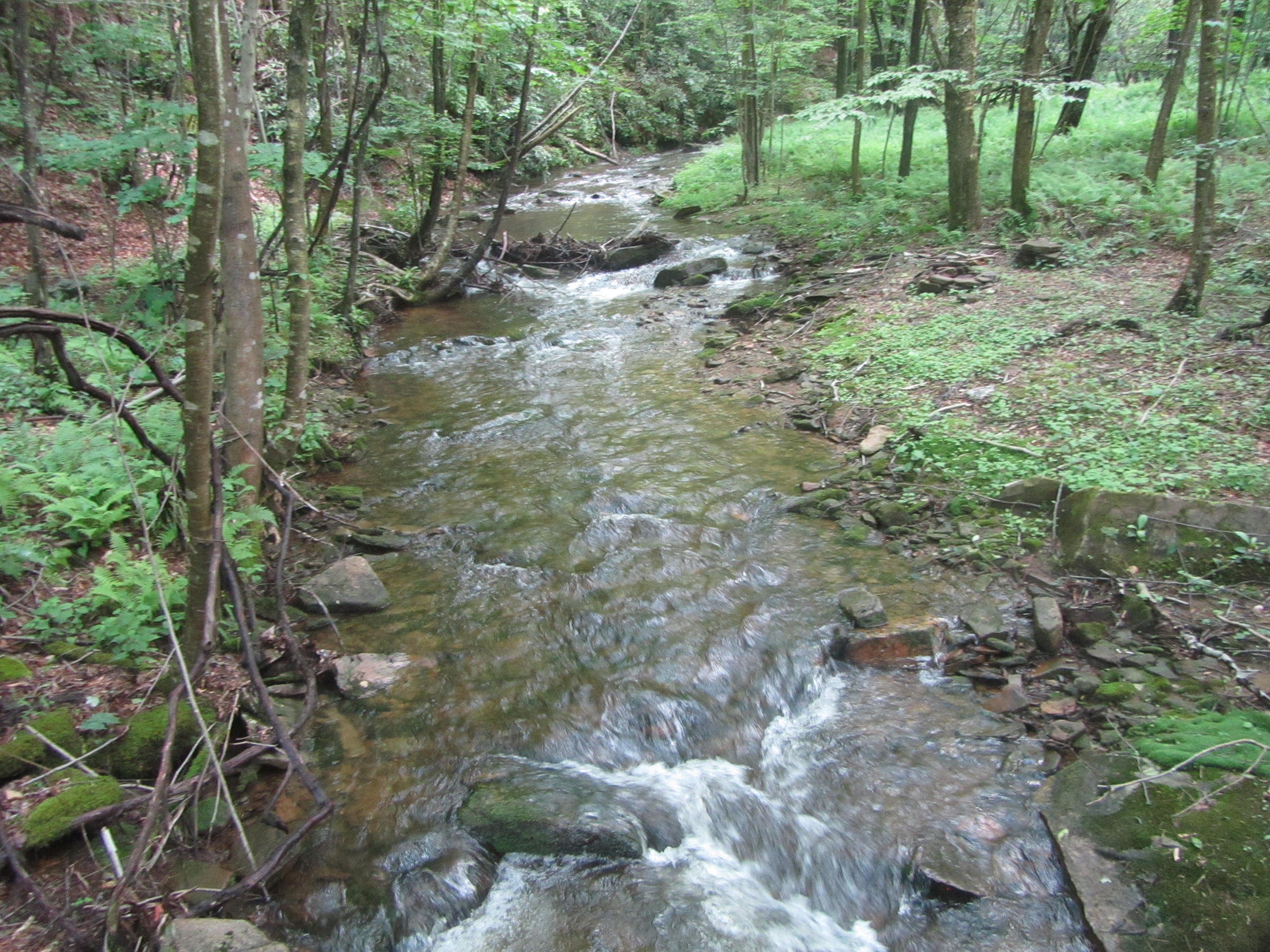
Once on the Plateau, the mileage seems to pass by quickly with little change in elevation. Sure enough the level hiking came to an end when I reached Sanders Draft. The trail along Sanders Draft seemed to have a little less vegetation than Laurel Draft and perhaps a little steeper and rockier. Several small waterfalls tumbled along the trail.
 |
| Sanders Draft |
 |
| The sound of the water made the hiking pleasant |
 |
| Small cascade into a deep pool |
 |
| Bridge over Sanders Draft |
I traveled the first 7-8 miles fairly quickly. As is common on Pennsylvania State Forest trails, the trail crosses a few small dirt roads and pipeline swaths. My first real challenge came after crossing Red Run Road.
 |
Gas pipeline clearings are a common sight
in Pennsylvania |
 |
| Dense vegetation along the trail |
 |
Despite the damp forest, I
didn't see that many fungi
|
The trail climbs its way through Porcupine Draft after the road crossing. The first couple drafts that the trail followed were dominated by ferns as ground cover. Porcupine Draft featured stinging nettle as the dominate vegetation. The easy solution to combat stinging nettle is to cover your legs. My past experience in the region with stinging nettle is that it's fairly localized and doesn't last too long. I just deal with the discomfort for a few minutes. This patch of stinging nettle lasted for much longer that I have encountered before. I don't know if everyone's reaction is the same, but for me, stinging nettle leave my legs frantically itch and burn for about 5-10 minutes after it rubs against me. Nothing relieves it until it just stops burning after a few minutes, but seems like an eternity.
 |
| Cascade on Porcupine Draft |
 |
| Stinging nettle crowding the trail still looks pretty |
 |
| Closeup look at stinging nettle |
Once I climbed through Porcupine Lick I regained the Plateau and cruised along at a good pace. The stinging nettle disappeared for the time being. For the most part, the QT stays in the forest with a open meadow thrown in every now and then. Occasionally the trail crosses a forest road or comes within view of a camp, but generally it's a pleasant walk in the woods.
 |
| The QT passing through a rocky stretch |
 |
House-sized rock covered in moss
along the trail |
I reached my first real viewpoint at the Deible Run Vista, about 13-14 miles into my trip. The view was fairly typical of the scenery in this part of Pennsylvania. Nothing spectacular, but a nice place to take a short break. The DCNR map shows the various vistas along the trail. Several of the marked vistas have become overgrown.
 |
| Deible Run Vista |
From the vista, the trail dropped fairly steeply a short distance to Deible Run to where it flows into the larger Mix Run. By this point, it was about 730PM and I was on the lookout for a place to camp. I had a list from an online source of possible campsites. Several options were listed along Mix Run. The first site I passed was well established, but I hoped to make it further up Mix Run. As I made my way along Mix Run, the options weren't looking to good. I saw plenty of flat spots near the run, but most were brushy and overgrown with no indication they were ever used as campsites. Finally around 8PM I reached a section along the run in a grove of pines that was flat and free of vegetation. My estimate put me at about 14.6 miles for the day, not too bad considering the late start.
 |
| Bridge over tributary of Mix Run |
Day 2
Mix Run- Alex Branch
22.4 Miles
I slept great my first night on the trail. I woke up about 530AM to a light rain and noticed some lightning and thunder. I wasn't quite ready to get moving. I decided to take down my food that was hanging from a tree so it didn't get too wet. Shortly after I got back into my tent the rain picked up. I decided to wait it out and dozed off. In the shelter of the valley, it still wasn't too bright with the cloud cover. Before long I snapped out of my slumber to the patter of heavy rain on my tent. In no hurry to get wet, I hunkered down. Unfortunately the rain only got heavier evolving into quite a downpour. The last forecast I saw predicted that the rain would break mid-morning. Finally, after three hours of what sounded like biblical rains in the tent, the precipitation let up some. I ate and packed everything besides my tent. By 915AM I made my break for it in a light drizzle.
Other than a couple sprinkles, the rain came to an end after I set out hiking for the day. Unfortunately I was still in for a wet morning. The trail traveled through brushy sections of mountain laurel that encroached the trail. Within minutes, I was soaked from the waste down. The morning saw some breaks in the clouds, but the saturated vegetation was very slow to dry in the humid air.
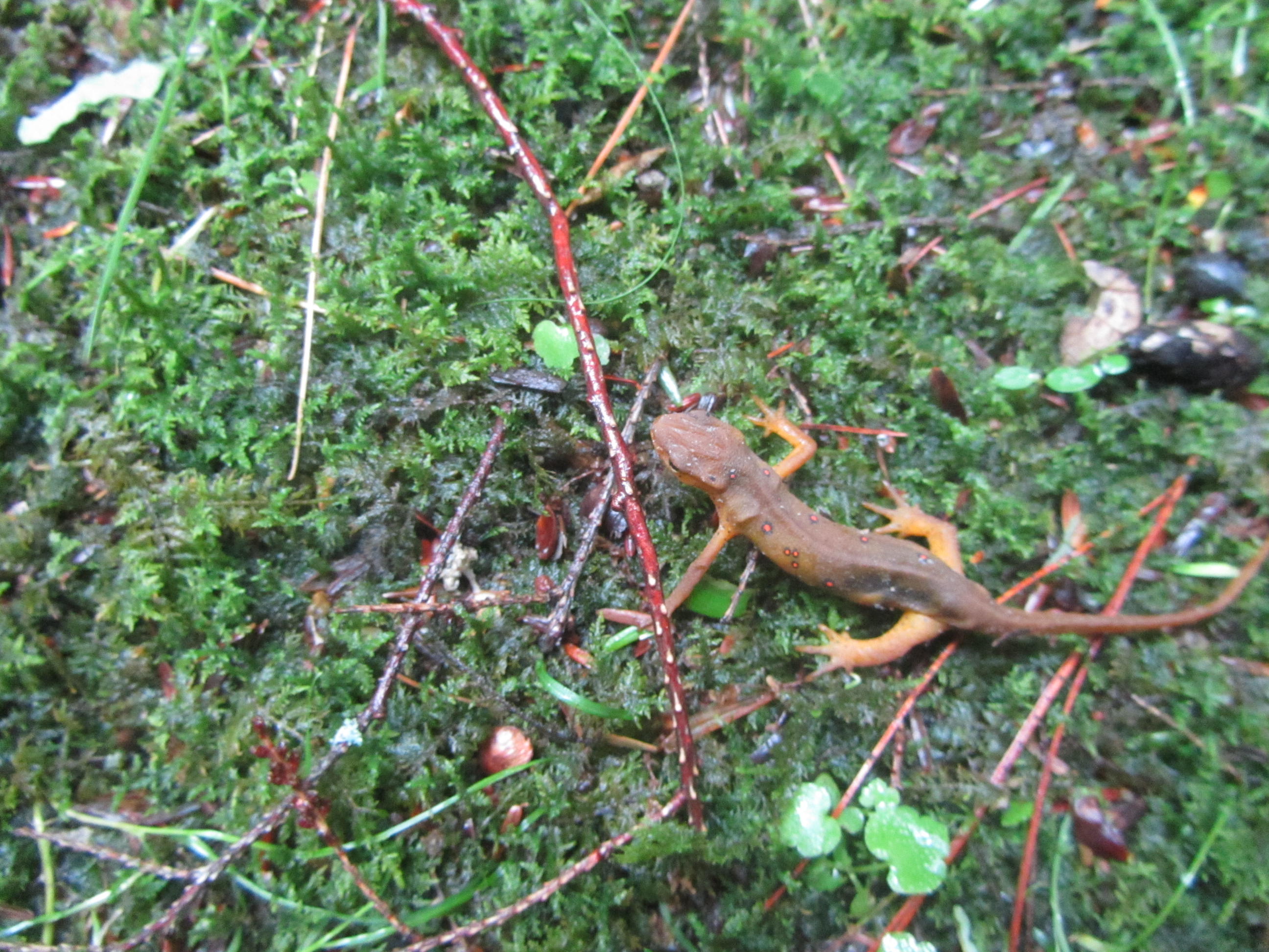
 |
This appears to be a newt between the red
eft and aquatic stages |
 |
| Mix Run |
For the most part, the next several miles away from Mix Run passed through a more open forest, so I didn't get much wetter. After about 6 miles into the day, I reached the Quehanna Highway. Here the trail navigates Sullivan Run. I encountered more stinging nettle. To add to the burning and itchiness of the nettle, I managed to get extra soaked from the wet vegetation.
 |
| Section of coniferous forest |
 |
| Ferns crowding the trail |
 |
| Moisture in the air from the morning rain |
 |
| The QT along an old grade |
Beyond the Quehanna Highway, the trail travels through a newer reroute. The original trail crossed Medix Run before climbing what is now the Bear Run Trail. The trail bridge over Medix Run washed out one two many times before the QT was rerouted to avoid the potentially dangerous crossing, now without a bridge. I heard good things about the old QT route and considered using that route. After the morning downpour, which I estimate to have been 1-2 inches of rain in a few hour period, I quickly abandoned the idea of fording the now swollen Medix Run.
The new QT reroute follows an old road and pipleline swath. It traversed waist high vegetation that was beyond saturated. Water sloshed out of my shoes with every step. On the bright side, the wet grasses cleaned the morning mud from my legs. I also encountered a turkey that scolded me as I passed by it.
 |
| The trail in waist high grasses that were soaked |
After a mile or so of this brushy route, the trail follows dirt roads a short distance to safely cross Medix Run on a solid vehicle bridge. Medix Run looked like chocolate milk and ran quite high and fast from the morning rain. It was a wise decision to skip the ford of it. Along the roads I encountered the first other hikers I had seen to that point, about 23 miles into my trip.
 |
| Site of an old CCC camp |
 |
| Medix Run |
Although I heard good things about the old QT route along Bear Run, I can't say I was disappointed with the reroute. The trail traveled along the Plateau through a long stretch of mountain laurel in its peak bloom. I found the new QT routing to be rather enjoyable.
 |
| Fern covered clearing |
 |
| Approaching a clearing along the Plateau |
 |
| Mountain laurel along the Plateau |
 |
| Mountain laurel flowers |
After the new old and new QT routes rejoin paths, another short dirt road walk follows Laurel Run. With the heavy morning rain, Laurel Run sounded angry. Listening to the rushing water makes the walking more enjoyable.
 |
| Junctions were well marked |
 |
| Road along Laurel Run |
After the short road walk, the trail reenters the woods along Saunders Run. The trail climbs away from the run and soon reaches Parker Dam State Park. Here the trail passes along the road by the park's campground. I saw a fair amount of people in the distance at their travel trailers and walking to the park's lake.
 |
| Bridge over Saunders Run |
 |
| Saunders Run |
 |
| The QT along the run |
 |
| I enjoy the mountain streams in PA |
It seems like the majority of QT thru hikers start and end their trip at the park. I made my way through the park as quickly as possible, eager to get back to solitude of the forest. From the state park, the trail seemed to take on a different feel than I had encountered to this point. I hiked the northern end of the loop so far, which seemed to have more frequent elevation changes between the Plateau and the various runs and drafts. The southern half of the loop seemed to stay along the Plateau longer stretches with only mild elevation changes. By now the sun overtook the morning clouds with temps hitting the upper 80s.
 |
| Approaching Parker Dam |
 |
| My foot next to large fungi for scale |
 |
| Kiosk at Parker Dam State Park |
 |
Log Slide from lumbering days
on display at Parker Dam State Park |
The last five miles of my day stayed along the Plateau for the most part. The elevation never changed much, even when it encountered a stream. Much of the trail passed through blooming mountain laurel. Despite my late start, the miles passed by quickly. I wrapped up my day before 7PM, covering 22 miles.
 |
| Back into the mountain laurel |
 |
The flowers held water from the morning
rain well into the afternoon |
 |
| Closeup of the flowers |
 |
| Muddy patch |
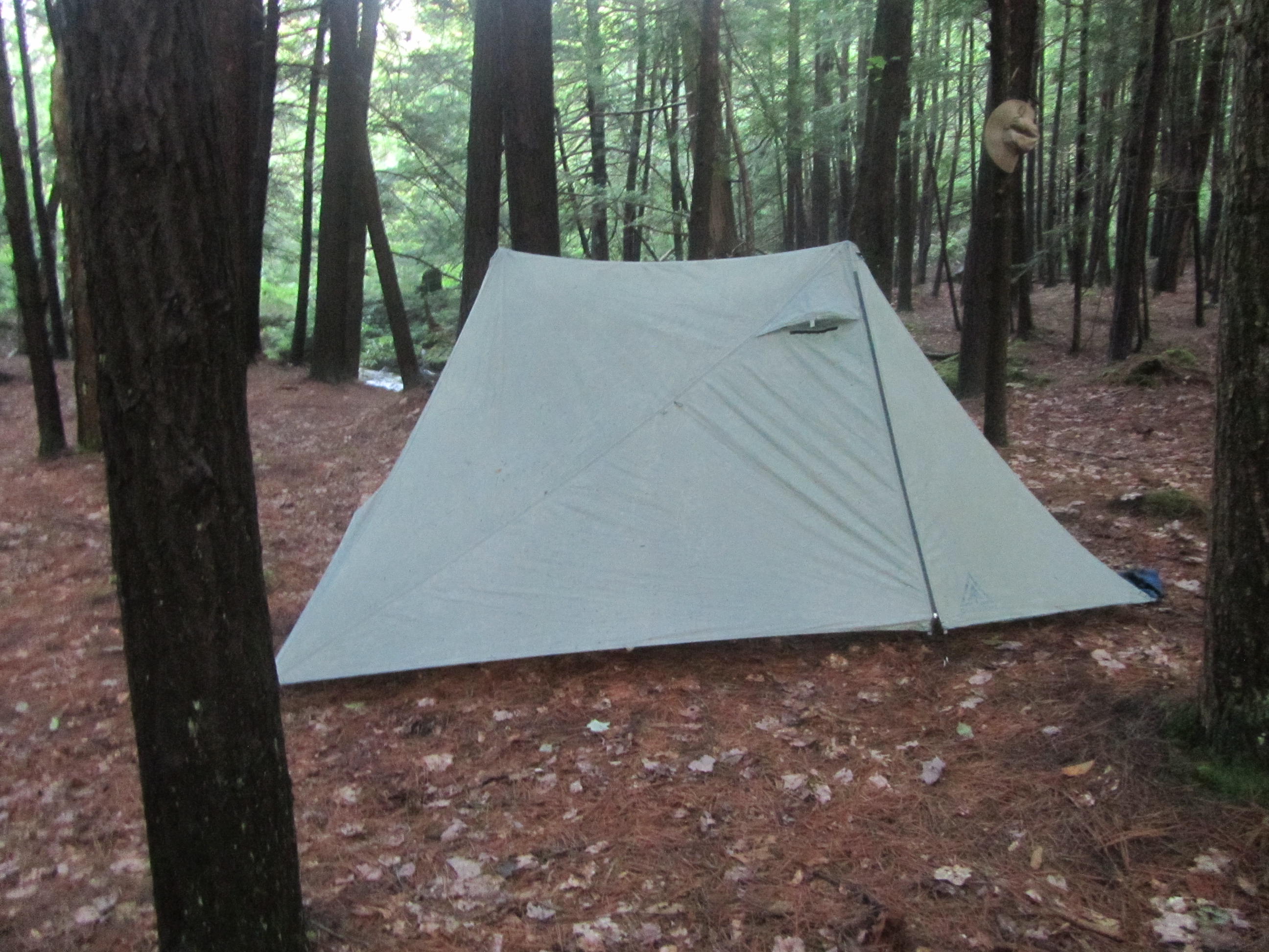
Similar to Mix Run, my information for Alex Branch showed the possibility of numerous campsites along the QT by the water. After passing the first well established site, I wasn't sure I'd pass another spot. Several sections of coniferous trees stood near the stream providing multiple spots to camp. I camped at the last established site along the creek before the QT turned away from it for good.
 |
| Beaver dam |
 |
| Pond above the dam |
 |
| Little Laurel Run |
I hoped to use the extra time I had at the campsite to dry out some of my gear from the morning rain and wet foliage. My tent fly managed to dry out in this time, but my shoes and socks needed more time. The air was quite humid from the rain in the morning. Steam rose from the wet ground around the creek well into the evening. I was worried I would wake up in a dense fog with more moisture, but fortunately it remained clear.
 |
| Fog rising from Alex Branch |
 |
| Alex Branch |
 |
| My tent by Alex Branch |
 |
The tumbling waters of Alex Branch
provided a nice background noise
to sleep by |
Day 3
Alex Branch- Wykoff Run Road
34.0 Miles
Alex Branch features numerous small cascades. With the high water level, its rushing waters were quite soothing and let me sleep well. I hit the trail for the day about 715AM. Although my shoes were still damp from the previous day, they dried out quickly with a pair of fresh socks. The southern half of the trail traveled along the Plateau with a lot less ground cover than the northern half. Although there was a fair amount of mountain laurel along the trail, the ferns weren't as thick and the stinging nettle was nearly nonexistent.
 |
| Open terrain on the Plateau |
 |
| Notice the flat terrain along the Plateau |
 |
| Brief rocky section |
 |
| Bridge over Trout Run |
 |
| Small cascade above the bridge |
Leaving Alex Branch, the QT quickly gained the height of the land close to 2,000' in elevation. When the trail did drop to a creek, it was usually never more than a couple hundred feet of elevation change. About 6 miles into the day, I reached the high point of the trail along Chestnut Ridge, roughly at 2,400’ in elevation. The trail passed through a good mix of terrain with some creekside walking, open meadows, and through blooming laurel thickets. There were even a couple of viewpoints.
 |
| Hiking along Roberts Run in the morning sun |
 |
| A lone garage-sized rock |
 |
| A meadow with a pond- I saw several deer near here |
 |
View near the trail's high point
on Chestnut Ridge |
Although there are occasional rocky stretches, generally the QT offers good footing over easy terrain that allows the miles to pass by with little effort while hiking on the Plateau. By early afternoon I had already hiked about 15 miles and felt pretty good. The only real challenge was the heat and humidity. Several days before I started my hike, the temperatures struggled to get out of the 50s back home. Each day on this hike topped 80 and this day was forecast to be close to 90. I kept hydrated and felt strong.
 |
| Pink mountain laurel |
 |
| Passing through the laurel tunnel |
 |
| I enjoy the fern covered open forests |
 |
| One of the few blowdowns on the entire trail |
 |
| Thick section of laurel |
 |
| Above an old logging dam on Gifford Run |
 |
| Bridge over Gifford Run |
 |
| A short section over rock |
 |
| The QT on Merrill Road for a short distance |
 |
| Hiking on a bed of moss |
Around the 15 mile point of the day I reached a QT landmark called Wildcat Rock with a plaque honoring a hunter. Here I ran into only the second set of hikers I saw in nearly 50 miles of travel on the QT. I talked to them a few minutes and they actually vacationed regularly close to where I live in the Adirondacks.
 |
| Ferns overtaking the trail |
 |
| Blueberries |
 |
| Interesting sign on the trail |
 |
| View along the Plateau |
 |
| I enjoyed the blooming laurel |
 |
| Another vista on the Plateau |
 |
| Wildcat Rock |
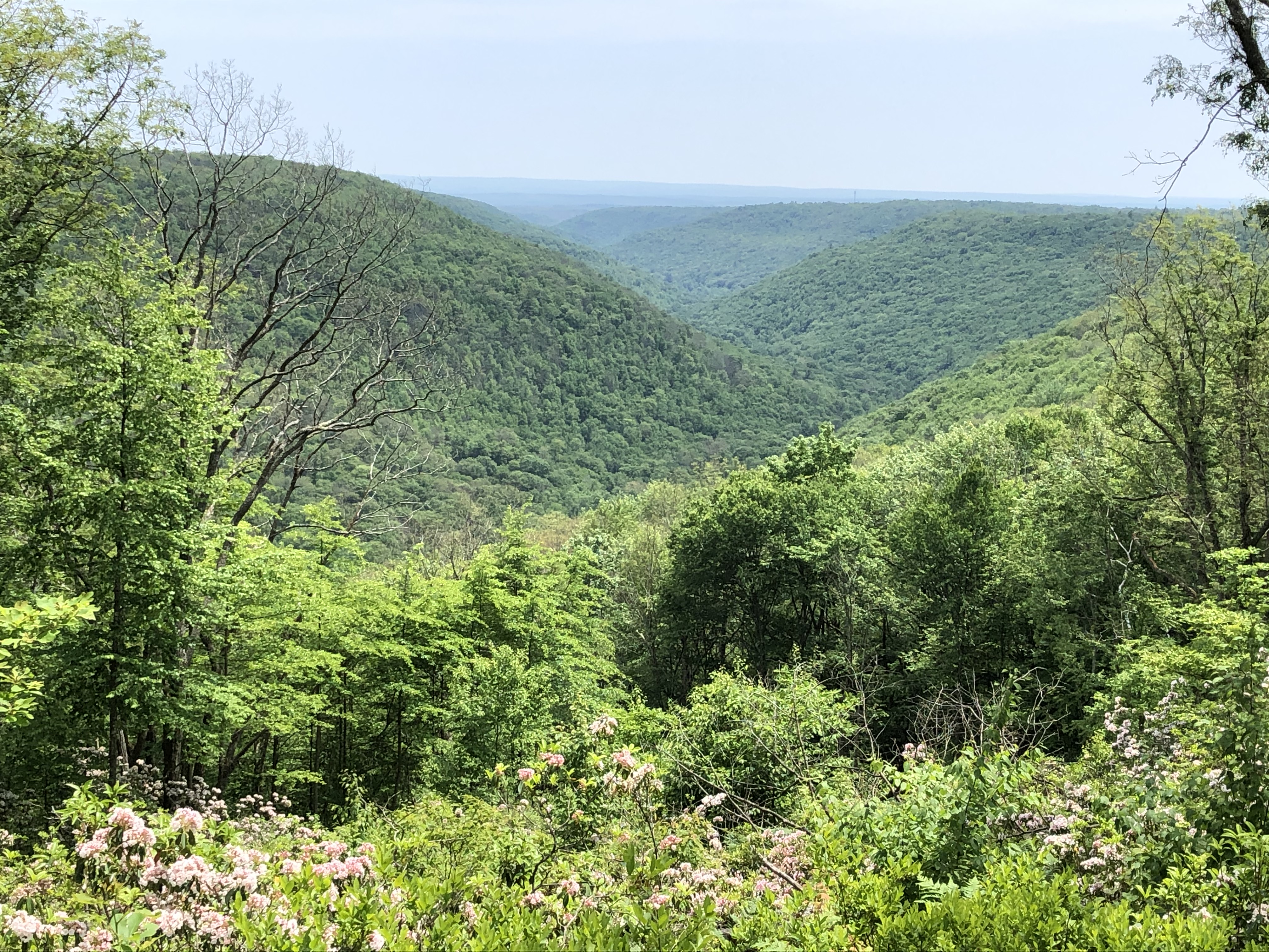
Shortly after Wildcat Rock the QT passes a powerline. Just beyond the powerline the QT reaches one of the best vistas on the trail. Beyond the vista, the map indicated several more viewpoints. The map makers were liberal with their definition of a view. I didn't pass anything else that I'd consider a view after this on the ridge. The other vistas on the map in this section were pretty grown over. After the good viewpoint, the trail left the Plateau. The QT descended, steeply at times, to Mosquito Creek.
 |
One of the best vistas on the QT, just past
Wildcat Rock, overlooking the
Mosquito Creek Valley |
Like Medix Run, Mosquito Creek has a reputation for washing away bridges. The last bridge built has since been lost to raging water. I was a little worried about the crossing with the recent heavy rain. As I reached the creek, the trail was blazed beyond the lost bridge, to a point upstream a short distance. Here a haphazard, improvised bridge crossed the creek. The bridge was comprised of a large blowdown that spanned the creek with cables for handrails and boards screwed into the trunk for better footing. The cables were quite loose, but the "bridge" was otherwise solid. I wouldn't want to negotiate it in wet weather however. Beyond the bridge, I took a break to cool down in a side creek and rehydrate.
 |
| Brushy trail along Mosquito Creek |
 |
| Makeshift bridge over Mosquito Creek |
 |
| Crossing the bridge |
 |
Mosquito Creek- I wasn't bothered by
mosquitos while I was there |
After my break, the trail climbed rather steeply back to the Plateau. Like much of the day, I was hiking in blooming mountain laurel. By now it was about 3PM and in the full sun. I hiked through the laurel, in "the zone", when my daydreaming was interrupted by a common sound in this part of Pennsylvania, a rattlesnake.
 |
| Rock outcropping along the trail |
 |
| House-sized outcropping |
Timber rattlesnakes are abundant in the forests of Pennsylvania and a well known sight to hikers in the region. I have seen them on the last two summer backpacking trips I've made to Pennsylvania in this area. This snake was a beautiful yellow color phase. It rattled well in advance of me arriving as it laid curled up in the middle of the trail, basking in the warm afternoon sun. I took several photos from a safe distance. It was happy in the middle of the trail, so I passed by at a comfortable distance in the laurel on the side of the trail.
 |
| Timber rattlesnake |
 |
| It's rattle is blurry in the photo as it rattled |
Not long after the rattler, the trail follows quiet dirt roads along the Plateau for a couple miles before dropping slightly back to the Quehanna Highway near Piper. At the highway, a sign indicated that I had less than 10 miles left to finish the QT and reach my car at Wykoff Road. It was only 5PM so I debated if I wanted to finish up the hike. More heavy rain was predicted overnight. Chances were pretty good that I would have a wet tent again and possibly a wet final several miles. I had already hike 24 miles for the day at this point but still felt strong. The day would reach 34 miles if I finished, one of my longest days ever and the longest since I was in my early 20s. I would struggle to finish in daylight, but that's what headlamps are for. I didn't commit to finishing and decided to reevaluate when I passed the various campsites that were ahead of me.
 |
| mountain laurel in a clearing |
 |
| Hiking along an old road |
 |
| Dense section of laurel |
 |
| Open forest |
 |
Last 10 miles at the
Quehanna Highway |
After crossing the Quehanna Highway, the QT travels through a nice open forest with ferns. As I hiked along, I spotted something black ahead. Sure enough, a black bear casually walked through the forest. It traveled perpendicular to my path, away from the trail at least 50 yards or so from me. If it noticed me, it didn't care. In no hurry, it walked out of sight into the forest, away from me.
 |
| Bear moving through the forest |
 |
| Better view of the bear |
About a half-mile further down the trail, I spotted another bear. This one was slightly further away and moving away from me. This one was a cub however. I knew the mother had to be nearby and given the direction it was traveling, I don't think it was with the first bear. The cub moved along quicker than the first bear. With no mother by its side, I was slightly more on edge even though we were moving in opposite direction.
 |
| The forest where I saw the two bears |
Soon after the cub sighting, the trail left the open forest for dense laurel thickets. Having just seen two bears, I was a little uneasy on the narrow trail. I didn't see any more bear in the area, but was startled when I flushed a grouse not too far from where I saw the cub. The grouse had several fledglings with it.
 |
Dense laurel thicket just beyond where
I saw the bear cub |
After some more open forest, I returned to the laurel. I was startled again when I left the laurel at a pipeline swath and was greeted by a snorting deer. The grouse and snorting deer all happened within a mile or so from where I saw the cub.
 |
| Clearing where I saw the grouse |
I left the Plateau briefly as the QT dropped to Upper Three Runs and Laurel Swamp Draft. By this point I decided to finish the trail. I still had a couple hours of light with less 6-7 miles left. The only thing slowing me down was the occasional break to filter water. I ate a couple granola bars on the fly.
 |
Stinging nettle in near Laurel Swamp Draft. It
wasn't close enough to the trail to cause too many problems
|
 |
| Vegetation starting to overtake the bridge |
The next several miles of the trail went by fairly quickly. The trail followed a mix of hardwoods and laurel and passed a couple of vistas. At Three Runs Road, the trail passed the crumbled remains of an old fire tower cabin. I also passed a nice piped spring with a good campsite. I reached the last road access of the day at Three Runs Road. From Three Runs Road, I had only five or so miles left on the QT.
 |
| Nice view above Laurel Swamp Draft |
 |
Bog bridges over a wet section
|
 |
| Historical marker along the trail |
 |
| Crumbling remains of the fire tower cabin |
 |
| Clearing at Three Runs Vista |
 |
| Rocky section of trail |
 |
| Piped spring |
Beyond Three Runs Road, the QT travels through a nice open forest before dropping to Upper Jerry Run. Upper Jerry Run sits in a fairly narrow hollow. The run tumbles over several small cascades in a laurel forest. In the confines of the hollow, the light was fading some. At one point I saw movement above the run ahead of me. Two barred owls took off from the run.
 |
| Gypsy moth caterpillars |
 |
Marker showing the way through
grassy stretch |
 |
| Upper Jerry Run |
 |
| The QT follows Upper Jerry Run closely |
 |
| Upper Jerry Run in fading daylight |
Leaving Upper Jerry Run, the QT climbs steeply back up to the Plateau. The next mile or so was one of my least favorite stretches of the QT. The trail came to a large grassy clearing with waist high vegetation. There was no tread to follow, just an occasional tree with a blaze. The trail then turned onto the Old Sinnemahoning Trail, which is just a wide grassy swath. I'm glad it was still fairly light, because it would have been tough to navigate in the dark.
 |
| Brighter back on the Plateau |
 |
The trail goes through here somewhere
in this waist high grass |
I didn't enjoy the high grass. When I eventually got back to my car, I found several ticks on me. I applied Picaridin earlier, which seemed effective most of the day, but I must have sweated it off by the time I reached this long stretch of grassy trail.
When the QT finally turned off the Old Sinnemahoning Trail, I gradually descended into a meadow with more trees. At this point it, I was hiking in twilight. I spotted several deer feeding in the meadow. The QT finally dropped into Upper Pine Hollow. Once in the hollow, the lingering light didn't reach the dense forest floor. I finally donned my headlamp for the last mile or so. I didn't have too much difficulty following the trail in the dark. I did have difficulty seeing the thick patches of stinging nettle in the hollow. Knowing that I was less than a mile from finishing the trail after hiking 33+ miles, the stinging nettles were more tolerable.
 |
Less than two miles to the end
of my hike |
Soon I heard a vehicle traveling along Wykoff Run Road. In another couple of minutes I could see my van reflecting from my headlamp. About 915PM I finished my hike of the QT and wrapped a 34 mile hiking day. Although my feet were tired, I felt surprisingly good. More than anything I was ready for dinner and looking forward to my fruit punch drink after drinking gallons of plain water over the course of the long, hot day.
It's nearly a seven hour drive back to my house from the QT. Since it was already after 9PM, and I was tired from my day, I had no desire to make the drive home. When I got back to my van, I ate my dinner at the trailhead. To clean 70+ miles of trail stink off my body, I stripped down and went into Laurel Draft by the trailhead to freshen up some. Hiking 34 miles on a hot humid day leaves you a little ripe. After dinner and freshening up, I crashed in my van for the night.
Not long after laying down, I felt something on my hip. I checked and found a tick trying to dig into my flesh. I scanned my legs and found a couple more tiny ticks. Like I said before, the excessive sweat must have washed the Picaridin off my legs by the time I negotiated the high grasses near the end of the day.
I was awakened around 5AM to loud thunder and soon a period of heavy rain. I definitely would have packed away a wet tent had I camped. Probably more of an issue would have been hiking through the high grasses after a heavy down pour. I would have been soaked from the waist down my last half-dozen miles if I stayed out one more night. I have had more than enough wet days hiking and backpacking over the years. I was glad that I decided to finish the night before. Other than swollen feet for the day, I had no pain or issues.
 |
| Large fungi |
Overall, I enjoyed the QT. The trail may not provide many far flung views. However, it does provide a peaceful, zen-like forest experience. I found it easy to get lost in my mind and take in the different forest landscapes while hiking the QT. Large portions of the trail feature open hardwood forests filled with ferns. I enjoy these types of forests. I also traveled through long stretches of blooming mountain laurel at their peak, which was quite pretty. Stinging nettle aside, the tumbling streams that drain the Plateau are always pleasant to the eyes and ears. Portions of the Plateau along the QT held large grassy meadows that provided a break from the forest as well as a good place to see deer.
 |
| More tunnels of mountain laurel |
Like most of the backpacking trails in this region, I find the miles fly by. Much of the trail travels along the Plateau with little elevation changes on nice footing. Most of the climbs and descents are fairly gradual along creeks and short lived. Over the course of 71 miles, the QT gains less than 10,000' in elevation. Compared to the trails in New England, Colorado, and the Adirondacks where most of my hiking has been the past 15 years, the terrain is fairly mellow.
 |
| The blooming laurel never got old |
I encountered only two other hiking groups on the QT over 71 miles. I enjoyed the solitude. For comparison, I encountered probably close to 20 deer (several snorted at me), 2 bears, 2 turkeys, a rattlesnake, a nonvenomous snake, dozens of red efts, 2 barred owls, a grouse family, and countless other birds and insects. I also heard screaming foxes on at least two occasions. I was lucky enough to hit the trail during peak mountain laurel bloom as well, which was a real treat.
 |
| Red efts were abundant after the rain |
The only downside to the hike was the weather. I was fairly lucky to not have any real rain while hiking. The morning deluge on my second day left the trailside vegetation saturated. As a result I was wet most of the day and my feet were drenched- which is never enjoyable. The temperatures were hotter than I had encountered this year. The region reached the 90s on the third day. Living in the Adirondacks, it doesn't reach 90 all summer some years. While I managed to deal with the heat, I certainly wasn't used to those temperatures.
 |
| Spicebush Swallowtail Butterfly |
I found the water to be plentiful for the most part, especially after the recent rain. Even with the heat, I never had to carry more than a liter of water at a time. I always made sure I was topped off before I climbed away from a creek to the Plateau. The longest stretch without water was maybe 5 miles on either side of Mosquito Creek where you encounter longer stretches atop the Plateau.
 |
| Kentucky Flat Millipede |
If you want a quiet backpacking experience with more wildlife than people, the QT is definitely work checking out if you are in the Mid Atlantic region. Although I hiked the trail somewhat fast, I think most would find the QT to be a manageable hike of four days for faster hikers. Hikers looking for a more casual pace might take seven days. Keep in mind, there aren't really options for resupply along the trail. Starting on the eastern end of the trail, you may be able to arrange a resupply at Parker Dam State Park to break up your food load.
 |
| Lots of snails after the rain |
If you enjoyed this post, check out and "LIKE" Tomcat's Outdoor Adventures on
Facebook where I post photos more often and revisit past adventures.


Hello Tomcat. I'm Darrell. I live in the village of Karthaus, Pa near the Quehanna Trail. I enjoyed very much reading your account of the hiking trip you went on on that trail. It's nice to get an "outsiders" opinion of this area and what it has to offer. Thanks. Keep up the nice work! And , good luck. Lmk if you're interested in coming to this area again. I can make recommendations for you.
ReplyDeleteThanks for reading and reaching out Darrell. I’m glad you enjoyed the post. I grew up in PA but never spent anytime in the PA Wilds much until the past few years. I really enjoy the remoteness of the area, the lush forests, wildlife, solitude, and there are plenty of great hiking options. I hope to hike some of the other backpacking trails in that region in the future.
Delete