Last summer, I hiked the Loyalsock Trail in Pennsylvania. This trip put Pennsylvania back on the map as a backpacking destination. I grew up in Pennsylvania, but overlooked its recreation opportunities. While the Appalachian Trail gets most of the attention in the state, Pennsylvania boasts 20 state forests covering more than 2 million acres. Over the years, these state forests built an impressive system of backpacking trails.
The longest loop in the state forest system is the Susquehannock Trail System (STS) in its namesake state forest. The route travels on numerous, existing trails to form a continuous marked route, primarily in Potter County with a small section in Clinton County. According to the most recent guide book, the route covers 83.45 miles. Despite the route opening in 1968, the STS remains relatively obscure outside of the region.
I knew about the Susquehannock Trail System for many years. It never really caught my attention until last year. I planned on hiking the route in October, but a spell of unreliable weather left me postponing my trip. Once again I planned on hiking the loop in April of this year, but COVID-19 put a hold on the trip once again. Finally with travel restrictions lifting and a string of good weather, I finally had time set aside for the trip in early June. I made the journey to the trail's Northern Gateway on June 5th. I slept at the trailhead to begin my trek early the next day.
I began hiking Saturday morning around 715AM on June 6th. From the Northern Gateway, the actual loop is reached by a .4 mile connector trail. Upon reaching the STS a "mile 0" marker trail marks the start of the loop with a trail register a few feet down the trail. Similar to the Loyalsock Trail, the STS features mile markers every mile along the trail. This is a convenient when starting at the Northern Gateway and makes it especially easy to follow along in the guide book.
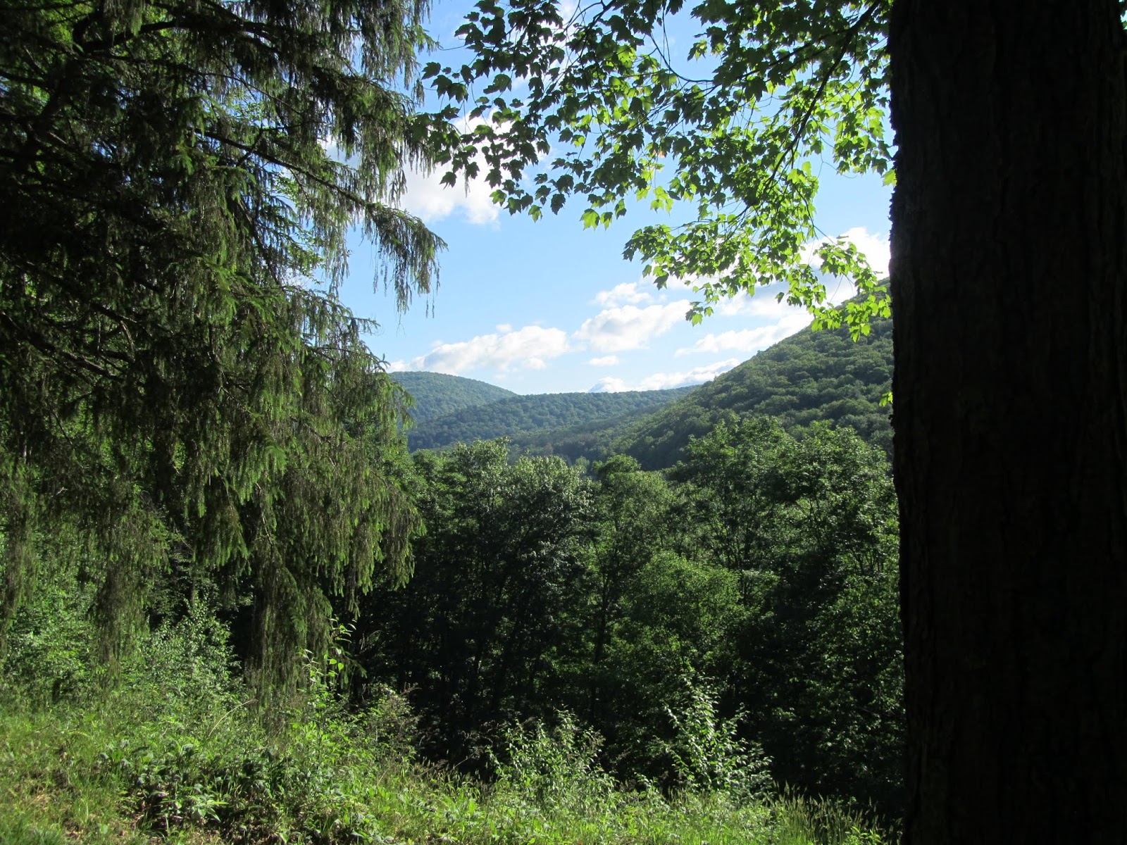
The first several miles of the STS follow the Allegheny Plateau before descending to Lyman Run. The first 10 miles of trail give you a pretty good idea of what to expect for the full loop. The trail travels along a mix of old roads that have been reclaimed by nature and narrower trail through mostly hardwood forests. The trail follows the relatively flat plateau with transitions to lower elevations along creeks and occasionally dry hollows. Since a majority of the trail travels through forest, far reaching vistas aren't common along the route.
 |
| Hiking old woods road |
 |
| Hiking trail |
 |
| A vista that is becoming overgrown |
 |
| An understory of ferns is common on the STS |
 |
| Small buck, you can see its nubs growing |
 |
| Hiking along Jacobs Run |
 |
| Bridge over Lyman Run |
 |
| Progress |
Although I didn't utilize any of them, the Susquehannock Trail Club started building three sided overnight shelters along the loop in the past few years. Since most of the shelters are no more than a few years old, they are in excellent shape. At the time of my hike five shelters were in place.
The first shelter encountered, about 10 miles from the Northern Gateway, is actually fully enclosed. The brick shelter was originally used as a dynamite house for CCC crews. All the shelters have log benches and fire pits. The open shelters all had chairs inside. The dynamite house had a large log carved into a tic tac toe board complete with wood x's and o's. The only downside to the shelters was only one of the five were convenient to a water source.
 |
The fully enclosed shelter
This is the former dynamite house |
 |
| Tic Tac Toe board at the shelter |
Most of the time I found the walking quite enjoyable. Despite frequent changes in elevation, the climbs and descents usually follow a gradual course on an old grade or on a easy grade in a hollow. That's not saying the trail doesn't have the occasional tough climb or descent. One of the first steep climbs comes on Cardiac Hill. A sign mid climb informs hikers that they nearly reached the halfway point of the climb.
 |
| Cardiac Climb |
 |
| Lush forests are the norm |
 |
| Never ending ferns |
Beyond Cardiac Climb, the trail followed the plateau and passed directly under the Cherry Springs Fire Tower. Unfortunately the tower is no longer accessible. An old CCC cabin sits near the tower. I enjoyed a break for lunch on the covered porch of the cabin. Despite the lack of tower access, one of the better vistas on the route sits just a tenth of a mile from the trail by the tower. Immediately before reaching the tower, the trail crosses PA 44. A right turn on the road leads a very short distance to a nice vista.
 |
| Cherry Springs Fire Tower |
 |
| CCC cabin by fire tower |
 |
| Vista along PA 44 just off the trail |
 |
| Zoomed in view |
Beyond the tower, the trail drops back into lower elevations for several miles. This allowed for several miles close to water. A stretch of trail followed close to Hogback Hollow. The small stream in Hogback Hollow featured evidence of beaver activity with lodges visible in dammed sections of the creek. Well above the creek, numerous wet stretches made for sloppy trail. The wet sections were also quite grassy.
 |
| The trail often passes by camps, this one is the Cherry Springs Hunting Club |
 |
| Beaver lodge |
 |
| Garter snake |
The trail dropped closer to the creek in a dense meadow. As I exited the forest and entered the meadow, I spooked a large animal that ran away quite loudly as it thrashed through the dense brush. I didn't see it but am pretty sure it was a bear.
The trail became somewhat obscure in the meadow and several dead end tracks showed it was a point of confusion. After following one dead end, I noticed a path leading to the creek and a trail blaze on the other side. A log bridge crossed the creek and the trail returned to more obvious tread.
 |
| Thick meadow where I spooked the bear |
 |
| Easy to miss bridge hidden in the meadow |
 |
| Hogback Hollow |
The trail followed Hogback Hollow through a mix of forest and thick grass. At times the trail was no more than a few feet from the stream. The trail eventually left the woods for a stretch of road walking. The first stretch followed a jeep road passing a few camps. A short stretch turned onto a quiet paved road and another few camps before turning back into the woods in less than a mile.
 |
| Trail hiking immediately above creek |
 |
| Dense vegetation along the trail |
I took another break for another bite to eat at Cross Fork Creek. After covering nearly twenty miles at this point, I took the opportunity to take off my shoes and socks to soak my feet in the creek for a few minutes. This always refreshes my feet and seems to take miles of hiking off of them.
 |
| Cross Fork Creek |
Beyond my rest, the trail continued in the lower elevations. The trail past a few more camps on narrow, two-track roads. Much of the time the trail followed or stayed close to one creek or another. Often these camps have names and are used as landmarks in the guide book. The trail left the last tiny road after crossing a suspension bridge over Cross Fork Creek.
 |
| The birds and the bees, or toads in this case |
 |
| Trail utilizing woods road |
 |
| Moving right along |
 |
| Suspension bridge on Cross Fork Creek |
 |
| Trail running along Cross Fork Creek |
 |
| Wildflowers along creek |
 |
| Chicken of the woods |
By the time I crossed the bridge, I was beginning to think about ending my day. I had covered more than twenty miles at that point. The map and guide showed potential camping along Cherry Run, which the trail followed. I decided to hike along Cherry Run and stop near a marked crossing that was still flat enough for camping. At this point it was just after 5PM with several hours of daylight. After contemplating, I decided to eat dinner, then move on for a few more miles.
 |
| Cherry Run |
After I ate and cleaned up, I was moving again shortly after 6PM. I decided to fill up with water to make a dry camp in a few miles. The trail climbed back to the plateau in a couple miles. The guide mentioned passing through hemlocks, which typically offer open understory, making it easier to find a camping spot. I found some brief after dinner entertainment as a raccoon scurried out of Cherry Run and climbed a tree.
 |
| Raccoon |
Sure enough the trail climbed to the plateau and reached a stretch of flat terrain. While most of it was suitable to camping, I came up to the 24 mile marker just before 730PM. I knew exactly where I was and it offered a nice spot to put up my tent. Although it was a dry campsite, I already ate and had a short mile before my next water source in the morning. The dry campsite also kept the area free of bugs. Since I already ate, my evening chores went by quickly. After seeing the raccoon, not too far from where I camped, I was happy to find a very solid location for my food bag to hang.
In the thick forest, darkness fell earlier than I expected. I retreated to my tent before it was completely dark. After 20 minutes or so, I had a visitor crunching the vegetation not too far from my tent. As strange as it sounds, I was told barking will scare most animals, including bears, since most wildlife doesn't want to encounter a dog. I barked and nothing happened. I heard another few crunches come closer. I opened my tent and had a peek but saw nothing. I clapped my hands and then an animal took off quite fast. I caught a glimpse of it as it ran off, but in the near dark it was difficult to tell what the dark form was. I could hear it for at least a mile as it crashed through the woods as it ran away. It took me a little bit to realize it was a small yearling size bear. Until I fell asleep again, I was a little on edge at every snap in the woods. Fortunately I found an excellent tree that offered very generous clearance to hang my food that evening. Other than what sounded like mice, I had no more large visitors as far as I knew. In the morning my food bag remained as I left it.
 |
| Approaching Hungry Hollow Road |
Day 2
Mile 24 to Cross Fork
25.0 Miles
I woke up and went about breaking my camp and eating breakfast on my second morning. At some point I bumped my thigh and felt a somewhat tender spot. I rolled up my shorts and had a tick embedded in my leg just under my shorts line. I was no stranger to ticks, having lived most of my life in PA. After leaving the state, I only had a couple ticks. It had been probably close to 10 years since I had one on me, many more years since I had one embedded. I have a small tweezers on my knife and attempted to remove it. Unfortunately with its head well planted in my flesh, the head remained as I removed the rest of the body. I did a thorough check and didn't have any more stowaways.
The first couple miles of the day started easy with a descent to Ole Bull State Park. The trail travels right through the park past campsites and its facilities. Camping is only permitted for a fee at designated sites within the park. Before reaching the campground, a short hike uphill leads to Castle View. Although not particularly stunning, its worth the less than 10 minute roundtrip detour since there aren't an abundance of vistas on the trail. It gives a good view of the next climb on the trail. As I passed through the park, I saw my first group that was also hiking the full STS. They were traveling the opposite direction.
 |
| Ole Bull State Park |
 |
| Castle View |
Leaving the park, the trail climbs fairly steeply back to the plateau. The trail switchbacks nicely keeping the climb manageable. Part of the way up the climb, a nice view over Ole Bull and the Cross Creek Valley distracts you briefly from the climb. I also heard a barred owl on the climb from Ole Bull. It landed on a tree nearby and gave a couple of calls before it took off again.
 |
| Cross Creek Valley |
 |
| Wild flowers |
Not long after reaching the high point of the climb, I stepped within a couple feet of a timber rattler. It initially didn't rattle, just stayed fully extended, calmly, as it soaked in the morning sun. After a couple pictures, I gave it wide berth and hiked around it. Apparently it didn't like the movement and decided to rattle and coil. At this point a couple hiked from the other direction. I stayed there to let them know where the snake was. I took a few more photos of it in its coiled pose before hiking again.
 |
| Relaxed rattler |
 |
| A good lock at its full body |
 |
| Coiled and rattling |
After the rattlesnake, the next feature of interest was Spook Hollow. The trail in Spook Hollow travels through a dark forest of gnarled Norway Spruce. The Susqehannock Trail Club (STC) has fun with this with signs in the area playing up the creepy looking forest. While the dark forest and trees do have a somewhat creepy look to it, the humorous signs make the area more interesting. Just before entering Spook Hollow, an overnight shelter was recently put in place.
 |
| Hiking in an open forest |
 |
| Lush greenery |
 |
| Spook Hollow Shelter |
 |
| Sign entering Spook Hollow |
 |
| Sign leaving Spook Hollow |
 |
| Forest in Spook Hollow |
After leaving Spook Hollow the trail travels through more typical terrain along the plateau. After the 35 mile point, the STS runs with the Donut Hole Trail for nearly 9 miles. The Donut Hole Trail is a 90 mile backpacking trail known for its challenging conditions.
 |
| Overgrown section of trail |
 |
| No rattlesnakes spotted here |
 |
| Trail following a quiet forest lane |
 |
| Start of the STS/Donut Hole Trail overlap |
While stinging nettle is a common feature along Pennsylvania trails. In my first 35 miles, I only saw short stretches of it and only contacted it a few times on my bare legs. It seemed where the STS traveled with the Donut Hole Trail, I encountered more stinging nettle than any where else on the loop.
 |
| Verdant |
The steepest stretch of trail along the entire STS happened to be on the Donut Hole overlap. The descent into Morgan Hollow drops steeply, at one point 600 feet in just over a 1/4 mile. This was one of the truly steep stretches of the entire STS. At the bottom of the hollow the trail crosses Young Woman's Creek. I took an extended break at the creek for lunch and soaked my feet in the surprisingly cold water.
 |
| Ted's Truss over Young Woman's Creek |
Climbing away from Young Woman's Creek, the STS travels through a series of ups and downs with several creeks nearby. Although common throughout the STS, this stretch featured plenty of lush vegetation, and greenery. One word that describes much of STS in early summer is "verdant". Much of the time the forest understory features dense ferns and thick grasses near creeks.
 |
| Lush greenery hiding the trail |
 |
| More Chicken of the woods |
 |
| Creekside hiking |
 |
| Almost half way |
One of my least favorite parts of the STS traveled just beyond Mile 40. The trail followed a gas pipeline for a distance. Travel was uncomfortable in the full sun. Much of the trail on the pipeline passed through high grass. The trail left the pipeline near another shelter. Beyond the shelter, the trail followed close beaver activity. The meadows around the beaver activity meant more high grass to walk through which was often in more full sun.
 |
| Hiking the overgrown pipeline |
 |
| Scoval Branch Shelter |
 |
| Beaver activity |
After several miles of lackluster trail, the STS and Donut Hole Trail split. The STS traveled in nicer forest. By then I had to decide on my plans for the evening. I wasn't quite ready to stop, but no obvious campsites were indicated on the map or guide book. As the trail began to climb away from the last noted campsite and water, I stopped to cook dinner. Once again I planned on cooking before stopping for the day, then push on another couple miles.
 |
| Just in case you forgot what trail you were on |
 |
| The STS passes several gas pipelines and its infrastructure |
The map showed the trail running close to Lieb Run with several hollow crossings. I hoped to find a spot to camp near the run. After dinner, a lazy climb brought me back up to elevation before the long descent toward Cross Fork and eventually Lieb Run. This descent followed soft footing in a mostly hemlock forest. I attempted to get as close to Cross Fork as I could and passed up a handful of decent campsites. Unfortunately the terrain became steeper as I got closer to the village of Cross Fork. Finally I found a flat spot on the very edge of town, just before leaving the woods.
 |
| These were all over this particular fallen tree |
My campsite was a little noisy due to its proximity to Cross Fork. The town quieted quickly after dark. I had a good nights sleep with little further noise in town.
Day 3
Cross Fork to Prouty Lick Run
22.7 Miles
Cross Fork lies at 1050 feet and is the low point of the STS. The trail follows the streets of the tiny village as well as Route 144. The trail crosses the fairly wide Kettle Creek on a road bridge in the village. For hikers looking to lighten their load, Cross Fork can be used to resupply with a small store and post office. A few establishments also serve food and drinks.
 |
| Kettle Creek |
 |
| Leaving Cross Fork |
 |
| Moving right along |
The trail climbs relatively steeply as it leaves town and continues back in the woods. Not long after reaching the height of land, it descends back to lower elevations following Elkhorn Run.
 |
| The mountain laurel was just starting to flower |
 |
| Dense mountain laurel |
 |
| Hiking through a rare open forest |
 |
| Elkhorn Run |
 |
| Hiking along Elkhorn Run |
The route leaves Elkhorn Run and soon enters the Hammersley Wild Area. The 30,000 acre wild area is the second largest in Pennsylvania and travels along the Hammersley Fork. Hammersley Fork is as scenic as any forest creek with numerous riffles and holes. The largest hole is known as "The Pool". A narrowing in the creek widens in a nice deep pocket of water. Had I not been there in the 9AM hour, I would have probably been enticed to take a dip. The air was still quite chilly though. Numerous campsites are available along the Hammersley Fork.
 |
| Remnants of an old bridge from the logging days |
 |
| Hammersley Fork |
 |
| The Pool |
The trail eventually crosses the creek and follows it upstream as it continually narrows. The trail travels between woods and meadow as it climbs higher along the creek. Ultimately the trail leaves the creek and climbs to McConnell Road.
 |
| Crossing Hammersley Fork on the downed log |
 |
| Upper reaches of Hammersley Fork |
 |
| A good look at how dense the forest is |
McConnell Road is a quiet forest road. Following the road uphill less than a 1/4 mile leads to an overlook. My plan was to drop my pack and make the quick detour to the overlook. Just before I reached the road, I heard movement ahead. I soon saw the source of the noise, a small yearling black bear. The bear ran up the trail and crossed the road, heading back into the woods on the other side. I still went to the overlook, Hammersly Vista, but decided against leaving my pack with food at the junction.
 |
| Hammersley Vista |
I returned to the trail after checking out the vista, now at mile 60. A new shelter was built just off the road. This one is so new that it isn't in the 2018 guide book. I took a brief break at the shelter before continuing.
 |
| Nearly 3/4 of the trail done |
Although I had seen numerous piles of bear scat on the loop, I noticed a pile just down from the bear crossing. Apparently the bears are common in the area.
 |
Evidence of bear, unfortunately (or fortunately) they usually run
before you can get a photo of the actual bear |
A few minutes after leaving the shelter, I felt something crawling on my leg. Another tick was making its way up my leg. I quickly noticed a second tick. After I removed them, I found two more ticks, one on my sock and another on my shoe.
Back in the lower elevations, the trail followed an old rail grade and passed several camps. A paved road crossing brought the STS back into the woods and steep grassy climb.
 |
| A good look at how green the area is while hiking through a field |
 |
| Hiking old rail bed near Sinnemahoning Creek |
 |
| Overgrown trail follows old road |
Around Mile 65 I reached Stony Run. I took an extended break to eat lunch and soak my feet. I'm surprised at how cold the water can be. As I sat down I found three more ticks on my legs.
 |
| Soaking my feet |
Leaving Stony Run, the trail continued its yo yo of elevation changes. The changes in elevation never seemed too drastic. After passing the 68 mile point, I reached the final shelter of the loop. The Wild Boy Shelter was probably the nicest location of the five shelters on the hike. Wild Boy Run flows close to the shelter. This was the only shelter with a convenient water source that flowed nicely.
 |
| Small trailside waterfall over mossy rocks |
 |
| Wild Boy Shelter |
I originally planned on spending the night at the shelter. I still had several hours of daylight left and wasn't ready to call it quits for the day despite covering 19.5 miles. I took a break at the shelter to plan my last few hours. When I stepped to the side of the shelter, a spooked a raccoon out of Wild Boy Run. It quickly climbed up a nearby tree.
 |
| Raccoon behind the shelter |
Leaving the shelter, I planned on hiking another three miles to the next campsite listed in the guide book. Easy hiking brought me to the top of Prouty Hollow. The last 1/2 mile descent of the day was one of the steeper elevation changes on the entire STS. I soon reached a trail junction that sat next to two branches of Prouty Lick Run with an excellent established campsite.
 |
| The end is getting closer |
 |
| Campsite on my last night |
I reached my campsite at 630PM, which is fairly early for me with a couple hours of daylight remaining. The campsite had rock seats in place with the creek bubbling next to it. It was a nice place to unwind for a couple hours. I was able to soak my feet in the frigid waters before eating my dinner.
The area around the STS is said to have some of the darkest skies in the eastern US. A near full moon hampered my sky watching abilities my first couple nights. I attempted to look at the sky during the night on my last night. The forest was so dense I couldn't really see the sky.
Day 4
Prouty Lick Run to Northern Gateway
11.7 Miles
My final morning, I was awakened just after sunrise by multiple nearby barred owls hooting and hollering. I was happy enough to get an early start. The day was supposed to be much hotter. I had a long drive ahead of me and didn't mind finishing early to get a jump on the trip. I had about 12 miles left to finish the hike.
The final 12 miles featured more rolling terrain alternating between the plateau and hollows. The terrain in the homestretch reaches the highest elevations on the entire STS, topping out around 2545'. I passed through a few longer stretches of grassy trail on the last day, but several searches revealed no more ticks. My final several hours went smoothly and I beat the heat, finishing the loop around 1130AM.
 |
| Hiking through hemlocks |
 |
| Creek crossing |
 |
| Hiking through the green tunnel |
 |
| Stepping stones on creek crossing |
 |
| Overgrown section looks like the home to ticks |
 |
| Trail obscured in ferns |
 |
| The homestretch |
 |
| More lush greenery |
 |
| The final mile marker |
I wasn't completely sure what to expect hiking the STS. It isn't known as a big scenery hike compared to other backpacking trips. I found my STS trip quite enjoyable. While the STS offers only a few vistas, the loop makes it up with other attributes. The forest along the trail is extremely lush and green. Earlier I used the word "verdant" to describe the hike. I would also say the STS is a nice, zen experience. Hiking the STS involves many miles of fairly easy hiking through peaceful forests allowing your mind to drift.
The STS remains a relatively obscure hike. This means relatively few people. Two of my four days included the weekend. I saw only two solo hikers and a group hiking the full loop. I saw one other Donut Hole hiker and only a few others on shorter trips.
The lack of people and quiet forests equal lots of wildlife. I saw two bears and had a near sighting with a third. That's as much as my entire AT thru hike. I counted numerous deer, two raccoons, a timber rattler, a handful of garter snakes, barred owls, a cardinal, and endless squirrels and chipmunks.
 |
| The first raccoon I saw on the hike |
 |
| Coiled rattler |
The official mileage according to the trail guide runs at 83.45 miles. Starting at the Northern Gateway adds about another mile total. With a few short side trips, I expect my trip covered just over 85 miles. Despite the length, the STS would make a great trip for the beginner or experienced backpacker. Beginners will appreciate a well marked trail with an excellent guide book and the opportunity to camp in shelters. Veteran backpacker will appreciate the wildlife, solitude, and peacefulness. There is just enough elevation change to make the trail challenging without being too difficult. The STS would make a great shakedown hike for someone preparing for a longer thru hike. The distance makes the STS a good choice for a novice looking to move up to a longer multiday hike. And in my case, the STS made a good choice for a backpacking trip to spend multiple days enjoying the peacefulness of nature and exploring a new place.
 |
| Elkhorn Run |
Despite its relatively obscurity, the STS has its own club dedicated to the trail. The Susquehannock Trail Club (STC) does a great job maintaining the trail. The STC keeps the trail interesting with its humorous signs such as in Spook Hollow or Cardiac Climb.
For more information on the STS visit the STC website by clicking
STC. The website has basic trail information as well as a place to order the most recent guide book with maps.
If you enjoyed this post, check out and "LIKE" Tomcat's Outdoor Adventures on
Facebook where I post photos more often and revisit past adventures.


