Owl's Head Mountain sits in the heart of the Pemigewasset Wilderness. Owl's Head usually comes with a bad reputation among hiker. It probably would be rarely climbed if it wasn't over 4,000' feet in elevation. Because it reaches that magic 4,000' threshold, it's on the New Hampshire 48 climbing list. Sooner or later, people attempting to climb all 48 mountains on the list take on Owl's Head.
Owl's Head isn't particularly tall at 4,025'. It ranks 43rd out the 48 mountains on the list. It's reputation comes from the difficulty reaching the mountain. Historically, to reach Owl's Head, hikers traveled 18 miles roundtrip. The last mile leaves official trails and climbs a slide to reach the summit. It doesn't provide as expansive views as many other hikes on the list and features a wooded summit with little to see. Allen Mountain in the Adirondacks has a similar reputation and is a good comparison. I just happened to hike 46 of the New Hampshire 48. It was now time for me to visit Owl's Head and see if it deserved its reputation.
I began my hike from the Lincoln Woods Trailhead just before 7AM on Wednesday August 2nd on a cool morning. The forecast looked great with little humidity and plenty of sun. It had been about 13 years since I hiked out of this trailhead. After crossing the East Branch of the Pemigewasset River on a nice suspension bridge, I traveled along the Lincoln Woods Trail.
 |
| Bridge over East Branch of the Pemi |
 |
| View of the river from the bridge |
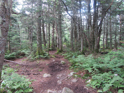
The Lincoln Woods Trail follow an old rail line from the logging days. It follows the river and is quite flat. Occasional views along the river offer a look at the Bond Range. Remnants of old tracks from the rail days still show in a few places. I followed the easy path 2.6 miles, jogging at times, to the Black Pond Trail. I already saw a few groups
 |
| Lincoln Woods Trail |
 |
| Remnants from the railroad days |
 |
| The Bonds |
In the past, the standard route to Owl's Head followed the Franconia Brook Trail to the Lincoln Brook Trail. In recent years the Black Pond Bushwhack has gained significant use and is starting to take over as the most common route to Lincoln Brook. In the process, using Black Pond eliminates several potentially dangerous stream crossings without bridges. It also cuts off about a mile of hiking each way.
The first .8 miles to Black Pond follow a marked trail. The trail ends at the namesake pond. From the pond, you are greeted with two pretty views over the water. The first view framed my objective for the day, Owl's Head. A short distance further, the Bonds come into view across the pond. On that particular morning, the view was especially nice as the mountains reflected off the still pond with wisps of fog rising from the water.
 |
| Start of the Black Pond Trail |
 |
| Along the Black Pond Trail |
 |
| Owl's Head |
 |
| The Bonds over Black Pond |
Although I don't use it for navigation, I occasionally will reference AllTrails before a hike for recent trail conditions. I checked prior to this trip since the water crossings were at dangerous levels a couple weeks prior. While looking at the recent reports for Owl's Head on AllTrails and NH hiking groups on Facebook, there seemed to be confusion on finding the "Bushwhack" portion of the Black Pond route. I'm not sure where the confusion comes from as the route is very obvious and at this point an excellent trail. It just doesn't have any markings or maintenance, which isn't unusual in a Wilderness anyway. People seem to have a hard time finding the transition at Black Pond to the start of bushwhack. No it's not marked, but if you take 30 seconds to look, its still pretty obvious where the route starts. At this point the "bushwhack" moniker isn't necessary. Now its just an unmarked trail or well defined herd path. It's certainly better than a lot of the trails I come across in the Adirondacks or the Whites.
 |
| Not much of a bushwhack |
 |
| Pretty obvious tread the length of the "bushwhack" |
Following the Black Pond route, I soon reached the Lincoln Brook Trail. The trail follows its namesake brook, sometimes right along its banks. Even if the climbing up Owl's Head is dreadful, the hike along Lincoln Brook is more than enough to make up for it. Lincoln Brook is a splendid mountain stream that tumbles along a rocky course. The water was high enough to provide a pleasant soundtrack in the background of rushing water. I stopped several times to enjoy the brook. Personally, I think just the hike along the brook made the trip worthwhile.
 |
| On the Lincoln Brook Trail |
 |
| Taking in Lincoln Brook |
 |
| Slide in Lincoln Brook |
 |
| Lincoln Brook is a lovely mountain stream |
The trail along the brook is slightly overgrown at times, a wide path at others. A few stretches required some creative step stoning to avoid mud from the recent rains in the past month. You could almost always hear the brook rumbling nearby.
 |
| Tumbling water in Lincoln Brook |
 |
| Looking upstream in Lincoln Brook |
 |
| Features like this provide pleasant background noise |
 |
| Trail following the banks of the brook |
 |
| Got to appreciate bright orange mushrooms |
 |
| Interesting stretch of blowdown |
 |
| Muddy stretch |
Eventually I approached a few water crossings, all within a short distance of each other. The water had receded a fair amount since the weekend rains. All of the water crossings had a decent selection of rocks to step across without getting my wet. A few spots my poles came in handy. On my return I met a larger group struggling to cross without poles. Recent reports a couple weeks early required a ford through thigh deep water in the brook.
 |
| First water crossing |
 |
| Another water crossing |
About a half-mile past the last water crossing, I reached the start of the Owl's Head herd path. Two cairns marked the path, but they may not always be there since the path is not maintained or an official trail. Even without the cairns the path is pretty easy to see as long as you know when to start looking for it. Pretty quickly it joins the slide path.
 |
| Start of herd path to Owl's Head |
 |
| Low on the slide |
If you hike in the mountains of New England or Adirondacks long enough, you'll probably hike a slide at some point. Some are worse than others as far as steepness, amount of scrambling, or loose ground. The Owl's Head slide seemed to be not too bad compared to a lot of the slides I've encountered. It's steep at times and a little loose, but doesn't really require much scrambling. Trees close to the path come in handy for handholds when needed.
 |
| Typical look up the slide |
 |
| A short scramble |
People often complain about the lack of views for the amount of work on Owl's Head. I was pleasantly surprised by the good views while climbing the slide. While there are certainly better mountains for far flung vistas, I won't complain about the nice views looking back at the Franconia Ridge. They were better than I expected.
 |
| Starting to get some views on the slide |
 |
| The north end of the Franconia Ridge |
 |
| My attempt at an artistic photo |
Since the herd path isn't an official trail, you have no markings to follow, although a few cairns were in place. After years of use, the path is well established now and pretty straightforward to navigate. Occasionally the path braids as it climbs the slide, but the braids seemed to rejoin and get to the same point. According to the White Mountain Guide, the route gains 700 vertical feet in only .3 miles to the top of the slide. Above the slide the steep travel continues until you reach the summit plateau.
 |
| Jumble of rocks higher on the slide |
 |
| Near the top of the slide in the forest |
Once at elevation the hike is somewhat lackluster. The path traverses the top of the mountain until reaching the cairn on the summit. Other than a partial view towards the Bonds, there isn't much to see. A few herd paths near the summit seemed to fade out before reaching any other views.
 |
| Typical terrain above the slide |
 |
| Traveling over the flat summit |
Using the Black Pond route, I hiked about 8 miles to reach the summit. At this point I stopped for a snack on the summit. One other hiker was at the summit when I arrived and another pair arrived while I was there. I didn't linger too long since there wasn't much to see.
 |
| Summit cairn |
Many people choose to descend via another bushwhack called the Brutus Bushwhack. This route avoids the slide on the descent. I was told there isn't much benefit to the Brutus Bushwhack in summer so I descended the slide. I was happy to catch the views again as I descended. The slide was nice and dry so the descent was pretty easy. I was back to the Lincoln Brook trail pretty quickly, passing several groups on their way up.
 |
| The best view from the top of Owl's Head |
 |
| Enjoying the views as I climb back down the slide |
 |
| Looking down the valley from the slide |
 |
| Descending the slide |
The Lincoln Brook Trail stays relatively flat. I had another hiked planned after I wrapped up this one. I took advantage of the flat trail and ran when conditions allowed, hiking when the trail became too muddy or rocky. Other than a few short stops to enjoy Lincoln Brook, I reached the turnoff for Black Pond pretty quickly.
 |
| Enjoying Lincoln Brook on the hike out |
I slowed my pace a little as I made my way towards Black Pond on the herd path. I stopped once again to enjoy the mountain views over the pond. While still quite pretty, it wasn't quite as impressive when the Bonds and Owl's Head reflected in the still morning water with the fog rising.
 |
| Back on the Black Pond herd path |
 |
| Large rock enroute to Black Pond |
 |
Another look at the Bonds from Black Pond
taken earlier in the morning |
After leaving Black Pond, I resumed my trot, quickly reaching the wide open Lincoln Woods Trail. Once on the Lincoln Woods Trail, I ran the final 2.6 miles back to the trailhead, stopping briefly to enjoy the river a couple times. I passed people headed into the woods pretty frequently on this stretch. Since they didn't have any gear, I'm guessing most were headed to Franconia Falls for the afternoon. I reached the trailhead at 1250PM.
 |
| Back on the flat Lincoln Woods Trail |
Using the Black Pond route both ways, this hike travels about 16 miles roundtrip. Despite the mileage, majority of the hike covers pretty flat ground. Roughly 14 miles travels with little elevation gain. Miles fly by enroute to the Owl's Head herd path on the mostly flat trails. If you are uncomfortable hiking on unmarked trails, maybe wait to tackle Owl's Head until you gain more experience traveling in the mountains. If you do hike Owl's Head, I also recommend watching the weather closely. The water levels tend to rise quickly in the area and the several water crossings on this hike can become quite dangerous.
 |
| Close up of Franconia Ridge |
After hiking to Owl's Head, I feel its reputation as a slog of a hike is undeserved- again similar to Allen Mountain in the Adirondacks. I found this hike to be a pleasant surprise. Yes it's a long way for one mountain with a treed, mostly viewless summit. But the journey to the summit more than makes up for the lackluster summit. The views from Black Pond, the tumbling waters of Lincoln B rook, and views climbing the slide all help make this hike a pleasant experience. I also enjoyed climbing on the slide as well and found it a nice change from the relatively flat hiking up to that point. Don't think of Owl's Head as just a trudge to knock off one more peak on a list. Enjoy the journey and sights along the way. After all, you are in a beautiful and fairly remote part of the mountains.
If you enjoyed this post, visit and “LIKE"
Tomcat's Outdoor Adventures on Facebook where I post photos more frequently and revisit past adventures.


