Despite plenty of daytrips hiking, nearly three years passed since my last backpacking trip. That was a 32 mile trip traversing the Mahoosuc Range in Eastern New Hampshire and Western Maine. (See
Backpacking the Mahoosuc Range) Nearly 5 years have passed since I attempted a long backpacking trip. That was a rain soaked attempt at a Long Trail thru hike in Vermont. After a couple drier days, I was plagued with 7 or 8 continuous days of heavy rain on an already saturated trail. My feet began to rot and only got worse as the rain continued on the morning that I decided to bail after 190 miles. I didn't complete the thru hike, but I managed to hike the entire trail combined with my 1999 AT thru hike.
Since I haven't backpacked for so long I was really chomping at the bit to spend some continuous days traveling through the mountains. Now living in Colorado, the possibilities are nearly endless.
There are two major trail systems in Colorado that run less than an hour from my home. The Colorado Trail (CT) runs nearly 500 miles and no more than 40 minutes from my house. The Colorado portion of the Continental Divide Trail (CDT) traverses the same general area just a few miles further away over Monarch Pass.
In the past few years, the Colorado Trail Foundation took over the maintenance of the CDT in the area. The CDT once incorporated several miles of walking over forest roads. The Colorado Trail Foundation built miles of new trail, relocating the CDT to this new trail and eliminating all but the smallest section of road walk on a quiet, high elevation forest road. They call this portion of the CDT the Collegiate West. The Collegiate West runs from Twin Lakes to 5 miles south of Monarch Pass, a distance of 83 miles. This route runs close to, and at times, along the Continental Divide, traversing many miles above treeline.
The portion of the Colorado Trail in this area, known as the Collegiate East in this section, runs 78 miles from Twin Lakes and travels south, meeting the Continental Divide 5 miles south of Monarch Pass. The Collegiate East and West meet each other at both ends forming a 161 mile loop. This loop has become known as the Collegiate Loop.
This portion of Colorado is in a subrange of the Rockies called the Sawatch Range. The Sawatch Range contains the highest peaks in the entire Rockies. This specific portion of the range is known as the Collegiate Peaks. Several of the peaks in the range are named after universities; including Mts. Princeton, Yale, Oxford, Columbia, and Harvard. Much of the surrounding area lies within the Collegiate Peaks Wilderness, thus the name of the loop.
I first heard of the Collegiate Loop before I moved to Colorado. At the time the Colorado Trail (Collegiate East) was already long in place. The Collegiate West was still a concept and the new portions of trail were just being built to link together existing trails. Several years have passed and the project is basically complete. Once small portion of trail is under construction to eliminate less than 2 miles of road walking on a quite four wheel drive road.
Living so close to the loop, this seemed like the perfect trip for me. Although I hiked or mountain biked small portions of the loop, nearly all of the trip was new terrain for me. At 160 miles, the loop is long enough to get fully submerged in the wild without being away for too long. The loop eliminated any need for arranging pickup or drop off to a trail. The loop spends many miles in alpine terrain, so the trip was likely to have great scenery.
This trip was also somewhat of a gift from Puma. Earlier in the spring I built her "Zen House". Letting me run off in the mountains for a week or more was my payment for the time I spent on her building.
Because of the high elevations on the Collegiate Loop, some areas may not be snowfree until July. I originally looked at a July 17th start date. Unfortunately dry conditions and a lightning strike led to the Hayden Pass Fire burning wildly just a few miles from our house. Although we seemed relatively safe, I postponed my trip a two weeks, "just in case" something changed with the fire. A few rains and huge firefighting response contained the fire many miles away from our home. My new date for departure was July 31.
Because the trip is a loop, there are many places to start. For most people, this is Twin Lakes. I'm guessing this is because this allow hikers to start on the lower Collegiate East and build toward the more dramatic terrain of the Collegiate West. The lower terrain allows time for acclimatization. Twin Lakes is also more convenient to Denver than the southern side of the Collegiate East.
Since I live about 40 minutes to the southern end of the Collegiate East, I started there, where the trail crosses Highway 50. My friend Rick Adams lives just a few miles from here and allowed me to park at his house while I was away and also brought me to the start of the trail.
Since the loop is relatively new, I didn't come across many first hand accounts. My impression is that most people take around 2 weeks to complete this hike. There are several places, particularly on the east side to resupply. While not exactly an ultralight fastpacker, I tend to move fast and cover a lot of ground in a day. My goal was to finish in 8 days and be fully self supported, no resupply or town stops.
DAY 1
US Highway 50 at end of South Fooses Creek- Dry Creek
27.3 Miles
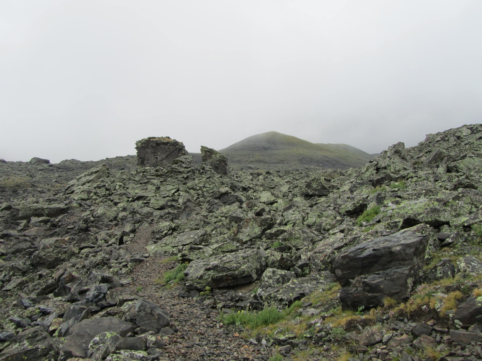
I began my trip at 822AM on July 31st at Highway 50, just west of Salida at the CT crossing near South Fooses Creek. I hiked north on the CT. I planned on hiking the Collegiate East first so I would have a build up of scenery, and the last half of my hike would traverse the higher and more alpine Collegiate West. I started out with a cool morning and a perfectly cloudless sky. The trail in this section is relatively easy with mostly rolling hills and little in the way of big elevation change. The elevation at my starting point was 8800' and my entire first day only reached 9800'.
 |
| The first view of a higher mountain in the first few miles |
Because of the low elevation, the travel stayed well below treeline. For the most part, the trail was a pleasant woods walk on smooth trail. Although I was staying relatively low, the trail still offered several nice views of the surrounding mountains. This loop circumnavigates around 11 14ers and endless other alpine mountains. My first day passed directly below Mts. Shavano, Antero, and Princeton among many other peaks. There are many clearings along the way that allow good looks at these mountains.
 |
| View toward the North Fork Valley |
Even though it was a Sunday morning I didn't really see too many people. It seemed like the people I saw were out for a casual Sunday walk or bike ride. Perhaps the most interesting sight the first morning was a large group of cattle grazing on the trail. This isn't uncommon on public land.
 |
| Cow traffic jam |
Despite the nearly perfect start to the morning, the weather wasted no time making an impression. I was expecting potentially volatile weather based on the forecast before I left. The dry pattern of July was forecasted to change and an active full on monsoon pattern was expected to make its presence this week. Within a couple hours of my start the clouds began to build. By 1150 AM, I heard my first thunder. The thunder continued periodically throughout the day but never seemed too close. I was still relatively safe well below treeline.
 |
| No shortage of views even at the lower elevations |
 |
| One of several long stretches of meadow |
The clouds continued to roll in but never really hampered the visibility too much. The trail continued mostly through the forest and intermittingly through stretches of meadow. The day before, there were some pretty heavy storms in the area and all of the creeks seemed to be flowing nicely.
 |
| Clouds moving in just before the rain |
 |
| Chalk Cliffs |
Just before 3PM my dry run came to an end. Initially the precipitation began as just hail. This isn't uncommon in Colorado. The hail was pretty small and somewhat soft. Soon after the hail started, rain began. It was warm enough I didn't put on my rain jacket. I did have to put on my pack cover. Although there were short breaks, the rain never really stopped.
 |
| The Chalk Cliffs Alien |
 |
| Mt Princeton in the distance |
After 20 or so miles I reached the area around Chalk Creek, just up from Mt. Princeton Hot Springs. It was still relatively early with plenty of daylight remaining. I wasn't in a real hurry to stop and set up camp, especially in the rain. I wanted to continue. There was one small problem. There was no real place to camp for nearly 7 miles beyond the creek.
 |
| Looking up the Chalk Creek Valley |
The loop in this area traverses its least aesthetically pleasing section (in my opinion). The trail follows a stretch of road. A good portion of this area passes through a residential area, then continues on paved county roads for nearly 6 miles. The section through the residential area passed close to a part of Chalk Creek that was dammed. With the cool damp conditions, the mosquitoes were fairly pesky. The rain was fairly steady through here, making the walk even less pleasant. Upon reaching Mt Princeton Hot Springs, the route heads uphill fairly steeply toward the lower Mt Princeton trailhead. The rain continued all the way to the trailhead.
I reached Dry Creek after 27.3 miles around 630PM. I didn't anticipate hiking so far, especially the first day, but the road walk made camping not an option. Despite the high mileage I didn't have any serious discomfort, I was just tired and discouraged by the extended rain. Dry Creek has a nice flat area for camping. Unfortunately it was still raining when I arrived with no sign of letting up. I quickly set up my tent when I arrived. A large tree gave me just enough cover to cook my dinner without getting too wet. After my dinner, I quickly retired to my tent for the night. I woke up to the sound of rain as late as 130AM. One other pair arrived shortly after I did but immediately retired to their tent, not to be seen again.
DAY 2
Dry Creek- Frenchman Creek
22.6 Miles
I woke up around 630AM and was surprised to see perfectly clear skies. The hiking was pretty easy going, even with substantial elevation gain. Much of the hiking remained on pleasant trail through the forest. The trail reached its highest point on the eastern portion of the loop. The trail topped out at 11,889' on the eastern ridge of 14er Mt Yale. The climb seemed to wear me down. I don't think it was the steepness that took its toll as much as I was hungry. I wanted to wait until I reached this high point to eat my lunch, so I was running on fumes by the time I got to this point.
 |
| Hiking through aspens |
While 11,889' is above treeline in most places in the area, here it managed to stay in a saddle in the trees. As I sat eating my lunch, I could see an alpine area through the trees, just behind me. If the trail climb traveled another couple hundred feet to the east it would have broke treeline and had some commanding views of Mt Yale. Nonetheless, I ate my lunch just a few feet from treeline while a chipmunk played hide and seek trying to grab any crumbs I may have dropped.
 |
| Mt Yale |
 |
| Closer view of Mt Yale |
 |
The first of several entries into the
Collegiate Peaks Wilderness |
 |
| Climbing toward Mt Yale |
After my lunch I felt reenergized and began a long descent for the next several miles. I dropped down to 9400' in elevation near Silver Creek, only to begin another long climb back over 11,000'. Even with the gain, the climb seemed very gradual and went quickly. Along the trail I had a clear view into the town of Buena Vista. I had phone reception and called to give Puma a quick update that I was fine.
 |
| Area around Mt Columbia |
 |
| Heading toward Columbia and Harvard |
 |
| Area around Harvard and Columbia |
 |
| Near Harvard and Columbia |
Just before 6PM I reached Frenchman Creek, my home for the night. There was an already occupied campsite right next to the trail. A couple hundred feet upstream was a large, flat area to camp. There was a large group nearby, but I found a spot between the two groups and kept to myself for the night. Although a few clouds had moved in, the skies never looked threatening.
 |
| Pleasant morning walk through the forest |
 |
| The larger Harvard Lake |
 |
| Smaller Harvard Lake |
 |
| View toward Columbia/Harvard ridge |
DAY 3
Frenchman Creek- Avalanche Meadow
25.2 Miles
I woke up Tuesday morning to mostly cloudy skies. I didn't know it at the time but this would be the only morning I would have no rain overnight and wake up with a dry tent rainfly. My morning had me climbing back to over 11,800' on a ridge off 14er Mt Harvard. Unlike the climbing on Mt Yale's flank, the climb on Harvard was much more rewarding. The trail traversed on the edge of treeline with many good views across the high alpine area. When it dropped from the alpine area, the trail traveled through several high meadows with continuous lines of sight into the high country. As I progressed, the view extended across the Pine Creek Valley to 14er group of Oxford and Belford. This was by far the most scenic stretch on the Collegiate East.
 |
| Reaching the edge of treeline |
 |
| View toward the lower Mosquito Range |
 |
| Crossing a meadow |
 |
| A look back to a ridge off of Columbia |
 |
| Traversing through sparse trees |
 |
| Crossing a high meadow |
 |
| View toward Belford/Oxford ridge |
 |
| Looking toward Harvard |
Besides the views, I saw two other interesting sights. The first was the remains of an animal spine along the trail. I'm not sure what it was, probably a deer, with a piece of hip still attached but perfectly preserved. I also saw a grouse type bird that was dark grey in color. When I returned home, I found it was a dusky grouse, a species I never knew about.
 |
| Animal spine |
 |
| Large cluster of wildflowers |
Continuing from the Mt Harvard area the trail dropped to Pine Creek before climbing back up a ridge off of 13er Waverly Mountain. The climb to the high point off the ridge was quite easy but offered no real view despite its relatively high elevation. From the ridge began a long, seemingly never ending drop to Clear Creek, where I ate my lunch.
 |
| Long traverse through a subalpine meadow |
 |
| Belford/Oxford ridge |
 |
| Another look toward Oxford |
In the last several miles before Twin Lakes, I spoke to a couple hikers passing the other direction that were recently in Twin Lakes. They had some more recent weather info for the next several days. It sounded like I had one more day before getting into more volatile weather.
 |
| Looking toward ridge off of Waverly Mountain |
The next 7 miles would bring me to the south shore of the Twin Lakes and the beginning of the Collegiate West. Unfortunately the last section into Twin Lakes was not the prettiest section of trail. I think this portion of trail is fairly new and used to avoid walking on Country Road 390. It doesn't follow the most scenic route. It begins with a long climb over a ridge on an exposed slope with long views of the road below. It continued by following under a powerline for a good distance, before connecting with less attractive trails, several on doubletrack trai,l before finally reaching a nice aspen covered trail with views to the lakes.
 |
| Leaving the Collegiate East for the West |
 |
| Overlap of the CDT and Collegiate West |
About 330PM I reached the Collegiate West. This was familiar territory since I just mountain biked in this area a couple weeks earlier. (See
Mountain Biking Twin Lakes) The trail follows along the shores of the lakes, sometimes just a few feet away. Views of the mountains are plentiful in the area including many chances to see Colorado's highest peak Mt Elbert, just a few miles to the north. Mt Massive, Colorado's second highest stands just north of Elbert and is visible as well.
 |
Mt Elbert and Massive over one
of the Twin Lakes |
 |
| Views toward Independence Pass |
 |
| Mt Elbert |
 |
| Mt Hope |
I had already covered 20 miles by the time I reached the lakes. There are several nice campsites close to the lake, but I wanted to continue since it was so early. After a rest along the edge of the lake, I decided to hike about 5 more miles to a spot listed in my guidebook as Avalanche Meadow, literally a meadow below an avalanche chute on Quail Mountain, that had a good water source and camping sites.
 |
| Heading toward Hope Pass |
 |
| Looking toward Twin Lakes |
 |
| Mt Elbert |
 |
| Heading away from Twin Lakes |
Diverging from the lakes, the trail changed character. The pleasant lakeside walk gave way to a steep and often rocky trail as it climbed toward Hope Pass. The sky threatened rain all day and finally began to shower about 3/4 of the way up this steep trail around 530PM. The rain stayed light however. I reached Avalanche Meadow about 615PM and the light rain stopped by 7PM. I was surprised to see several tents in the area when I got there. Except for some light showers before midnight, majority of the night stayed dry and I saw stars for the only time on my trip from this campsite.
 |
| Old cabin just south of my campsite |
Even though I arrived at 615PM, I managed to cover over 25 miles. I remained dry for most of the day and had no ill effects from the mileage.
DAY 4
Avalanche Meadow- Texas Creek
25.6 Miles
I had another long, tough day planned for my fourth day. I was soon getting into a long, exposed stretch above treeline that I wanted to hit early in the day. I had to set myself up in a campsite close to this exposed portion of trail, hoping to traverse most of it before the chance of thunder and lightning increased later in the day. On day 4, I planned a big 25 mile day that would involve two long climbs over 12,000 foot passes.
 |
| Entering the alpine zone |
 |
| The trail making its way to Hope Pass |
 |
| Looking across the alpine terrain |
 |
| Mt Hope |
The day started out nearly perfect with blue skies. My campsite was just shy of 11,000' and less than 2 miles from Hope Pass, taking a lot of the effort out of my first obstacle. I quickly climbed above treeline and had some beautiful, unobstructed views. I was at the 12,548' Hope Pass before I knew it and soaked in the wonderful views that included Mt Elbert, Twin Lakes, and numerous 14ers to the south.
 |
| Looking at Mt Hope |
 |
| Looking back toward Twin Lakes |
 |
| Trail through the tundra |
 |
| Just below Hope Pass |
Prior to a reroute, Hope Pass was part of the standard CT route. The old joke was: "Hope Pass, I hope I never have to climb it again". Despite climbing more than 3000' from Twin Lakes, the climb isn't really that terrible and the view more than makes up for any struggle. I could see issues for people not acclimated. Twin Lakes sits at 9200' and climbing 3000' without easing into it and spending some time at elevation first could cause problems.
 |
View north from the pass toward Twin
Lakes and Elbert Forebay |
 |
| Prayer flags at Hope Pass |
 |
| Looking toward Mt Hope |
 |
| South from the pass |
A long descent from Hope Pass brought me back into more rolling terrain at more modest elevations. By the time I stopped to refill my water around 11AM. clouds were already beginning to build. I passed within an easy 3 miles of 14er Mt Huron, but knew with the rapidly building clouds I would have a serious risk of storms hitting. I already had an extended stretch above treeline traversing Lake Ann Pass in just a few miles.
 |
| South of Hope Pass |
 |
| Morning sun on I believe Missouri Mountain |
 |
| Looking up the Lake Fork Valley |
 |
| Looking back toward Mt Hope |
 |
| Another look toward Mt Hope |
 |
| Descending below Hope Pass |
 |
| Jagged ridge below Hope Pass |
 |
| Crossing a talus field |
I stopped around noon for lunch just a couple miles before Lake Ann Pass. The clouds continued to build and looked threatening. It still wasn't thundering or lightning and I estimated I had about 2 hours to get over the pass. I didn't want to stop hiking for the day at noon and figured I'd have to take a chance to get up and over the pass before bad weather moved in.
 |
| Looking up Clear Creek Valley |
 |
| Traversing an open slope |
 |
| Looking up the South Fork Valley |
 |
| I believe Winfield Peak |
 |
| Hiking through a low meadow near Clear Creek |
 |
| Mt Huron |
 |
| Heading toward the South Fork Valley |
By 1230PM as I began to wrap up my lunch break, it began to shower. There was still no thunder or lightning. I began making my way toward Lake Ann Pass. The showers fell in short intervals as I continued toward treeline. The view heading toward Lake Ann Pass is dominated by the Three Apostles, one of the more jagged looking groups of summits in the Sawatch Range.
 |
| Peaks above Silver Creek |
 |
| The Three Apostles starting to come into view |
 |
| Three Apostles |
 |
| Lower peaks in the area |
 |
| Getting closer to the Three Apostles |
 |
| Pleasant walking through a meadow |
 |
| Continuous views through the meadow |
I popped out above treeline and was greeted with awesome views. Still no thunder or lightning, but I could see rain making its way closer to me from the north. I took a short couple minute diversion to Lake Ann to get a few pictures. Otherwise, I kept moving as quickly as I could toward the pass. My progress was slowed slightly since the trail is much cruder passing over long stretches of scree. I was literally a few steps from Lake Ann Pass when it started to rain lightly. I took a few photos and moved on.
 |
| Small waterfall enroute to Lake Ann Pass |
 |
| Part of the Three Apostles |
 |
| Mt Huron |
 |
| Breaking out at treeline |
 |
| Looking back toward Huron |
 |
| Looking just below Lake Ann |
 |
I'm not sure but I think it may be Ice Mountain
in the middle |
 |
| Lake Ann |
 |
| Climbing above the lake |
 |
| Clouds moving in |
 |
| Looking back down the trail |
Although I didn't linger, Lake Ann Pass has fine scenery. Although obscured some by fog, all of Taylor Park Reservoir can be seen. There is a good line of sight to the jagged peaks of the Elk Range between Aspen and Crested Butte. To the north, I could see most of the terrain I traveled since the morning as well as the hulking mass of Mt Huron, just a couple miles away.
 |
| Climbing above the lake |
 |
| Looking back at the lake |
 |
| Looking northwest |
 |
| Looking toward Granite Mountain |
 |
| A good look at the pass |
 |
| Just above the lake |
 |
| Another good look at Lake Ann Pass |
 |
| Terrain gets rougher closer to the pass |
 |
| Rain moving in |
 |
| Another look toward Huron and Ice Mtn? |
 |
| Just before I started getting sprinkles |
I just barely started making my way down the south side of the pass when it began to hail. The hail by itself wasn't so bad. I was still well above treeline though and hail is usually associated with thunder and lightning. It didn't wait very long before the thunder began. Fortunately, the thunder seemed stuck north of the pass. I moved quickly toward treeline as the thunder continued and rain fell in various intensities. I still had a fairly long stretch above treeline below the pass. The trail heavily switchbacked toward treeline taking its time to lose elevation.
 |
| Taylor Park Reservoir |
 |
| Looking up the Continental Divide from the pass |
 |
| Taylor Park |
 |
| Looking at the Divide |
 |
| Descending from the pass |
 |
| Looking back toward the pass |
As I finally made it to treeline, I felt a little less at risk in the trees. The thunder continued, loudly at times, but never danger never seemed imminent as I continued into thicker trees. The rain, up until now just showers, picked up into a steady rain.
 |
| Getting closer to treeline |
 |
| Elk Range in the distance |
 |
| Taylor Park Reservoir |
 |
| Hiking away from thunder |
 |
| At least I still have some visibility |
I began to get quite chilled as it rained. I stopped under a tree with good cover to put on my rain jacket and get a quick bite to eat. The trail became quite muddy and had water flowing down it. I just trudged along, not wanting to stop after my break.
I passed a couple junctions, but followed the signage for my route. I eventually looked at my map. I had some confusion at an intersection. Apparently I passed the Texas Ridge Trail, I thought it was the Texas Creek Trail. A long stretch passed since that junction and I wasn't seeing any other landmarks. Because of the poor visibility, I didn't have a good line of sight for my location either. For a time I thought I missed a turn. I doubted I was on the right path. Finally the steady rain let up and I popped out at another intersection and realized I was on the right track.
By now the rain nearly stopped except for a few light showers. I was happy to be out of the steady rain, but now I had a new problem. I was on the Texas Creek Trail. The trail traveled through a willow choked meadow along the creek. The willows were now drenched from the rain. As I passed through the willows along the trail, I became even wetter from the waist down than I did from the rain. This began to get into my shoes and socks.
 |
| Texas Creek |
The trail eventually left the willows for the most part. I had only a few miles to go to my campsite for the night. The rain finally came to an end not long before I reached my campsite just before 7PM. I set up camp at the junction of the Texas Creek and South Texas Creek Trails. My long 25.6 mile day seemed even longer after hiking hours in the rain. Mother Nature was kind for a moment and it stopped raining long enough to allow me set up my camp, eat dinner, and crawl into my tent for the night.
DAY 5
Texas Creek- Tincup Pass Road
20.4 Miles
The entire purpose for my long day yesterday was to set myself up close to my next segment south of Cottonwood Pass. The trail runs at least 15 miles above treeline, and I wanted to get at it early to avoid afternoon thunderstorms.
 |
| Views before the rain |
 |
| Entering the meadows below Cottonwood Pass |
 |
| Wet willows |
Colorado weather is fairly predictable this time of year. The day starts out clear. By midday, clouds start to build, leading to afternoon showers and thunderstorms. By night, it clears, and out come the stars. The cycle repeats again the next day. This is Colorado's monsoon season.
 |
| Peaks along the Continental Divide |
 |
| Mountains that I couldn't see yesterday |
 |
| More wet willows |
 |
| Cairns marking the trail |
While several days have started like this on my hike, the showers lingered much longer than usual. This was the case yesterday. Day 5 of my trip was even more unusual. Instead of the typical southwestern US monsoon, I seemed to be getting into southeast Asian type monsoon conditions.
 |
| Fog above Texas Creek |
 |
| Approaching Cottonwood Pass |
Last night the sky never cleared. Showers fell periodically through the night. I woke up to dreary and foggy conditions. The rain stopped long enough to pack up for the day and eat. I managed to get in a couple miles before the rain began. I passed through several sections of willowy meadows, that managed to get me soaked on my lower half early in my day.
 |
| Rain getting heavier |
 |
| Just below the pass |
 |
Looking back at the trail below
Cottonwood Pass |
I hiked through open, exposed meadows several miles before I reached 12,142' Cottonwood Pass. A fairly steady rain began falling while traversing these meadows. The visibility and scenery were pretty poor of the surrounding mountains, but at least there was quite an array of wildflowers to keep my attention.
 |
| Good mix of purple wildflowers |
 |
| More wildflowers |
By the time I reached the pass, the rain was steady. I was at over 12,000' in elevation, and the already cool air was even cooler in the steady rain. When I reached the pass, I just kept chugging along, hoping that maybe the weather would break at some point during the day. I was greatly looking forward to this long alpine stretch of my trip.
 |
Looking down at increasingly bad weather
from Cottonwood Pass |
 |
It may not look bad but it was cold and raw here
with steady rain and a brisk wind |
 |
| Fog below in the valley |
The trail over the next 15 miles travels up, over, along, and just below the Continental Divide for its duration. I've never hiked this particular stretch, although I hiked near hear, and know the scenery is wonderful. Well, not so much on this day.
 |
| Clouds rolling over the ridge |
 |
| Continuing in the rain |
 |
| More valley fog |
As I crested my first ridge, the rain became quite heavy. Depending on my orientation to the Divide, the wind became fairly strong as well. My guess is that the temps were only in the 40s. As I got blasted with rain and wind, I would become quite chilled. I still would get occasional views, they just weren't as far reaching and were often obscured by the low clouds. My main entertainment for the day was seeing a ptarmigan with three baby chicks. Since I didn't have many mountain views, I also enjoyed a good display of wildflowers.
 |
| Mother Ptarmigan |
 |
| Nice wildflower variety |
 |
| Wildflower closeup |
 |
| Another wildflower closeup |
I would reach a low point and begin climbing. During the climbs I would warm up again. This pattern of getting chilled, then warming on the climbs, would repeat itself throughout the day. I would stop to get a snack when I was warm, but otherwise kept grinding along. Occasionally the rain would nearly stop. When the rain stopped, the clouds descended and left me in zero visibility. There were even a few brief moments where the sun seemed like it might make an appearance, but each time it gave way to heavier rain.
 |
| Continuing along the Divide |
 |
| Still raining and raw |
 |
| The trail along a steep hillside |
 |
| Mineral Basin |
 |
| Rocky stretch of trail |
After an extended, nearly rainfree stretch that I was stuck in thick fog, I crested a ridge. The opposite side of the ridge had decent visibility and was rainless at the moment. I sat down to check my map and grab a snack. Within a minute the rain began again. I had two more climbs before the descent to my destination for the evening. The rain picked up again and chilled me, even on the climbs.
 |
| This foggy view wasn't uncommon |
 |
| Breaking out of a long stretch of fog |
 |
You can just barely tell there are mountains in the background
with a marmot enjoying its clear spot on the rocks |
I finally crested the last ridge of the day and began the long swithbacking descent to Chalk Creek at Tincup Pass Road. I descended into the foggy valley and the rain let up some. Just after 4PM I reached Chalk Creek. The rain slowed to a mist and I quickly set up my tent and put everything I would need to keep dry for the night inside. Within 10 minutes the sky opened up and began raining heavily again. Around 415PM I crawled in my tent and didn't leave until around 6AM the next morning. Because of the rain, I couldn't cook, so I nibbled on a granola bar for dinner. Sometime around 4AM the rain finally stopped, and I heard just the dripping of the trees on my tent.
 |
| Hiking below the mountaintop fog |
 |
| Nice look at socked in summits |
 |
| Just before the skies opened up again |
DAY 6
Tincup Pass Road-Hunt Lake
18.0 Miles
My respite from the rain was short lived this morning. The rain stopped around 4AM. By 530AM it began again. Sometime after 6AM it slowed to a drizzle and I got up. The rain all but stopped and was mostly mist from the heavy fog that consumed the area. The fog seemed to be lifting slowly and a few of the surrounding peaks became visible. I packed up as quickly as I could before more rain fell, ate a few bars, and was hiking by 715AM.
 |
| Another day of foggy summits |
 |
| Clouds rolling in |
 |
| A break from the fog |
The trail quickly climbed back into the alpine zone. Once I reached 12,000' or so, the trail didn't have any big elevation changes as it traversed a high meadow between the higher summits. The summits passed in and out of the clouds and rain intermittently fell at varying intensities. As I passed through the meadow, I had more encounters with my friends the overgrown, wet willows. Walking through the wet willows was unavoidable and further soaked my lower half, including my shoes and feet. I mountain biked this section a couple years ago on a much nicer day. To see this area with better visibility click the link
Alpine Mountain Biking on the CDT: St.Elmo-Alpine Tunnel-Tincup Loop
 |
| Clouds skimming the higher terrain |
 |
| Starting to descend toward the valley |
 |
| One of the few peaks not in the clouds |
I dropped down into lower elevations. The trail followed an old rail grade from past mining days, including the remnants of an old tunnel entrance. There are a few interpretive signs along the way with historical information on the area.
 |
| Looking down Tunnel Gulch |
 |
| Along the old rail bed |
 |
| Looking back up Tunnel Gulch |
 |
| Wildflowers along the trail |
The upper reaches of the rail grade pass through some rocky areas that seemed to be a marmot playground. The sound of chirping marmots was nearly nonstop. Since the rain let up by this time, I enjoyed watching the chubby rodents play hide and seek with me. I particularly enjoyed watching a mother marmot with her two little ones.
 |
| Bring on the marmots |
 |
| Marmot deciding if it should hide |
 |
| HIde and seek |
 |
Making sure my Marmot brand rain jacket wasn't
actually made of marmots |
 |
| Baby marmot |
 |
| Mother and baby |
 |
| Mother and two babies |
 |
| Marmots weren't the only rodent in the area |
I managed to stay dry for several miles with nothing more than a few sprinkles falling for several hours. As I reached the low point of the section, I had a snack before heading to my next alpine stretch. I left the old, abandoned townsite of Hancock and began hiking up a rough jeep road toward Chalk Creek Pass.
Climbing the jeep road quickly took me back above treeline. This stretch of road seems lightly used and only runs a couple miles. Trail builders are actively working on a new segment of trail to eliminate this road walk. Even though I only encountered a few sprinkles, the higher terrain was obscured by clouds.
At the end of jeep road, above treeline, sit the two Hancock Lakes. At the lakes, just below Chalk Creek Pass, I stopped for lunch. Although the pass was visible, clouds shrouded either side of the trail at the pass. More wet willows helped further soak my shoes and socks. I crested the pass and was immediately engulfed in fog on the south side.
 |
| Looking down at the Hancock Lakes |
The north side of the pass descended into the South Arkansas River watershed. With the fog came more consistent light rain that would linger with me the rest of my day. By this point I began to feel some foot issues developing with the constant wet condition. As I descended to the low point of the day, I stopped to remove my shoes and socks. I put medicated powder on my feet to hopefully eliminate some friction and maybe soothe the irritation.
 |
| Ponds on the south side of Chalk Creek Pass |
I only had two miles and about 1000' of climbing after tending to my feet. The rain continued however and my remedy didn't seem to do much. I reached Hunt Lake about 5PM in a light rain.
 |
| Boss Lake |
At 11,470', Hunt Lake was my highest campsite of the trip. The lake sits in the woods right at the edge of treeline. There was one other hiker set up when I arrived.
 |
| My tent along Hunt Lake |
The rain slowed to a heavy mist not long after I arrived. I set up my tent right away. I put on warmer clothes and cooked some dinner while chatting with the other hiker. Soon the rain stopped and a few patches of blue sky began to appear. By 730PM, the sky was finally clear and the air was calm. I got my first view not obscured by clouds or fog in days.
 |
Short window of clear skies over Hunt Lake
and my campsite for my last night |
Not long after the clear skies emerged, more fog dropped onto the higher summit in the area by the time I returned to my tent for night. I was awakened around 1AM to the patter of rain on my tent and some fairly gust winds. Both the rain and wind continued through the night.
 |
| Another look over Hunt Lake |
DAY 7
Hunt Lake- US Highway 50 near South Fooses Creek
22.2 Miles
Although the wind was still blowing when I woke up for the morning, the rain calmed to a mist. I packed up and was moving by 630AM. Within minutes I began climbing above treeline, gaining the Continental Divide. On the Divide, visibility was down to 100 feet if I was lucky. The wind was around a steady 25MPH and gusty with a temperature in mid 40s. Not long after gaining the Divide it started to rain once again. This time Mother Nature wasn't fooling around and the rain was quite heavy. Combined with the wind, the rain felt like I was getting blasted with a fire hose.
Since this was my last morning, I started hiking with my dry socks to finish my hike. Unfortunately, the driving rain quickly drenched my dry socks and flooded my shoes. I quickly felt my wet socks and shoes rubbing my feet uncomfortably. With how heavy the rain was falling, I didn't noticed my feet so much at the time however. I was more aware of how chilly I was becoming and the fact that rain wasn't letting up. I was wearing an extra fleece shirt and winter hat under my rain jacket and still was quite chilly. Under the circumstances of how ridiculously intense the weather was at the moment, I couldn't help but yell profanities at the sky. Why? I'm not sure, but it seemed to help me deal with the conditions at the moment.
The driving rain continued for nearly 5 miles. At times, I started to run to get to lower elevation more quickly. I only had a few more miles before I reached Monarch Pass. If the rain continued, I figured I'd cut my trip short 13 miles early at the pass. As I dropped toward Monarch Ski Area, the rain finally slowed down quite a bit and I dropped into the trees, softening the wind. This entire area stays above treeline to the top of the ski area with unobstructed views. I saw nothing but thick fog the entire time.
Although the visibility remained next to nothing, the rain slowed to a drizzle by the time I reached Monarch Pass. Monarch Pass has a gift shop and visitor center. I stopped in the building to get some feeling back in my fingers and warm up as well as eat a little. I skipped breakfast this morning, planning to eat on the fly. The unexpected deluge kept me from eating the first 9 miles of the morning, and I was quite hungry.
From the pass, I had 5 more miles on the CDT/Collegiate West before dropping back to US 50 at my starting point. Although the rain was basically reduced to a mist at this point, I remained in thick fog and had no views in the clouds. This portion of the route is known as the Monarch Crest and isn't new territory for me. This segment is a renowned mountain bike destination and I have ridden here before. Normally the views are quite impressive. This was a Saturday morning. Even with the horrible conditions, there was still a fair amount of mountain bike traffic on the trail. To see the views on a less miserable day, click on the link to my blog post from last summer mountain biking this section.
Mountain Biking the Monarch Crest: Twice is Nice
 |
| Not so great visibility on the Monarch Crest |
The fog began to lift during my last mile along the Crest. The visibility wasn't superb, but at least I had some views while I was still above treeline. After 5 miles along the Crest, I left the CDT and began my descent down South Fooses Creek, once again on the Colorado Trail proper. I was now 8.6 miles and 3000' feet of descent away from finishing my loop.
 |
| The first window of visibility all morning |
 |
| Starting to get views as I'm ready to leave the Monarch Crest |
 |
The southern junction of the Collegiate
East and West |
The clouds began to lift as I headed down the CT. I even saw some sun for the first time since Wednesday morning. With all of the recent rain, the CT was a little muddy. The upper reaches of the trail had quite the wildflower display.
 |
| Looking into the South Fooses Creek drainage |
 |
| Good variety of wildflowers |
 |
| Tunnel of wildflowers |
 |
| Alpine sunflowers |
A lot of hikers will tell you that long downhills are worse than climbs. The knees and feet can take quite a beating on a long descent. My feet were soaked from the morning downpour. As I made the 8 mile descent, my feet rubbed aggressively in my shoes. I could feel my toes in particular taking a beating.
Knowing the trip was coming to an end, the last several miles seemed to last forever even though I was making good time. With 5 miles left, I took my last break for a bite to eat and take off my rain jacket and pack cover for the first time in days. When I started hiking again, I noticed the pain in my feet from the continuous rubbing in my wet socks and shoes. After hiking a few minutes my feet went numb and I didn't notice the rubbing. Although the sky was a mix of clouds and sun as I neared the finish, I managed to get caught in one last rain shower 15 minutes before I reached Highway 50.
At 206PM, I reached Highway 50 and finished my trip. From Highway 50 I needed to get back to Rick's house and get my car some 5-6 miles away. I put out my thumb, and within 5 minutes I got a ride that took me right to my car.
I hiked 161 miles over 7 days. I climbed more than 34,000 vertical feet. 5 of the 7 days had a substantial amount of rain. I had only full day of sun. When I made it home about an hour later, my heels were raw and the tops of toes were bloody and scuffed open.
 |
| Feet after I showered and cleaned them |
 |
| At least there not actively bleeding anymore |
 |
| My heels a few hours after I finished |
Despite the less than stellar weather, I still enjoyed this trip. I certainly would have enjoyed it more if I could have enjoyed the scenery that was often lost in the clouds. Even with the visibility and rain issues, I still saw a lot of fine scenery. Despite the weather, it's always rewarding spending time in nature. If you don't have time for a longer thru hike, I definitely recommend the Collegiate Loop for a longer, backpacking trip. If you don't have enough time for the entire loop, I recommend the Collegiate West as a good "bang for you buck" hike with its extended stretches above treeline and alpine scenery.
 |
| The Three Apostles |
Like I said before, this entire hike follows either the Colorado Trail or the Continental Divide Trail/ Collegiate West. Generally the trail is well marked at junctions and there is an obvious tread in place. A few intersections may cause minor confusion, but generally the route is obvious. In some of the higher elevations above treeline, the trail is crude, traversing sections of scree and talus. Cairns or rock corridors are in place to help identify the trail. The trail is overgrown a few place in sections of thick willows in some of the meadows. The tread was also poorly defined in a few less traveled portions of trail on the Collegiate West particularly above treeline.
 |
| Lake Ann |
There are several valuable resources for planning this hike. The Colorado Trail Foundation oversees and maintains the entire route, and their website,
http://coloradotrail.org/, is a good starting point for planning. The most recent edition of the Colorado Trail Data Book has thorough details on the route including mileage, elevation, water sources, camping sites, landmarks, junctions, and resupply points. A company called Latitude 40 Maps has a detailed topo map that covers and shows the entire route in detail on their Salida and Buena Vista map. I took both the Data Book and map on my hike.
 |
| Lake Ann from above |
At 161 miles, most experienced backpackers should be able to cover this route in 10-14 days. Even though I finished the hike in 7 days, I don't recommend hiking it that quickly unless you are a seasoned backpacker with an endurance background. Hikers from lower elevations may want to take a day or two to acclimate before attempting this hike. The elevations range from 8100'- nearly 13,000'. I live in the general area of the route at 7500' and regularly recreate at high elevation so this wasn't an issue for me. I encountered a group from Illinois that drove into Twin Lakes from Illinois. They drove straight through and began hiking at 9200' to nearly 11,000' the first day and were struggling with the elevation.
Chances are you will share the trail and won't be alone. This area has a short season and most users are concentrated in this short window. I encountered people daily. There was only one campsite I had to myself. I encountered quite a few long distance backpackers, including numerous CT thru hikers. Even though you can enjoy solitude while your hiking, even on the days with nasty weather I encountered people. Portions of the trail are open to mountain bikes and horses as well. A few brief sections allowed dirt bikes.
Since this route is part of the CT and CDT, it's possible to hike shorter segments of this loop. There are numerous access points along the route and shuttles are available in some of the local communities close to the trail. For the more ambitions, you can hike the entire Colorado Trail or CDT.
If you enjoy my blog, Like my Tomcat's Outdoor Adventures
Facebook Page. I post photos more frequently that I blog.