The Pharaoh Lake Wilderness often shows up as a suggestion for backpacking destinations in the Adirondacks. I never hiked in the area, but most pictures of the Wilderness paint a nice picture. Located between Schroon Lake and the northern end of Lake George, the 46,000 acre Wilderness is centered around its namesake lake. While the mountains are relatively small, the Wilderness boasts nearly 70 miles of hiking trails and a large number of ponds. 38 primitive tent sites and 14 lean tos are situated throughout the Wilderness with most of the designated camping areas sitting on a body of water.
 |
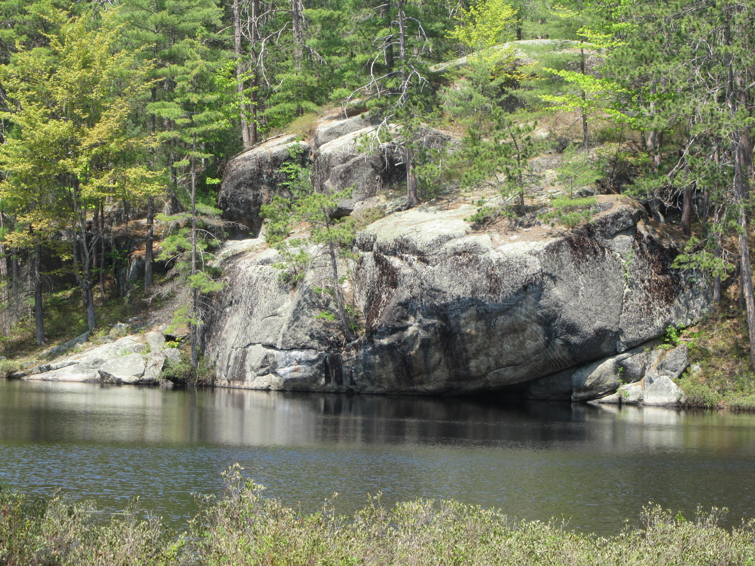
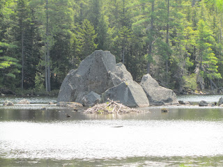
| The rocky shoreline of Pharaoh Lake |
I was looking for an early season (by Adirondack standards) backpacking trip relatively close to home. A trip to the Pharaoh Lake Wilderness fit the bill. My goal was to see as much of the Wilderness as possible as a loop while minimally retracing my steps. I also wanted to visit as many ponds as I could on my loop and visit the summit of Pharaoh and Treadway Mountains. After a busy spring, I finally set off May 22nd. This was a little later in May than I wanted on count of potentially buggy conditions, but I took my chances.
I looked over a map of the Wilderness and came up with a roughly 43 mile loop starting at the Blue Hill trailhead near the small settlement of Paradox. My route would visit nearly 20 ponds and the two most scenic mountains in the Wilderness. I began my hike just after 8AM on the 22nd.
I began my hike on the Long Swing Trail/Blue Hill Trail, which offers an alternative to walking the dirt road into Crane Pond. Vehicles with high clearance still used the rough road to drive up to Crane Pond. The Long Swing Trail is a nice enough hike with a good view at an unnamed, boggy pond. After reaching Crane Pond I headed toward Pharaoh Mountain.
 |
| My starting trailhead |
 |
| Waterfall by the trailhead |
 |
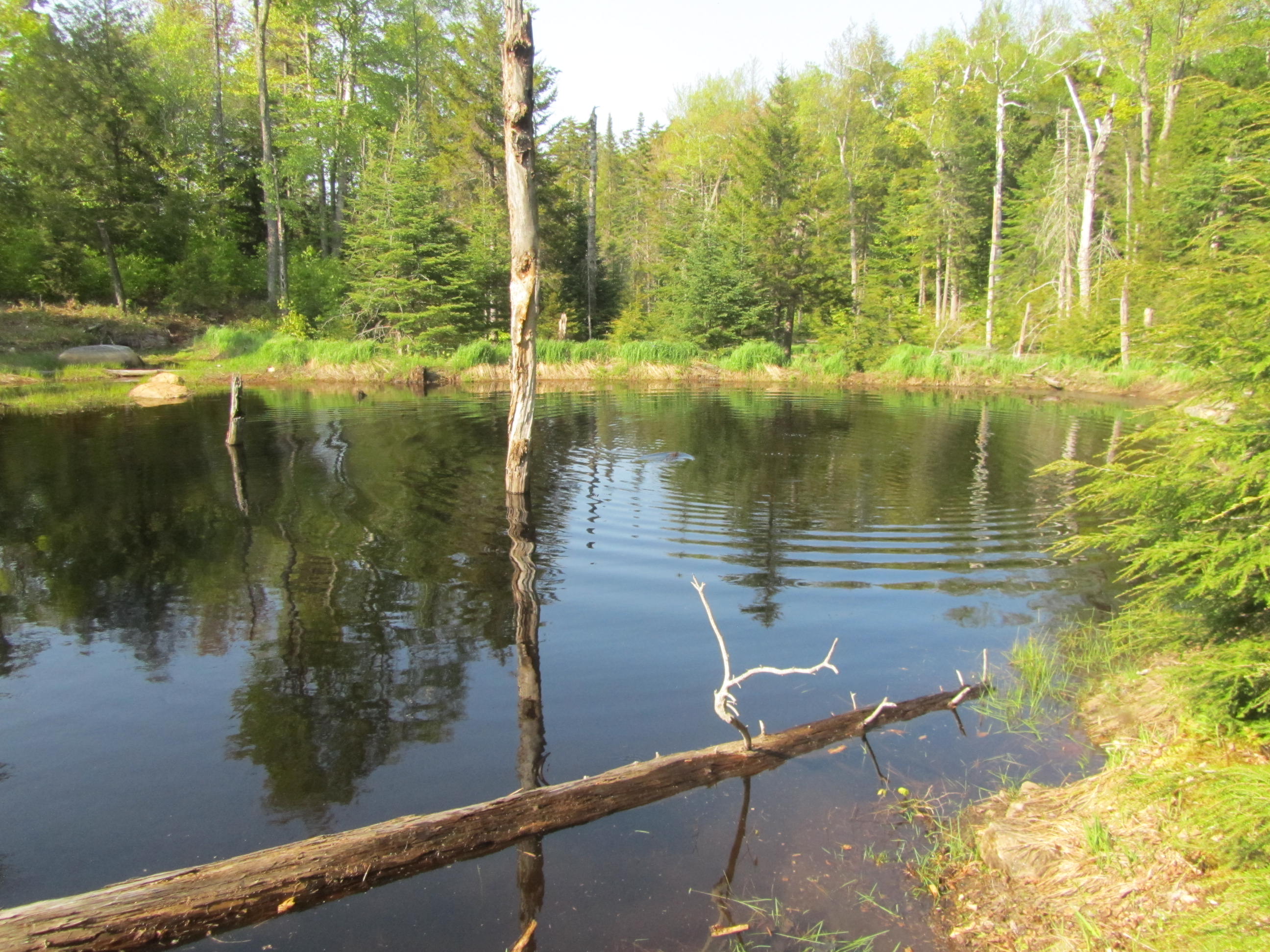
| Boggy area early on the hike |
 |
| Nice coniferous forest |
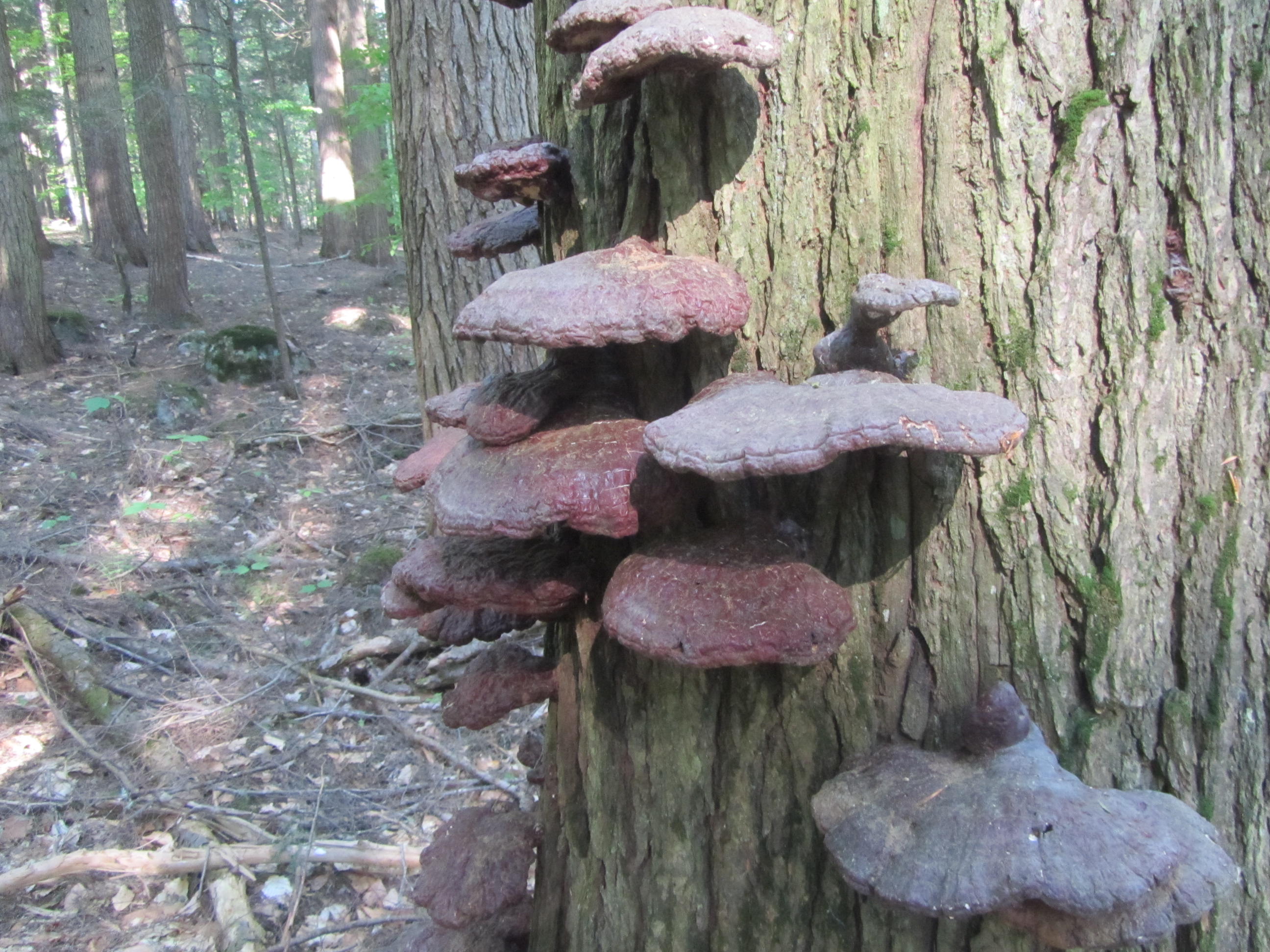
 |
| Neat fungi |
 |
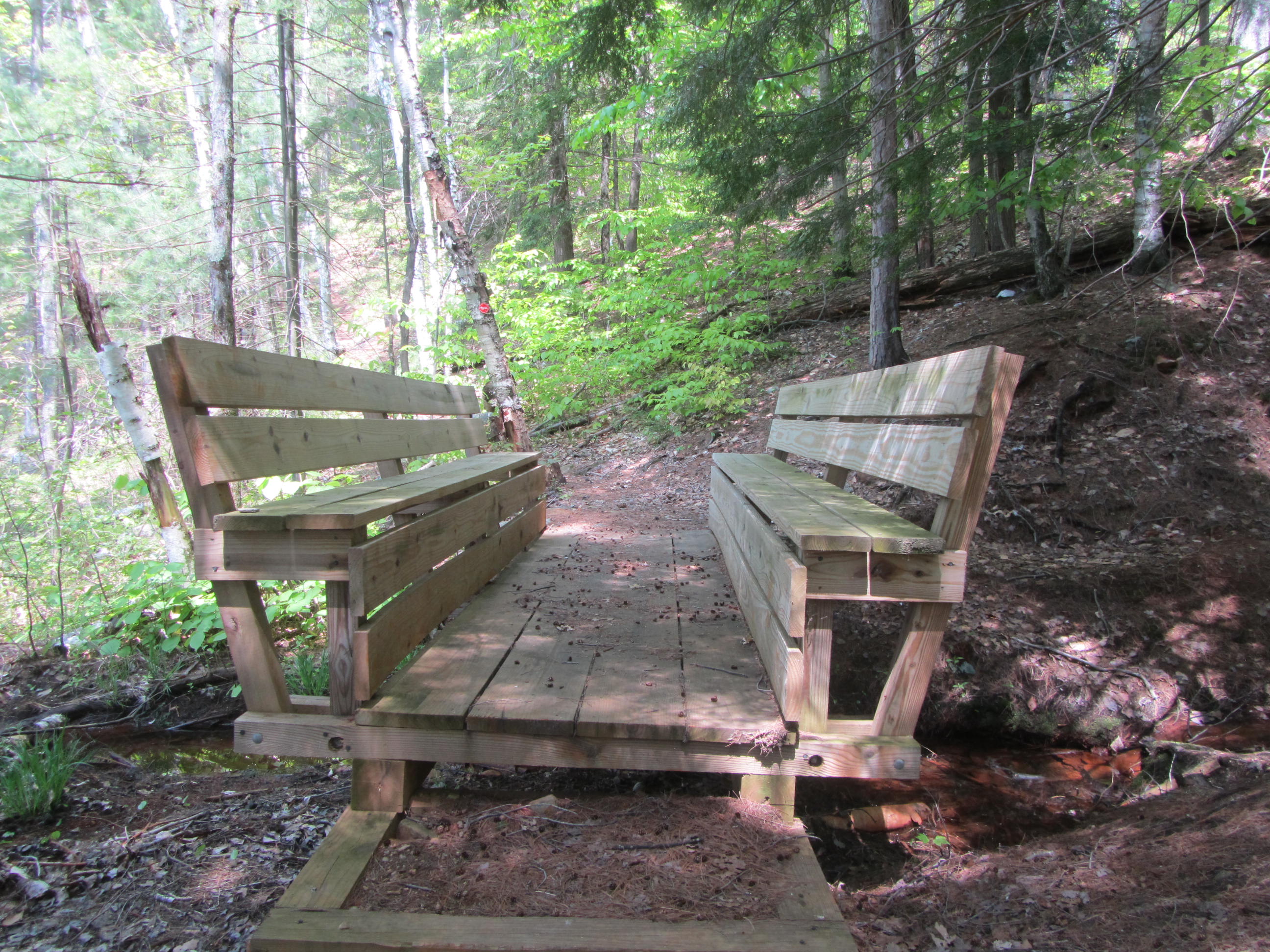
Bridge over a small creek
|
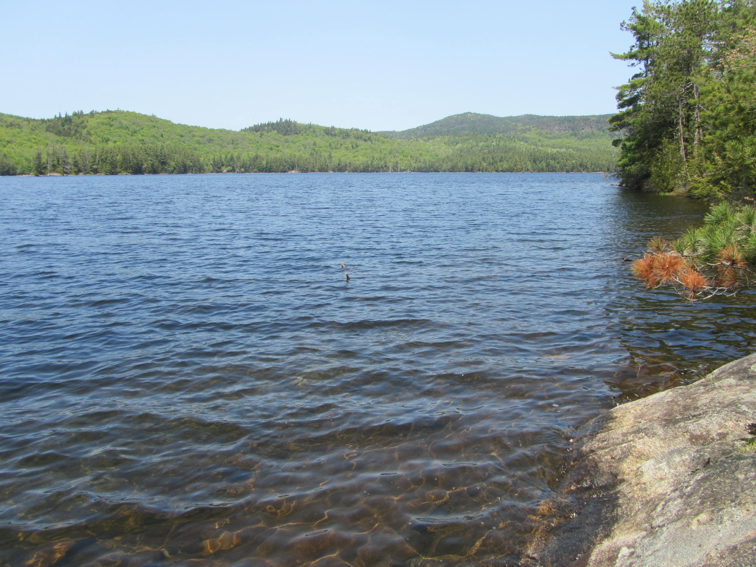
 |
| Crane Pond |
At 2,556', Pharaoh Mountain stands as the highest mountain in the Wilderness. Standing just over 6 miles form my starting point, I gained over 1,800 vertical feet enroute to Pharaoh Mountain. Despite the elevation gain, the climbing never felt too steep. The trail traverses some rocky and slabby stretches, but never seems too difficult.
 |
| Glidden Marsh |
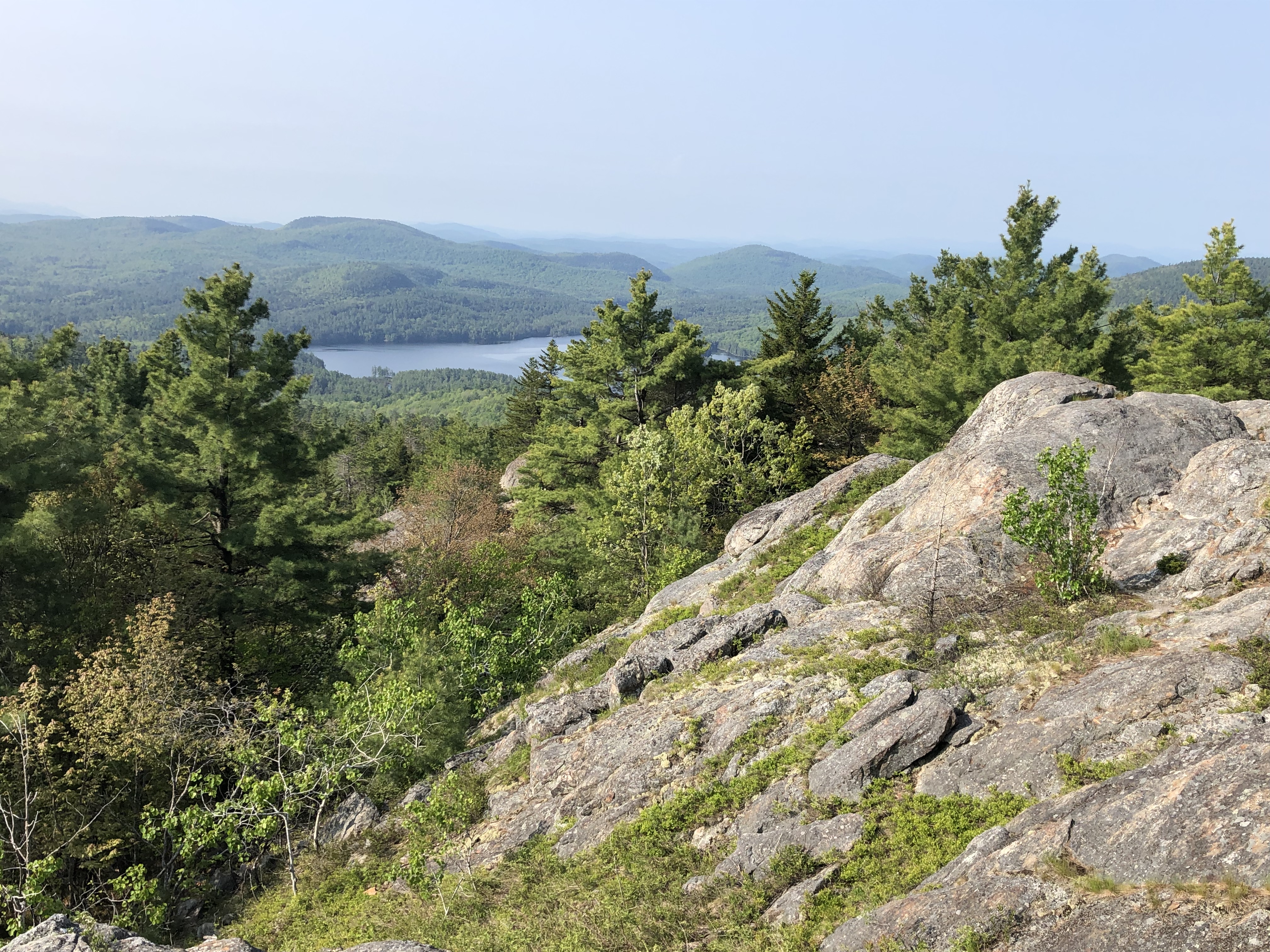
Pharaoh Mountain's summit offers pretty impressive views for a fairly low peak. While the summit itself isn't entirely open, it's possible to get views in every direction if you take the time to explore the top of the mountain. The largest open area faces west and provides about a broad view. Schroon Lake dominates the view with the southern High Peaks and Central Adirondacks in the distance. Smaller, rocky clearings face more northerly with a better look at the High Peaks area.
 |
| Looking toward Schroon Lake |
 |
| View to the north |
 |
| High Peaks |
 |
| I believe this looking to the northwest |
In the open clearings near the summit, the black flies started to emerge if I stayed still too long. They weren't bothering me until the summit, and only in the clearings. A steady breeze didn't seem to deter them.
 |
| Closeup of Schroon Lake |
 |
| Zoomed in view of the High Peaks |
 |
| I believe this looking over Goose Pond |
A designated tent site sits on the top of the mountain. More rocky clearings near the tent site allow for additional views to the north as well as across the center of the Wilderness. The Green Mountains of Vermont and Lake Champlain are both visible. Leaving the top of the mountain, you get an unobstructed view of Pharaoh Lake.
 |
| Pharaoh Lake |
Descending Pharaoh Mountain toward Pharaoh Lake, the trail traverses tougher terrain. The trail seemed steeper. At one point, I scrambled down a small 6-foot ledge. As the trail drops further away from the summit, the terrain mellows.
 |
| 6-foot ledge on the trail |
 |
| Moss lining the trail |
The trail descends until it reaches Pharaoh Lake. At 441 Acres, Pharaoh Lake is the largest body of water in the Pharaoh Lake Wilderness and sits fairly central to the Wilderness. A trail circles the entire lake. To see as much of the lake as possible, I turned left and headed toward the north end of the lake. The trail often walks right along the shore. Several tent sites sit right along the shore as well.
 |
| Reaching shore of Pharaoh Lake |
 |
| Trail along the lake |
I stopped briefly at a lean to at the northern end of the lake to take a couple photos. I encountered a garter snake basking in the sun. Just like the tent sites I passed, the lean to sat right on the water with a beautiful view of the lake.
 |
| Island on Pharaoh Lake |
 |
| Garter snake |
 |
This part of the lake is called Split Rock Bay-
I'm guessing this is the split rock |
 |
| View from the lean to |
 |
| Pharaoh Lake #4 Lean to |
 |
| Passing by the garter snake again |
I left the lean to and traveled along the northeast shore of the lake. The hiking was quite pleasant through the pretty forest with a constant chatter of bird songs in the background. I even passed a couple of small waterfalls.
 |
| Mossy stream |
 |
| Most of the bridges looked new |
 |
| Waterfall below the bridge |
 |
| Stream emptying into Pharaoh Lake |
I stopped at another lean to on the east side of the lake to have some lunch. Just like the previous lean to, this one sat close to the water with nice views across the lake. By now it had warmed up and the black flies started to pest me if I sat still to long. They weren't terrible, but definitely noticeable. I escaped with maybe only a bite or two. This was the first time they bothered me since the summit of Pharaoh Mountain. Once I started hiking again, they didn't bother me.
 |
| Lake by the lean to where I had lunch |
 |
| Pharaoh Mountain |
Leaving the lean to, the pleasant hiking continued along the eastern side of the lake. I stopped frequently to enjoy the views across the lake. Thankfully the black flies seemed to stay away.
 |
| Section of coniferous forest |
 |
Pharaoh Lake was always close to the trail
around the lake |
 |
| The lake visible from the trail |
 |
| Pharaoh Mountain |
 |
| Rocky shoreline |
 |
| Looking across the lake |
 |
| Islands |
Much of the time the trail travels right along the lake. Numerous slabs of rock along the shore would make nice swimming spots. Since it was only in the 60s, I didn't have much a desire to swim. On a hot day I could see taking a dip. I saw the first people of the day in this stretch. They weren't hikers, however. A couple of canoes were on the lake. The lake is at least three miles from the closest trailhead, so I'm not sure how they get the canoes in there. I've heard the DEC brings the boats in for people to use.
 |
| Looking toward the south end of the lake |
 |
| The walk along the lake was quite nice |
 |
| The trail crossing a smooth section of rock |
 |
| An improvised lean to along the trail |
After traveling along Pharaoh Lake for several miles, I finally departed the lake and headed toward the Springhill Ponds. I don't think the trail toward Springhill Ponds sees as much traffic as the areas around Pharaoh Lake. The start of the trail seemed a little less defined with a couple of blow downs at its start. The trail is never hard to follow though, and a relatively nice walk. I passed a couple of meadows and nice mountain streams. I saw another garter snake in this stretch.
 |
| Leaving Pharaoh Lake |
 |
| Large blowdown |
 |
| Moss lined trail |
 |
| Marshy stream along the trail |
 |
| Tumbling mountain stream |
 |
| Snake number two of the day |
 |
| A 6-foot waterfall along the trail |
To reach Springhill Pond, you need to travel a short distance on a marked side trail. The side trail changes quite a bit of elevation before reaching the pond. I traveled a little around the pond since it seems fairly isolated. After the trail seemed to fade away I headed back to the main trail after taking a few photos.
 |
| First look at Springhill Pond |
 |
| Another view of Springhill Pond |
Leaving the Springhill Pond area, the trail climbs gradually toward the ridge of Ellis Mountain. While the climbing isn't particularly steep, the descent was a little steeper. As I descended, I saw the first hiker of the day, some 15+ miles into my trip. I stopped to filter water as I neared the low point in this stretch. After a couple minutes of standing still, the black flies found me. They weren't unbearable, but I was ready to move on after a ten minute rest.
 |
| Junction of Springhill and Berrymill Pond Trails |
I reached another junction, not too far from a trailhead, and made my way towards Berrymill Pond. The grounds cover encroached the trail at times, but the trail was easy to follow. Some descriptions I read about this trail made it sound wet and overgrown, but it seemed pretty straightforward to follow and mostly dry. I passed some areas that went by beaver activity, but the trail wasn't affected by it. There was quite a few blooming trillium flowers and blooming hobblebush along the trail here.
 |
| Brushy section of trail |
 |
| trailside bog |
 |
| Log bridge |
 |
| Blooming Hobblebush |
 |
| Trillium |
At one point, I saw something fairly large and brown move awkwardly across the trail and into the brush. As I got closer, I realized it was two beavers moving across the land. They aren't the most graceful when not in water. They quickly made their way down to a small pond just off the trail. I dropped down to the pond and was greeted by several tail slaps. After a minute they seemed less threatened and swam around a bit. I enjoyed watching them at fairly close range, but the black flies began swarming me after a couple minutes. As I moved away, they slapped their tails again.
 |
| Pond with the beavers |
 |
| Two beavers |
 |
| Closeup of a beaver |
Soon after the beaver sighting, I reached the Berrymill Pond Lean to. The shelter sits on a narrow arm near the outlet and it's difficult to see the bulk of Berrymill Pond. There is a nice waterfall at the outlet of the pond however that's worth the short side trip.
 |
| Outlet of Berrymill Pond |
 |
| Near the outlet of Berrymill Pond |
 |
| An arm of Berrymill Pond |
Leaving Berrymill Pond, I descended toward Putnam Pond Campground. While the hiking was pretty easy, this section of trail was heavy with mosquitoes. I put the hood on my shirt up and tried to get through the worst section as quickly as possible. I frequently would look a the back of my arms to find multiple mosquitoes at a time. I was wearing long sleeves which helped, but a few managed to bite me through the shirt. The worst of the mosquitoes lasted only about a mile or so. If I wasn't assaulted by the mosquitos, I would have took more time to enjoy the pleasant walking through the coniferous forest. There was some streams with small cascades that were pretty.
 |
| Another newer bridge |
 |
| Mossy waterfall |
 |
| Another small cascade |
Not long after the mosquito cloud, I reached the paved trailhead near Putnam Pond. A short minute-long stroll along the road brought me back into the woods on the Grizzle Ocean Trail. A state run campground sits along part of Putnam Pond, I could hear people in the distance at the campsites, but didn't see anyone.
 |
| Trailhead by Putnam Pond |
My goal for the night was to camp at the Grizzle Ocean Lean to. The last couple miles from the Putnam Pond road to Grizzle Ocean were rather nice. The trail is rather easy. Several pretty streams flow near the trail. There is easy access to the south end of Putnam Pond. The south end of the pond is far from the campground and much more quiet. I could hear loons in the distance on Putnam Pond. I also scared a large bird. I didn't get a clear look at it through the trees, but it looked like a bald eagle.
 |
| View from the south shore of Putnam Pond |
The Grizzle Ocean Lean to sits about a half-mile off of my route. I was intrigued by the name and wanted to see this pond. While there, I wanted to hike the small mile-long loop around the pond as well. Since I still had about 90 minutes of light, I decided to hike the loop before I settled at the lean to.
 |
| Long boardwalk over the outlet of Grizzle Ocean |
The loop around Grizzle Ocean was nothing to write home about. The trail is brushy and a little hard to follow. Only a couple spots you actually are on the shore of the pond. I did startle some beavers however and they slapped their tails at me. I reached the lean-to about 715PM.
Grizzle Ocean, despite its name, is a fairly small pond. I've read it gets its name from a fisherman catching a fish so big that it looked like it came from the ocean. In the evening, I saw quite a few small fish near the shore. I also saw some newts along the shore.
 |
| Grizzle Ocean Lean to |
Fortunately, by the time I arrived at the lean to, the black flies and mosquitos were both pretty sparse. I was able to filter water, cook, and eat without being eaten alive. I had my tent with me in case I needed to protect myself from biting insects overnight. I decided to sleep in the lean-to since the bugs went into hiding and I had the place to myself
I pretty quickly turned in for the night just after dark- about 915PM. After all, I did hike close to 25 miles for the day and got up fairly early. There was a pleasant chorus of frogs in the distance and a loon in the pond calling occasionally. I could also hear a loon on a distant pond. I was also serenaded by barred owls. I heard both the classic call as well as their courting calls. The courting call is sometimes referred to as a monkey call. It also sounds like an angry duck at times. If you never heard it, I recommend listening to them
here. The owls carried on nearby for about an hour before moving further away.
 |
| Grizzle Ocean at evening twilight |
I usually don't like lean tos all that much to sleep. I have not slept in one since my Long Trail hike in 2011. After about an hour of laying down in the lean to I remembered why. I had a mouse friend visit me through the night. I didn't have any food in the lean to and my pack hung from the rafters. It seemed to enjoy scurrying across and through a few stuff sacks I had nearby. At one point I was awakened as it crawled across my head. I had my hood on, but I still didn't appreciate the visitor.
I awoke from my sleep a few times throughout the night. The resident loon called several times. I heard beaver slapping at one point. Near morning the barred owls began their calling again. I don't mind those kinds of sounds of nature as sleep disruptions, but I don't enjoy the mice.
 |
| Morning sun on Grizzle Ocean |
I enjoyed not having a tent to pack up in the morning. Even with one less chore, I was still kind of slow to get moving and wasn't on the trail again until after 7AM. That may not sound late, but considering it is light around 5AM, I feel it's a slow start when traveling solo. While I was packing up and eating breakfast I saw a loon take off from the lake and circle above the water before leaving the area.
Shortly after departing for the morning, my first destination was a side trip to Treadway Mountain. Treadway is reached by a two mile trail. The trail starts off easy enough, but quickly starts climbing over open rock. Cairns mark the way over open stretches and across rock. One small scramble of about 6 feet needs to be negotiated at one point.
 |
| Leaving the Grizzle Ocean Trail |
 |
| Mud Pond |
 |
| Treadway Mountain trail |
 |
| Rocky stretch enroute to Treadway |
 |
| Section requiring some scrambling |
 |
| Hiking on open rock |
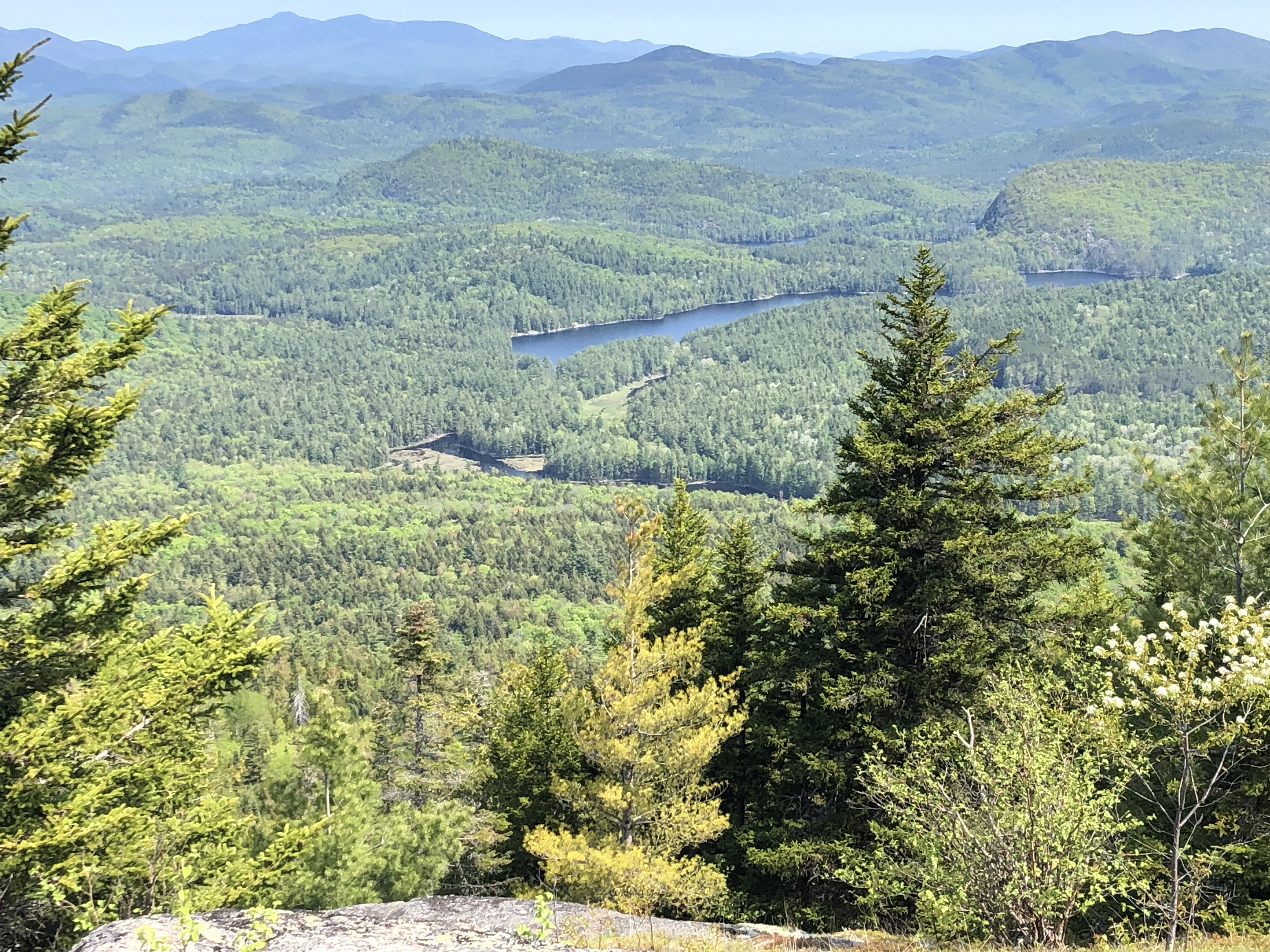
A slightly lower summit is traversed before dropping down briefly before gaining the higher summit. Treadway stands at a modest 2,244'. The last half-mile is fairly rugged for such a small mountain. The summit is fairly open with good views in most directions if you take the time to explore the different outcroppings. The view as somewhat obscured by haze while I was there, but you get good views of Pharaoh Mountain and Lake with glimpses toward the High Peaks to the northwest. Black flies tried to find me on the summit, but a stiff breeze seemed to keep them out of reach. I was rewarded with more nice views as I descended.
 |
| Pharaoh Mountain poking out above the trees |
 |
| View from Treadway |
 |
| Pharaoh Lake |
 |
| View on the descent of Treadway |
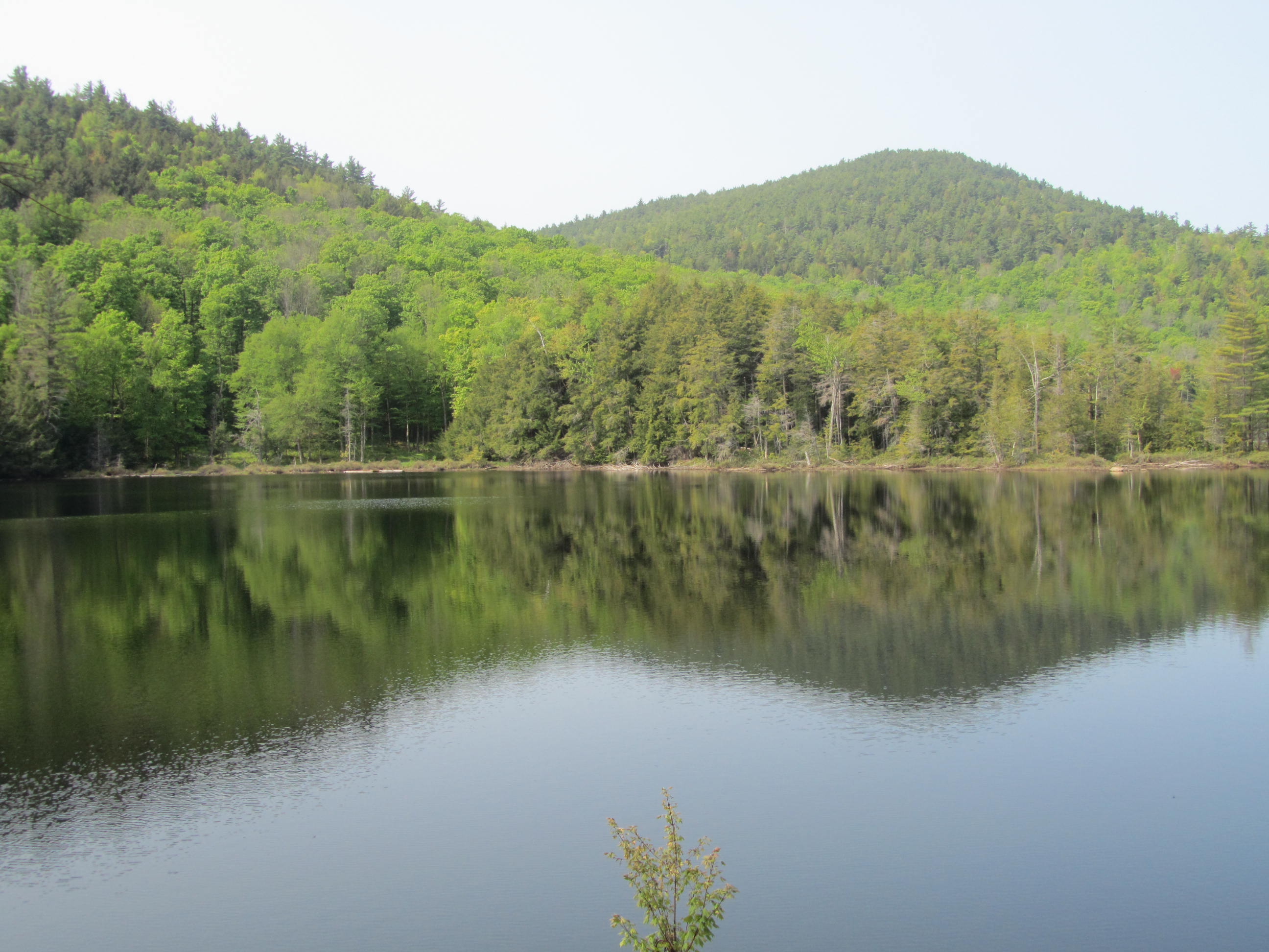
My next several miles took me to a series of small ponds. I started passing the boggy looking Mud Pond. Shortly after that, I walked the shores of the small but scenic Clear Pond. The Clear Pond Lean to sits close to its banks. I caught a glimpse of Rock Pond through the trees. I continued over more boggy area and reached Little Rock Pond with nice views of surrounding low mountains.
 |
| Small waterfall below Mud Pond's outlet |
 |
| Clear Pond |
 |
Bridge over stream between Rock and
Little Rock Ponds |
 |
| About to cross the bridge |
 |
| Little Rock Pond |
 |
| The trail along the water |
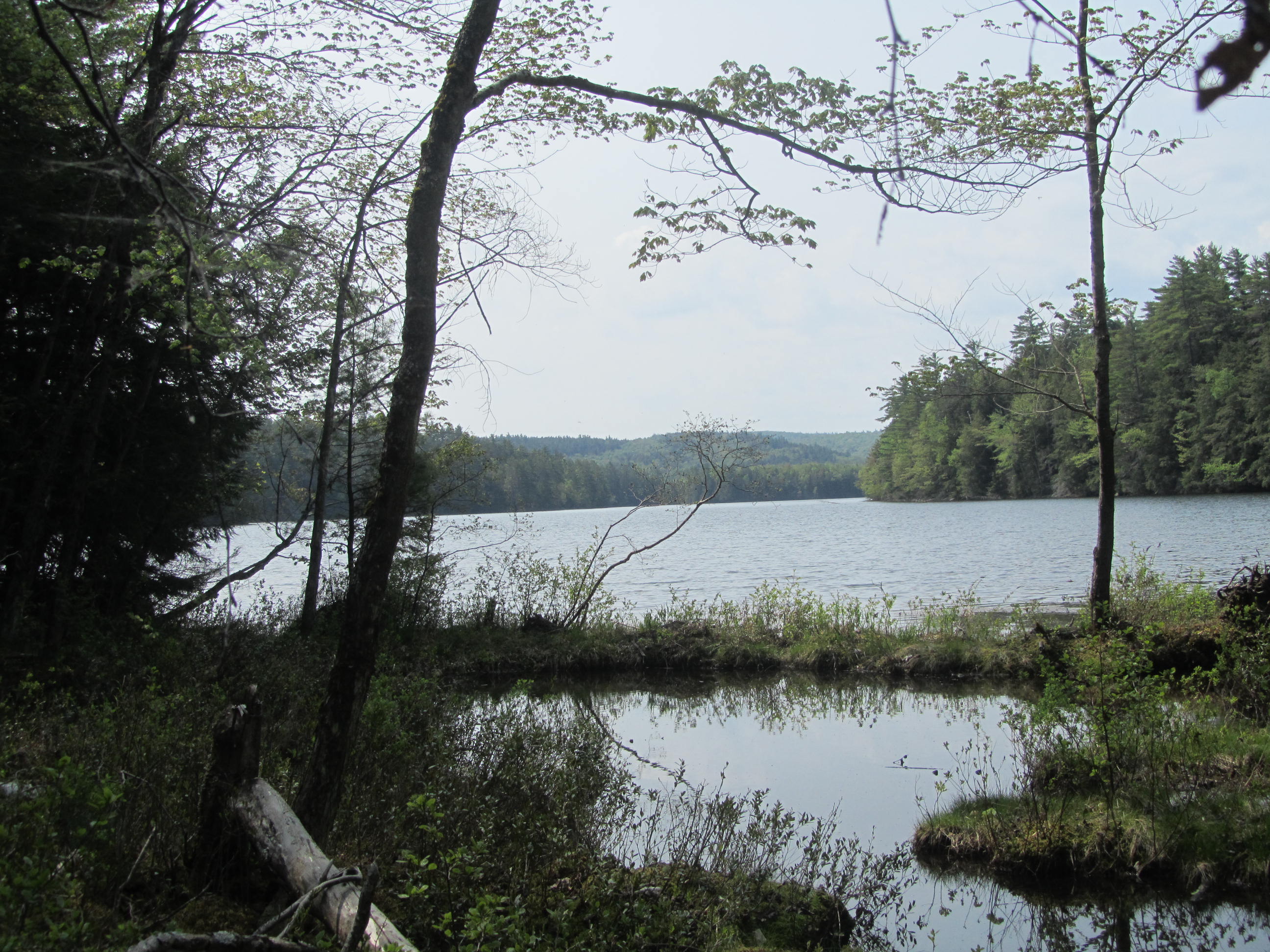
Beyond Little Rock Pond, I walked along another boggy pond. This might be part of Little Rock Pond or one of its streams. The boggy little pond was teeming with wildlife. I startled several frogs along the shore. A few sunning turtles dove off logs into the water as I neared. Waterfowl swam in the distance.
 |
| Bog just beyond Little Rock Pond |
Looking to take in more bodies of water and terrain in the Wilderness, I headed east. My destinations were North Pond and Heart Pond. Before I reached North Pond, I startled a huge garter snake. The snake was at least 3 foot long and very fat for a garter snake. It looked like it just ate a chipmunk. It was one of the largest garter snakes I have ever seen.
 |
Photo doesn't show it, but this was a very
large garter snake |
After taking a few pictures of the snake, I continued toward North Pond, which is really just an arm of Putnam Pond. Just before reaching the campground at Putnam Pond, I headed north past Heart Pond toward Bear Pond. Heart Pond is a boggy looking pond with a tent site right on the water. I was somewhat surprised at the terrain between Little Rock Pond and Heart Pond. I expected flat trail, but there was a fair amount of short steep hills.
 |
| North Pond |
 |
| Heart Pond from its campsite |
I enjoyed the hiking along the Bear Pond Loop. The terrain was rather easy. I passed through some boggy areas. When not bothered by bugs, I enjoy the scenery of backcountry bogs. The trail traveled along Bear Pond longer than I expected. Bear Pond has an isolated feel to it. I don't think it sees that many visitors. The trail crosses its inlet stream with a waterfall just above the trail.
 |
| Reshette Swamp |
 |
| Bear Pond |
 |
| Waterfall at Bear Pond's inlet |
I expected the trail leading away from Bear Pond to be rough and rocky with steep climbs. I was pleasantly surprised that the trail followed an old tote road with easy footing in a pleasant coniferous forest. The Bear Pond Trail brought me to the north end of Rock Pond.
 |
| Easy hiking on an old tote road |
 |
| View from the north end of Rock Pond |
Along the north end of Rock Pond are relics of the past. A series of stone foundations, a massive metal pipe, and a mine entrance mark the location of an old graphite mine. The pipe was part of an old steam boiler. Apparently operations started in the beginning of the 1900s.
 |
| Old foundations |
 |
| Old boiler |
 |
| Nice bridge with benches |
 |
| Mine entrance |
From the mine, the trail works its way down the west side of Rock Pond. At times the the terrain offers quite the challenge as it negotiates a steep hillside with big drops to the pond below. The frequently rocky trail often descends to the shores of the pond. Large slabs of rock slope into the pond from the shoreline. Several small mountains line the pond. Multiple campsites sit right on the shore as well. At one point, I saw massive tadpoles swimming along the edge of the pond. Later in summer, I would be tempted to swim in the clear water. Rock Pond is quite stunning and a worthy destination on its own.
 |
| Narrow trail along cliffs above Rock Pond |
 |
| View across Rock Pond |
 |
| Looking down Rock Pond's shoreline |
 |
| The trail right along the pond |
 |
| Last look at Rock Pond |
After traveling a good distance around Rock Pond, I kept an eye out for my next trail. I crossed over a small outlet stream and reached an unmarked junction. On the map, the junction didn't seem to line up with the trail. The trail I wanted headed toward Lilypad Pond and followed stream leaving Rock Pond. This trail followed a stream so I took a compass bearing to confirm, the unmarked junction was my trail.
After 30 minutes or so, I reached Lilypad Pond, confirming I took the correct trail. Unlike Rock Pond, Lilypad Pond isn't too pretty of a pond. It looks like it was once a larger beaver pond that has since drained. I stopped for a few minutes for a snack and to look at my map at the lean to by the pond. Now in the heat of the day, the mosquitoes and black flies were looking for a meal.
 |
| Lilypad Pond |
A couple minutes after leaving, Lilypad Pond, I crossed paths with the same backpacker I saw the day before. I spoke to him for a minute. During my brief pause, the black flies came out in full force. I moved on quickly to escape the cloud. While hiking the black flies never really bothered me.
The next several miles brought me to more bodies of water. The trail passed tiny Horseshoe Pond before walking along Crab Pond. Horseshoe Pond sits in a nice isolated location with a secluded campsite. Crab Pond is quite a bit larger with large trees along its shore, islands, and a nice remote feel. Less than a mile past Crab Pond, I reached Oxshoe Pond. Oxshoe features rocky shoreline and a lean to that sits on high ground above the pond just back from a rocky perch.
 |
| Horseshoe Pond |
 |
| East end of Crab Pond |
 |
| Sign showing the way |
 |
| Outlet of Crab Pond |
 |
| Dark stretch of forest |
 |
| Rock outcropping on Oxshoe Pond |
 |
| Looking down Oxshoe Pond by the lean to |
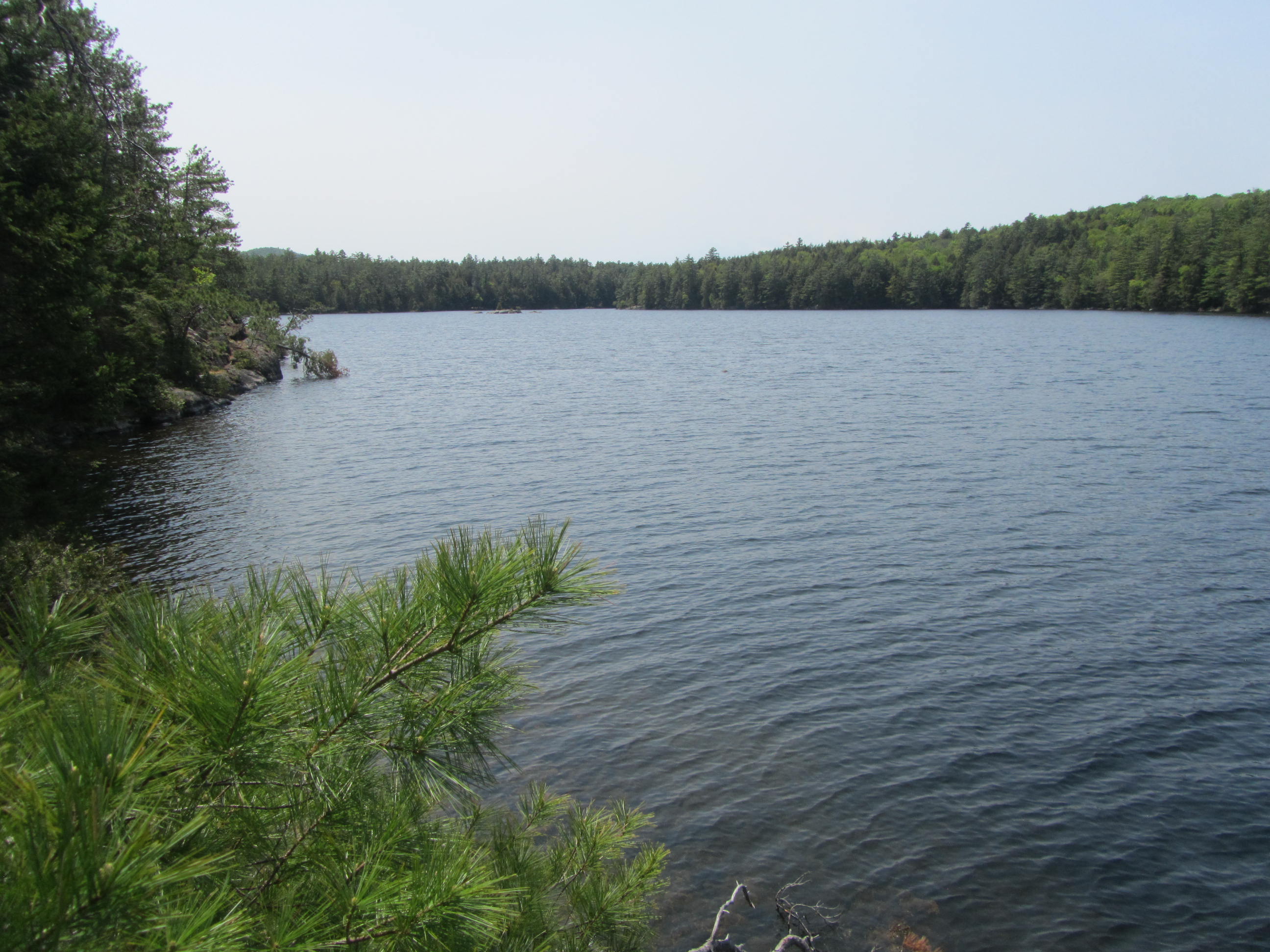
From Oxshoe Pond, I descended to Glidden Marsh. I wasn't bothered by bugs for a few miles. Upon reaching Glidden Marsh, the mosquitoes came out in force. I once again put up my hood and picked up my pace. I frequently wiped mosquitoes off the backs of my arms as they attempted to bite me through my shirt. Within a mile of leaving Glidden Marsh, I was back by Crane Pond and retracing my steps to finish my hike back on the Long Swing Trail.
 |
| Glidden Marsh |
 |
| Crane Pond |
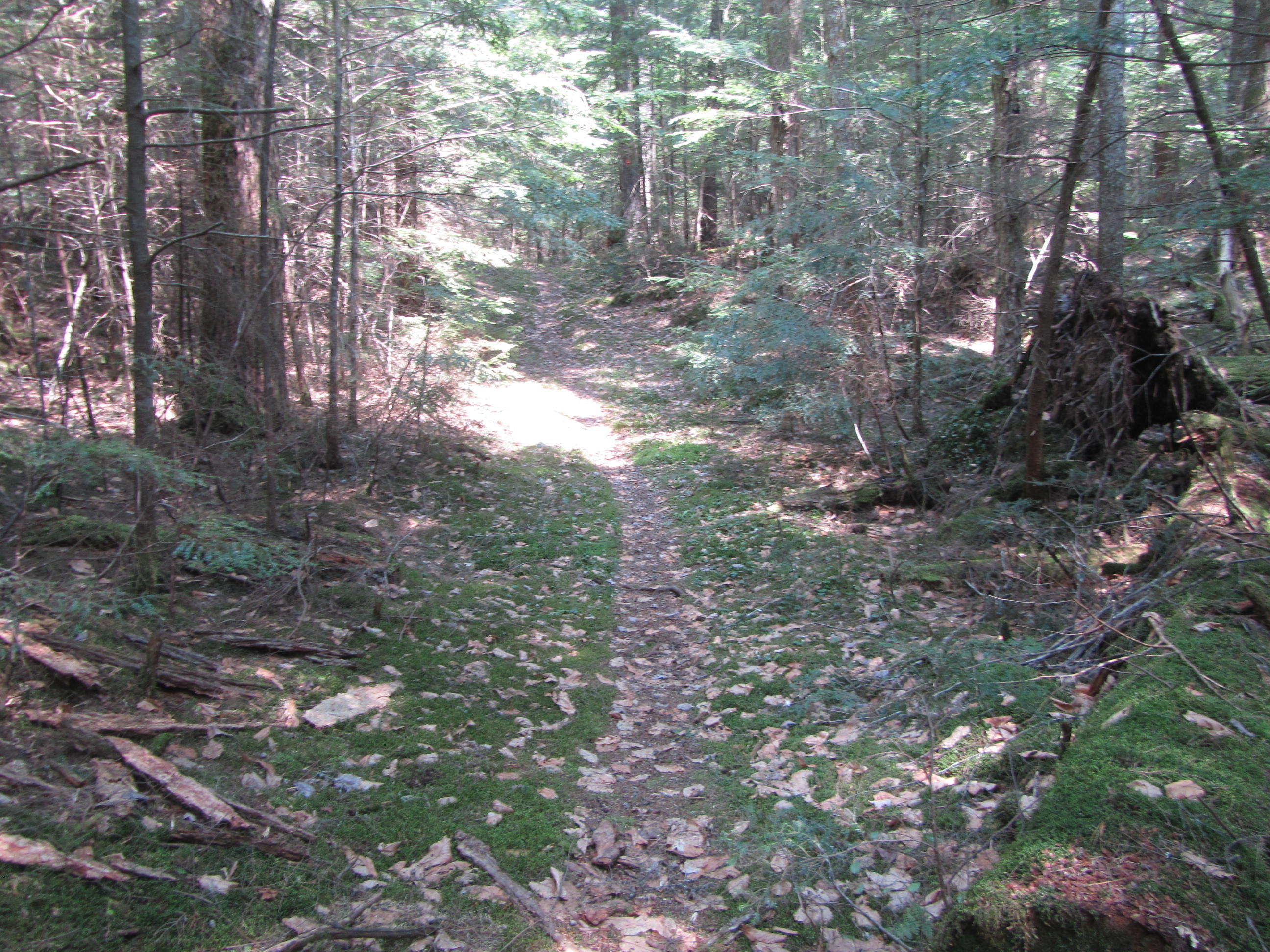
Back on the Long Swing Trail (Long Swing Tail in guide books and maps but Blue Hill Trail on signs), I climbed over a ridge and suddenly the mosquitoes gave up chase after a mile and a half. The rest of hike was peaceful with no more issues with bugs. My final few miles went by pretty quickly.
 |
| Final three miles |
Before finishing the hike, I had one more interesting wildlife sighting. I stepped on a rock in the middle of a stream (the outlet to the bog near the top of the post). I stepped a couple feet away from a tiny watersnake. The snake at best was 10 inches long The snake struck at me, but was no closer than two feet from biting me. I stepped away to get a few photos. I had to step on the same rock again to get by it. It struck a couple more times, getting nowhere near me, before slithering into the water.
While watersnakes aren't that exciting as far as snakes go, it was pretty comical seeing it put on a big show for such a tiny snake. Watersnakes tend to fade in color as they get bigger. This one looked quite bright and was a darker color than most I have seen. I'm assuming it was just born this spring. I have seen many watersnakes over the years and have handled several. They are usually quite feisty and quick to strike when you get too close or attempt to handle. I didn't attempt to handle this snake, or even get that close to it. It just happened to be extra defensive.
 |
This watersnake is about 10" long,
the zoomed photo is deceiving |
I reached the trailhead about 330PM, having covered at least 18 miles for the day. My total trip distance was around 43-44 miles. Although the elevations in the Pharaoh Lake Wilderness are fairly low, I still managed more than 7,000' feet of elevation gain over the route.
 |
| Pharaoh Mountain view |
I was pleasantly surprised by the Pharaoh Lake Wilderness. The abundance of ponds made for nice scenery. The views from Pharaoh Mountain were pretty expansive for a relatively low mountain. While Treadway's vista wasn't quite as nice as Pharaoh, the terrain on the mountain was quite interesting.
I was really surprised by how few people I saw. I'm guessing that starting my hike on a Monday helped limit the number of people I saw. People probably avoided the area this time of year because it overlaps with the peak of black fly season. While I did encounter some buggy sections, overall the black flies and mosquitoes were not that bad for the later part of May.
I also managed to hike through a couple of great days of weather. My first day was pretty comfortable in the mid 60s. It was cool enough to keep the bugs away and for comfortable sleeping with mid 40s at night. My second day was a little warmer reaching the mid 70s.
 |
| Giant and Rocky Peak in the distance over Crane Pond |
With so many campsites and numerous trail options, its possible to create a variety of backpacking itineraries in the Pharaoh Lake Wilderness from an overnighter to a week if you take your time. The area can get crowded in the peak summer season and fall, especially on the weekends and holidays. Given the lower elevations and abundant water, I would expect buggy conditions in the late spring through summer so plan accordingly. It is the Adirondacks, so that is to be expected most places in the backcountry. If you are looking for a laid back backpacking trip in the Adirondacks that is suitable for beginners, but still with plenty of variety and scenery to please veteran backpackers, I highly recommend the Pharaoh Lake Wilderness.
Additional resources:
 |
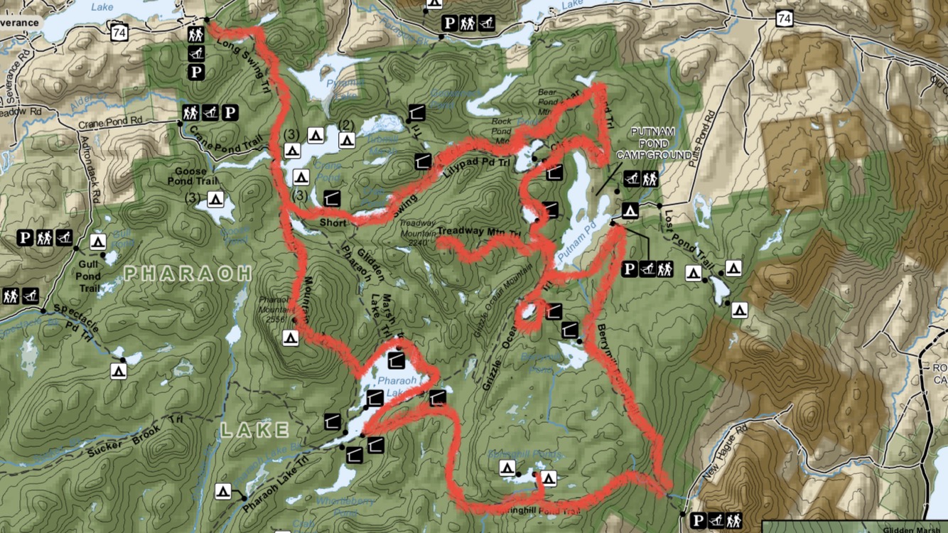
My route in red. I started at the top
left and hiked counterclockwise. |
If you enjoyed this post, be sure to check out and "LIKE"
Tomcat's Outdoor Adventures on Facebook where I post photos more often and revisit past adventures.