The White Mountains of New Hampshire are one of the premier hiking destinations in the eastern US. The Whites feature the highest mountains in the Northeast and a dense network of trails. Over the years I have hiked more than 500 miles in New Hampshire. Over 400 of those miles were racked up on backpacking trips. After moving out of the Northeast, nine years have passed since my last outing in the Whites. Now that I live back in the Northeast, I started looking over maps of the Whites to plan another backpacking trip.
 |
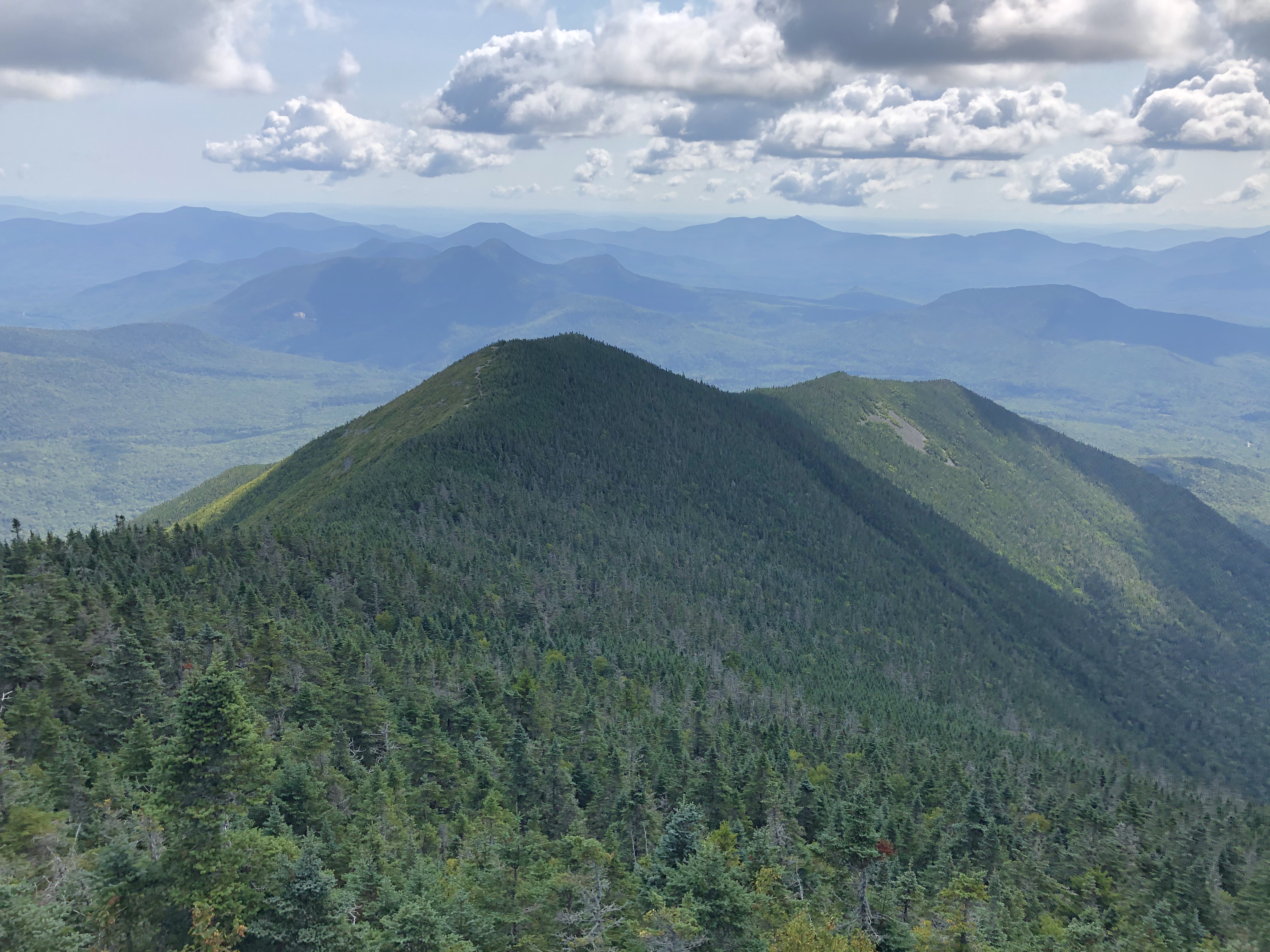
| View from Mt Carrigain |
I wanted to visit parts of the Whites I have never hiked before, while incorporating as many summits into my route. I cobbled together a route covering nearly 90 miles with 14 summits over 4,000'. Best of all, with the exception of a couple miles, the route visited areas I have never been before. My route covered much of the southern portion of the White Mountain National Forest.
My first challenge was finding a good window of weather that gave me the best chance for a mostly dry trip. This proved difficult. I finally settled on the first week of September around Labor Day. As the time approached, the forecast took a turn for the worst. I originally planned on starting on Labor Day, a Monday. Soaking rains moved into the area, so I pushed it back a day. Unfortunately the rain lingered and I pushed it back one more day, starting on Wednesday, September 7th. I left home the day before to get a good jump on the day.
Day 1
Waterville Valley- Wilderness Trail
25.0 Miles
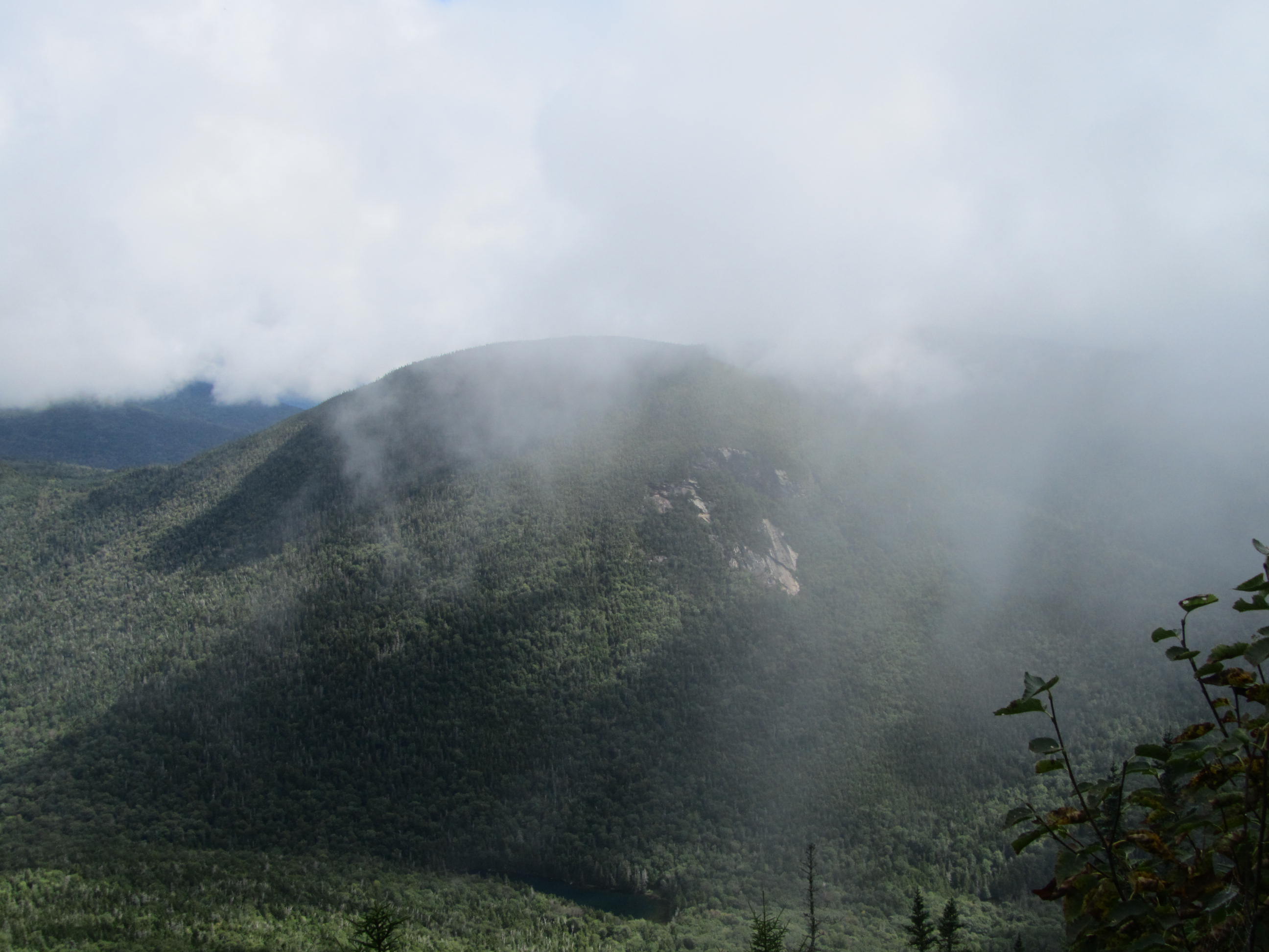
My trip began around 730AM on the Mt Tecumseh Trail at the Waterville Valley Ski Area at around 1,880' in elevation. Unfortunately, the weather that postponed my trip a couple days, lingered. Low clouds shrouded the area. I began my climb toward the first of many summits of the trip, Mt Tecumseh. Although it wasn't raining at the trailhead, I soon climbed into the clouds where I entered a heavy mist. If there are views on Tecumseh, I wouldn't know, since the visibility was basically zero. Any vegetation I brushed against left me increasingly wetter. From the summit I continued on the Mt Tecumseh Trail, eventually descending to Tripoli Road and loosing all the elevation I gained.
 |
| My starting point |
 |
| Nice rock work |
 |
| View from a ski trail |
 |
| Rocky section |
Mt Tecumseh stands as the lowest summit of the New Hampshire 4,000' Peak list. The elevation has long been listed as 4,003'. A new survey in 2019 measured the peak at only 3,997'. For now Tecumseh remains on the New Hampshire 48 list. My most recent copy of the White Mountain Guide still shows the 4,003' elevation.
 |
| Socked in summit of Tecumseh |
When I reached Tripoli Road, I followed the road roughly a mile to the trailhead for Mt. Osceola. Unlike Tecumseh, that I had to myself, the Osceola trailhead was fairly full for a dreary, Wednesday morning. On the lower reaches of the hike toward Osceola I had a brief break from the mist. As I climbed however, I soon reached clouds again and a steady drizzle. In the unpleasant conditions, I trudged uphill. Although steep at times, the trail wasn't overly rough. I passed several hikers enroute to the summit. Despite an open area that probably had good views on a clear day, I could see only a wall of clouds. With no reason to linger at the 4,340' summit, I moved on quickly.
 |
| Beginning of climb to the Osceolas |
From Osceola, I continued toward East Osceola. Although only a mile apart; a steep, rock chimney provides a challenging obstacle between the two peaks. The chimney, while not completely vertical, requires some careful scrambling. Descending the chimney probably isn't too bad in dry conditions, but I took extra care downclimbing in the drizzle. Beyond the chimney, I arrived at the 4,146' summit of East Osceola pretty quickly. The drizzle almost completely let up by the time I reached the summit.
 |
| Chimney between the summits |
 |
| East Osceola's summit |
Descending to the north from East Osceola, the terrain becomes much rougher and the pace slows down. As I dropped in elevation, the clouds started to lift. I got a few peekaboo views back toward East Osceola and into the valley over the Kancamagus Highway. Just before reaching the highway, I stopped at a stream crossing for a break, nearly 14 miles into my day. I reached the highway, dropping below 2,000' in elevation for the second time since my starting point. I followed the Kancamagus Highway to the east about 3/4 of a mile before heading back in the woods on the trail toward the Hancocks.
 |
| East Osceola visible in a break in the clouds |
 |
| The clouds are slowly lifting |
 |
| Lingering clouds |
 |
| Greeley Ponds Trail |
 |
| Small creek crossing |
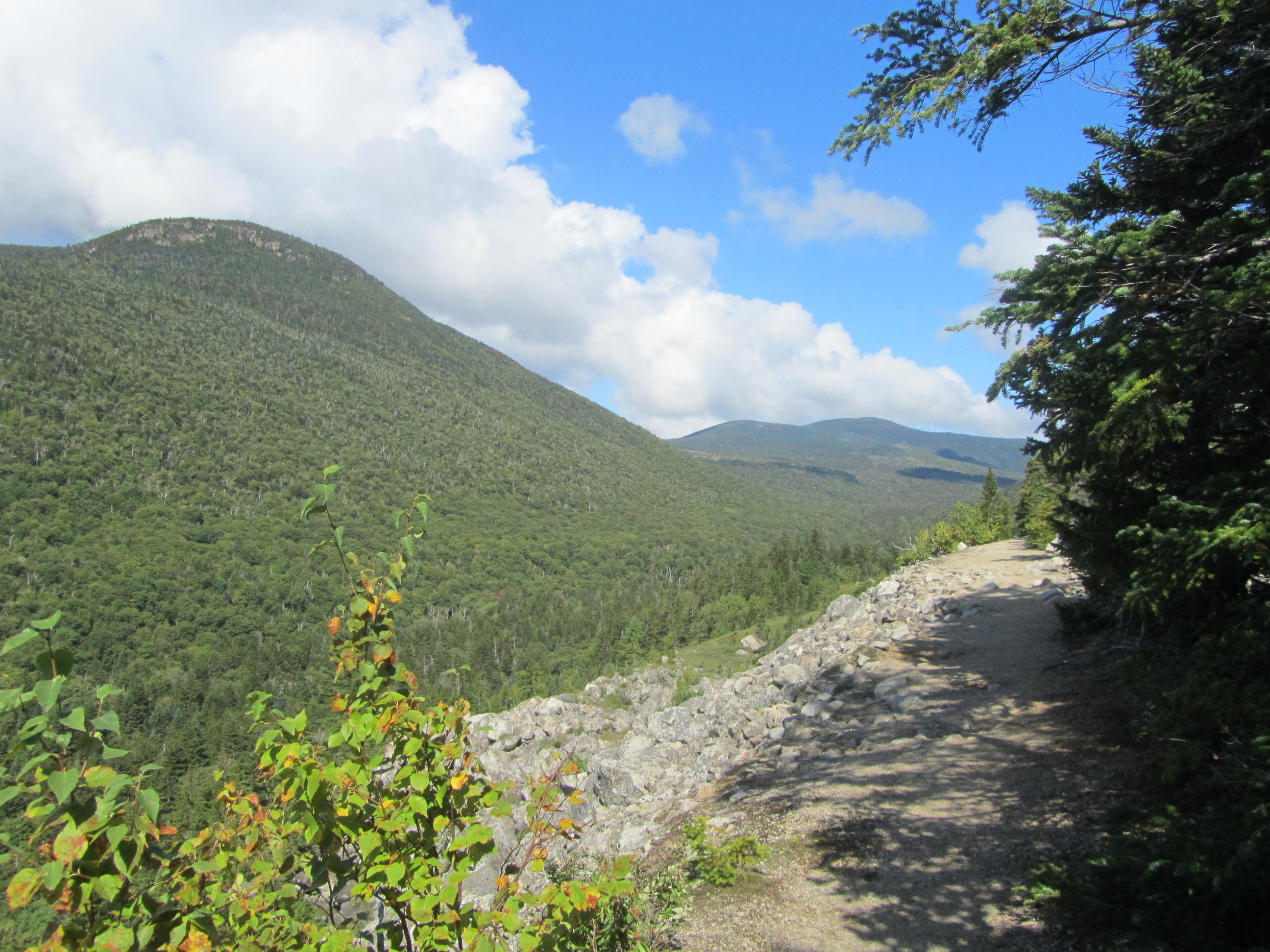
Leaving the highway, the trail climbs fairly gradually as it makes its way toward a side loop of Hancock and South Hancock. Looking to visit new peaks, I followed the Hancock Loop Trail. The first mile of the Hancock Loop Trail leads to the actual loop. I decided to take the north spur hitting the slightly higher North Hancock. The climb to 4,420' North Hancock was relentless, gaining about 1,100' in about a half-mile according to the altimeter on my watch. By now, the clouds had partially broken up, given me a few views near the summit.
 |
| Easy rock hop |
 |
| Cascades on the Hancock Loop |
 |
| Sign on North Hancock |
 |
| Partial view on North Hancock |
From the north summit, the 4,319' South Hancock summit is reached in just over a mile. Although the summits were wooded, open ledges nearby provided decent views. The descent from South Hancock wasn't nearly as steep as the climb to North Hancock. After finishing the loop, I returned to the Cedar Brook Trail, now about 20 miles into my day.
 |
| Between the Hancocks |
 |
| Nice bog bridges |
 |
| View near South Hancock |
 |
| Looking east from South Hancock |
 |
| Slides on North Hancock |
From the end of the Hancock Loop, I climbed to the north and entered the Pemigewasset Wilderness (The Pemi). Wilderness Areas see less maintenance and the trail conditions immediately deteriorated when I entered the Pemi. The trail immediately became muddier and brushier. My plan was to camp somewhere along the Cedar Brook Trail, a few miles beyond the end of the Hancock Loop. I wasn't able to find any place to camp once in the Pemi. The brushy forest left me no options for setting up my tent. Within the Wilderness, there are regulations on camping within 200 feet of water or trails. The only flat spot that was clear enough for a tent was sandwiched between a stream and the trail and only a feet from either. Finally I reached the end of the Cedar Brook Trail and turned onto the Wilderness Trail.
 |
| Entering the Pemi |
 |
| Muddy trail conditions in the Pemi |
 |
Doesn't look like many people pass
through here |
 |
| Mushrooms enjoy the wet forest |
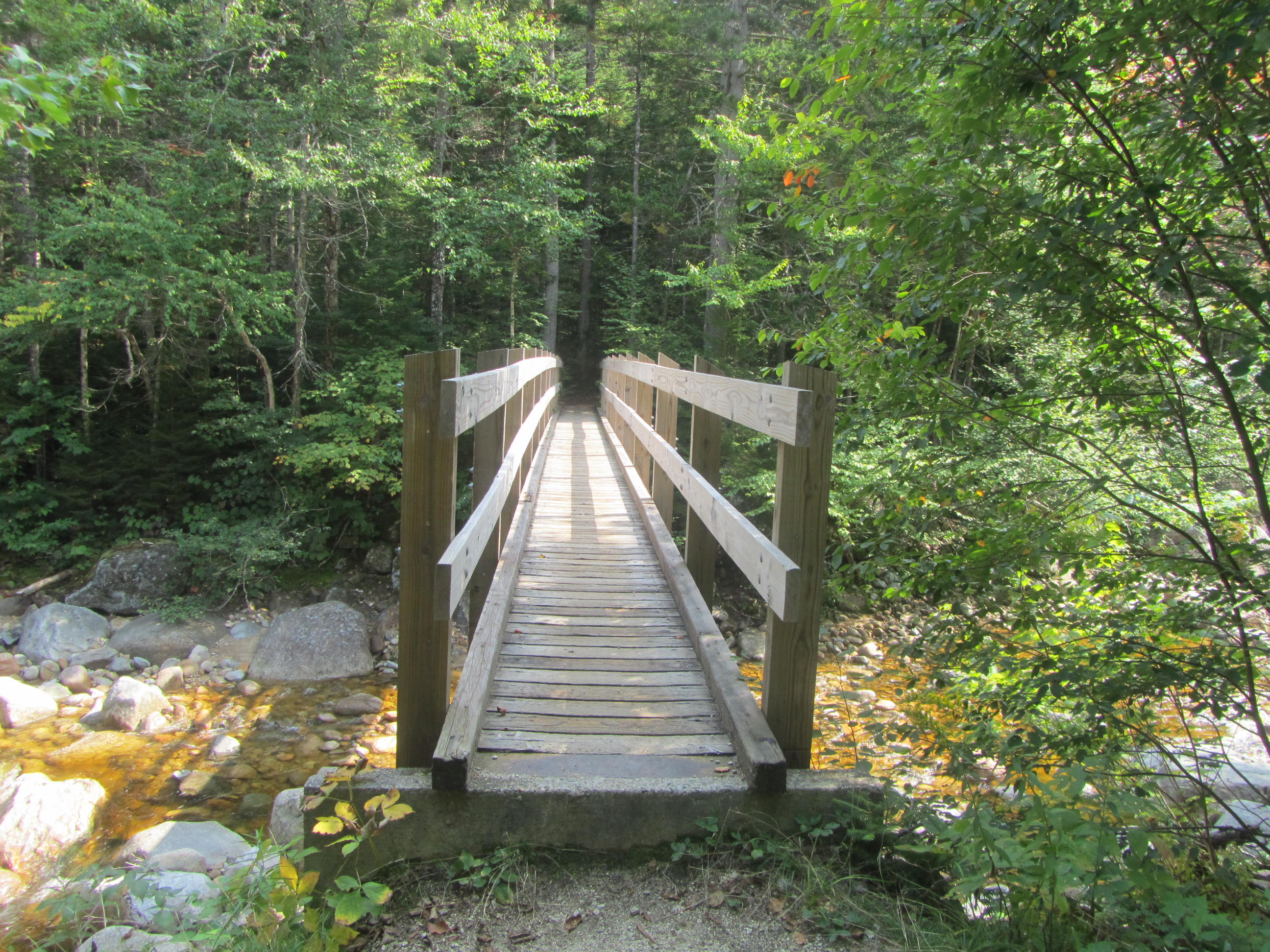
My route had me on the Wilderness Trail for only 1.5 miles. The Wilderness Trail parallels a river over flat terrain. I was more optimistic about finding a place to camp in this stretch. I finally passed a brushed over old trail that headed toward the river with numerous sites to camp. It turns out an old trail at one time crossed the river on a bridge. The bridge has been long since removed and the trail discontinued. The stone bridge pillars still stood however. By the time I reached this spot it was close to 7PM and light was fading. I set up my tent and enjoyed my dinner along the river.
 |
| River by my campsite |
I didn't anticipate hiking so far. I covered close to 25 miles with more than 7,000 vertical feet of climbing over five mountains above 4,000'. Luckily I had fresh legs on my first day. Despite the mileage and climbing, I didn't feel to beat up, just hungry at the end of the day. I certainly slept well.
Day 2
Wilderness Trail- AT near Ethan Pond/Twinway Junction
17.3 Miles
I packed up my gear and hit the trail about 740AM. The weather looked promising for the day. I quickly reached the junction for the Thoreau Falls Trail. With the rain earlier in the week, I was a little nervous about this section. A river crossing early on the Thoreau Falls Trail once had bridge. The bridge has since been removed, requiring a ford. I don't think the ford is too difficult in late summer, but I thought it may be running high after a couple days of rain. Much to my surprise, the river was quite boney and I could easily cross on rocks without getting my feet wet.
 |
| Nice hiking on the Wilderness Trail |
 |
| Start of the Thoreau Falls Trail |
 |
| Old site of the bridge |
 |
| Looking upriver while fording |
The Thoreau Falls Trail runs deep in the Pemi Wilderness. I expected a messy trail with lots of mud and brush. I was pleasantly surprised by the trail however. Its condition was much better than I expected, especially after days of rain. It's a rather scenic trail as well. It travels along wild and rushing mountain streams that are quite pretty.
 |
| Nice view over the North Fork |
 |
| Smooth trail |
 |
| Old logging relics |
 |
| The trail follows old logging roads |
 |
| The North Fork |
 |
| Small cascades on the North Fork |
 |
| The trail follows close to the river at times |
 |
| More cascades |
After five miles the trail reaches its namesake feature, Thoreau Falls. The falls are quite pretty, dropping about 80 feet over a series of cascades and winding slides. The view from the top of the falls takes in the lofty ridge of the Bonds and only adds to the appeal of the area. The falls are a worthy destination and great place to take a rest.
 |
| View from the top of the falls |
 |
| Upper drop of the falls |
 |
| Looking down the falls |
 |
| Looking up the falls |
Shortly after the falls, I left the Pemi and followed the Ethan Pond Trail, which also coincides with the AT. I headed north (which is actually southbound on the AT in this section) toward Zealand Falls Hut and eventually Mt Hale. Along the AT, the trail passes an open area below the crumbling slopes of Whitewall Mountain. In the clearing, you have a nice look at the crumbling jumble of rock of Whitewall, Zeacliff, and Mt Carrigain and the Hancocks to the south.
 |
| Zeacliff from the AT |
 |
| Crumbling slopes of Whitewall Mountain |
 |
| The view south from below Whitewall Mountains |
 |
| Rough section of the AT |
After just a couple miles on the Ethan Falls Trail, I continued on the AT to Zealand Falls Hut. Just prior to the hut a side trail leads to the bottom of Zealand Falls, another scenic waterfall. I took a break at the hut, taking advantage of good drinking water and a bathroom. More cascades tumble near the hut. A nice view from the hut looks to the south.
 |
| Zealand Falls |
 |
| View from the hut |
 |
| More falls above the hut |
 |
| View from the falls |
From the hut, I turned off the AT, making my way to the next mountain on my itinerary, Mt Hale. The climb to Hale went by fairly quickly. Hale has a reputation as one of the easiest 4,000' mountains in NH and can be reached in only 2.2 miles from the north. I was surprised to have the summit to myself. 4,054' Mt Hale isn't the prettiest. A big clearing within the trees doesn't offer any views. An oversized summit cairn sits where a tower once stood.
 |
| Start of the Lend-A-Hand Trail |
 |
| Enroute to Hale |
Almost immediately after arriving at the summit, at least a dozen grey jays emerged from the trees. Grey jays are one of my favorite birds. They have learned to associate people with food and will readily take nuts or fruit from your hand. They were known to live near logging camps back in the day and become tame. Unfortunately I didn't have any jay-worthy food handy. By the time I got some nuts from my pack, they disappeared and lost interest in my presence.
 |
| Summit cairn on Hale |
I descended Hale to the north to Zealand Road. A short mile along Zealand Road brought me to the Zealand Trail. The Zealand Trail offers short access to Zealand Falls Hut over tame terrain. I passed a lot of people hiking out on the Zealand Trail. Despite the tame terrain and hiker traffic, the Zealand Trail is fairly scenic. Along its course, it travels through meadows and ponds along the Zealand River. Long boardwalks seem to enhance to experience.
 |
| Roadside cascade |
 |
| Interesting root system |
 |
| Zeacliff |
 |
| Boardwalk over boggy area |
 |
| Interesting fungi |
Near the end of the Zealand Trail, I had to make a decision. My originally itinerary had me turning onto the A to Z Trail, then over the Willey Range. I covered about 17 miles at this point. Continuing on my route, the next definite camping was about 10 miles away at Ethan Pond. Now 330PM, I didn't have confidence making that distance before dark, with three peaks in between on the Willey Range. I didn't like the prospect of a 27 mile day after a 25 mile day on the rough terrain of the Whites either. I scouted a 1/4 mile or so down the A to Z trail, only to find a very brushy trail. I didn't have confidence I would find a place to camp and I knew once on the Willey Range I would be out of luck for camping. After last nights difficulty finding a campsite, I didn't want to risk a bad night. The boggy Zealand Pond sits at the A to Z Trail/Zealand Trail junction. The area was rather muddy and didn't look like an appealing place to camp. I decided to travel about .3 miles south back to the AT where there was a large area to camp just off the trail.
 |
| Easy trail |
 |
| Boggy part of Zealand River |
 |
| Bridge over Zealand River |
 |
| Marshy area |
I reached the AT campsite around 4PM to find it overrun with numerous tarps and gear, but no people. It looked like a group base camping from the spot. Fortunately there were more sites across a small creek beyond the group. Later when the group returned, I found out a private academy was using the site as a basecamp for a week long orientation in the outdoors. The group was louder than I would have liked and had a large campfire that smelled like burning garbage. I kept to myself and luckily they quieted down by 10PM, a couple hours after I went to bed.
Before I went to bed, I looked over my maps and tried to determine my plan for the next two days. I cut my day shorter than I would have liked to guarantee a place to camp. I had to be at work Sunday morning. I also had a nearly five hour ride back home. Originally I allotted five days for this hike, but the rain pushed my start back two days. This put a 90 mile trip over rugged terrain down to four days with no wiggle room. At this point I figured to play it safe, I needed to cut some distance to make the last two days more manageable. I decided to cut out off about 10 miles of my trip and skip the Willey Range.
Day 3
AT Near Ethan Pond/Twinway Junction- Camp Rich Tent Site
26.6 Miles
From my campsite, I retraced my steps on the AT toward Thoreau Falls. Beyond Thoreau Falls, I continued another .5 miles to the Shoal Pond Trail. I passed by Whitewall Mountain again. Even though I just saw this area the day before, the view was pretty in the morning light. A wisp of fog hung over the valley below the trail.
 |
| Zeacliff in the morning sun |
 |
| Wisp of fog over Whitewall Brook |
 |
| Nice bridge on the AT |
 |
| North Fork |
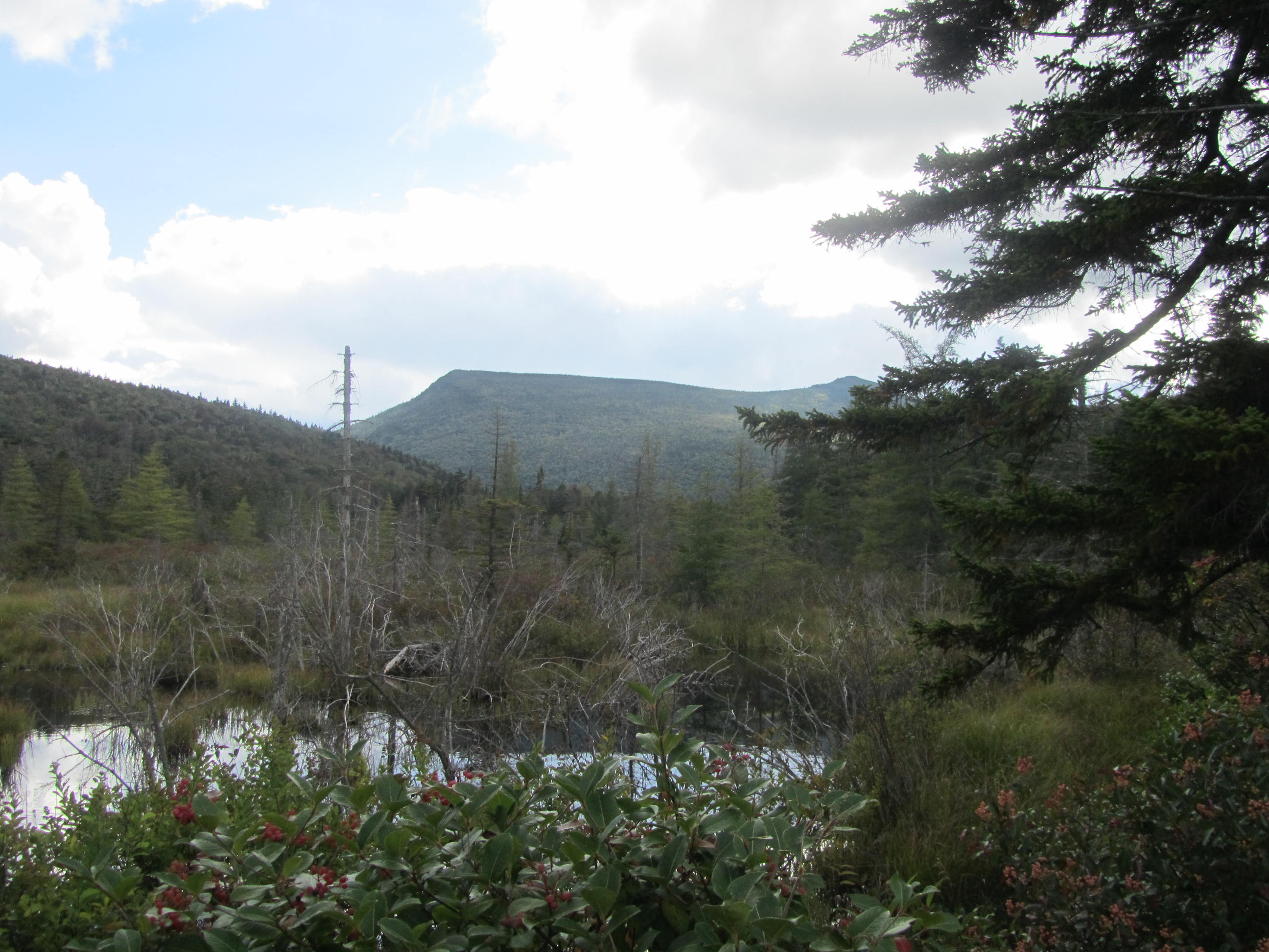
The Shoal Pond Trail has a reputation as an unpleasant trail. I have to say that it lived up to its reputation. The trail starts at the Pemi boundary and travels deep into the Wilderness. The trail was wet and overgrown almost immediately. The upper reaches of the trail are quite muddy with ancient and decaying bog bridges. Fairly quickly, the trail passes its namesake feature. The pond itself isn't too inviting. It looks fairly shallow and is quite boggy around it, making it hard to reach. Over the pond are some nice views, particularly to the south toward Mt Carrigain.
 |
| Start of the Shoal Pond Trail |
 |
| Sign at start of the Pemi |
 |
| Brushy trail |
 |
Some of the better bog bridges on
the Shoal Pond Trail |
 |
| Shoal Pond |
 |
| Carrigain reflecting in Shoal Pond |
Beyond the pond, the conditions didn't improve much. Vegetation was quite dense along the trail, leaving me soaked. It was impossible to not submerge your feet in standing water. Even if you avoided standing water, the roots and bog bridges were extremely slick. I slipped into the water several times. At one point I stepped on a bog bridge that wasn't attached to anything, causing me to immediately sink and submerge my feet. I may have spouted off a profanity or two on this stretch of trail. Occasionally the trail was tough to follow. Periodically the terrain opened up and followed ancient logging roads, but eventually you ended back in the thick vegetation again.
 |
| Messy trail |
 |
| A pretty section of the Shoal Pond Trail |
 |
| Mossy forest |
The trail only runs about 4 miles. After a couple miles conditions improved somewhat, or at least became less consistently bad. After a larger creek crossing the trail entered an area with a lot of step-over logs and tight brush, that happened to be the wettest brush of the trail. Finally the trail reaches Stillwater Junction after another wider creek crossing.
 |
| A slide along the Shoal Pond Trail |
 |
| Interesting section of trail |
 |
| Creek crossing at Stillwater Junction |
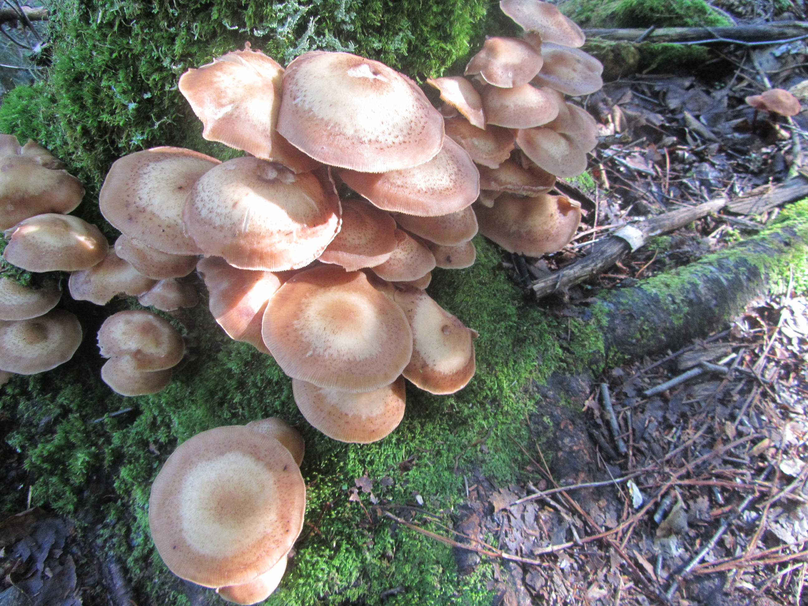
Once off the Shoal Pond Trail, I headed toward Mt Carrigain and the start of the Desolation Trail. The stretch from Stillwater Junction and the start of the Desolation Trail follows a beautiful mountain stream with frequent campsites. This is fairly remote country, deep in the Pemi. The Desolation Trail climbs Carrigain from the north. I stopped to refill my water before making the climb up Carrigain.
 |
| Desolation Trail |
 |
| Fungus enjoying the damp forest |
 |
| Another variety of fungus |
The Desolation Trail climbs Carrigain in about 1.9 miles. These are relentless miles, with 2,500' of elevation gain. The trail starts off mild enough before becoming much steeper. Despite the initial steepness, the tread is fairly smooth. A little over a mile into it, the trail enters bands of rock with a mix of steps and short scrambles that continues the remaining distance to the summit. The air was humid and I was drenched from sweat for my effort.
 |
| Rocky climb toward Carrigain |
 |
| More rough trail |
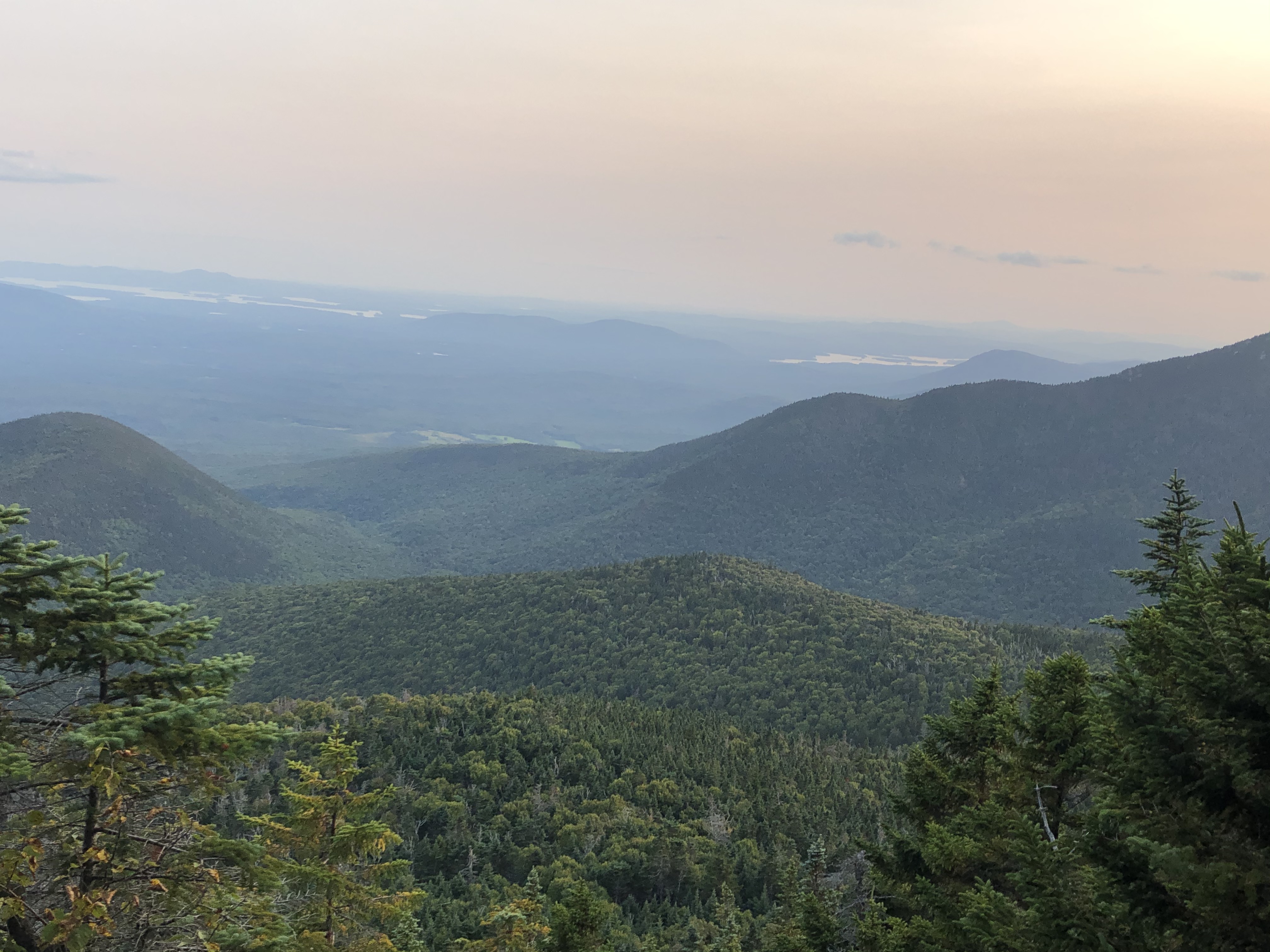
At 4,700', Mt Carrigain stands as the highest summit on my trip and the 13th highest peak in New Hampshire. Up until this point, it was the highest mountain in NH that I haven't climbed. Although Carrigain's summit stands below treeline, it rewards you with some of the best views in the Whites from a observation tower that rises above the trees. It's said that you can see 42 of the 48 4,000' summits of NH from Carrigain. The views are quite impressive. Despite a hazy day, you truly can see quite the expanse from the tower.
 |
| Looking toward the Presidential Range |
 |
| Looking east-southeast |
 |
| Signal Ridge |
 |
| I think looking toward the Osceolas |
 |
| Lafayette Ridge in the distance |
While the views definitely make Carrigain a great place, the grey jays tried to steal the show. Several other hikers were already in the tower when I arrived. When one of them open a food wrapper, the jays emerged from the forest to the tower. This time I had a trail mix pack handy and had some of the birds perched in my hand to eat. In the past I put food on my head to allow the birds to land on head. The trick worked again. It's been probably at least ten years since I had fun with the grey jays.
 |
| My new friend |
 |
| Enjoying my company |
After an extended break and lunch, I descended on the Signal Ridge Trail. Compared to the Desolation Trail, this route is practically a walk in the park. It descends much more gradually along the ridge. Several narrow spots on the ridge provide more nice views.
 |
| Mount Lowell |
 |
| Vose Spur |
 |
| Open terrain on the descent |
 |
Looking back at Carrigain with the
tower visible |
To cut off several miles, I planned on following an old forest road lower on the mountain. On some maps the road is more prominent than others. My AMC map showed it, though less obviously than a Caltopo map I referenced before the trip. When I reached the appropriate spot on the trail I found a brushed over road. Following it a short distance, I came to the conclusion it was and old section of the Signal Ridge Trail that has since been relocated. It wasn't following the right direction and immediately crossed several creeks. I returned to the main trail and soon found another spur that looked more like my route.
 |
| The start of the road is visible |
At first the road appeared obvious, but it quickly became overgrown. Generally, I would call it a herd path at best. A faint tread could be seen as it traveled through brushy, young hardwood saplings. At times the tread disappeared and it became a true bushwhack. To be safe I took out my compass and got a bearing. The most obvious indicator of the route was the canopy was clearly lower where the road once traveled compared to the surrounding forest. This route traveled about 1.6 miles and changed from herd path to bushwhack much of the time, with an occasional short stretch actually resembling a road. Finally the trail dumped me out on Sawyer River Road where I was hoping to end up. My last obstacle was a shallow creek crossing that could be step stoned across. Unfortunately I slipped on a wet rock submerging my feet once again for the day. I wouldn't recommend this route if you are only comfortable following a perfectly defined trail.
 |
| Faint path in the brush |
 |
| Almost road-like here |
 |
| Not much of a discernable path |
I followed the Sawyer River Road about .3 miles to the start of the Sawyer Pond Trail. The Sawyer Pond Trail runs about 6 miles to the Kancamagus Highway. About 1.5 miles into the trail, it reaches Sawyer Pond, which is the last official campsite for a while. It was pretty early and I wasn't ready to stop at Sawyer Pond for the night. I did stop at the pond to enjoy the scenery from the shoreline of the surrounding low mountains.
 |
| Sawyer River Road |
 |
| Start of the Sawyer Pond Trail |
 |
| Bridge over the Sawyer River |
 |
| Sawyer River |
 |
| Cascade along the Sawyer Pond Trail |
 |
| Sawyer Pond |
The terrain on the Sawyer Pond Trail allowed for good mileage as it traveled on mostly flat terrain. I had plenty of energy and daylight. From the Pond it was less than 5 miles to the Kancamagus Highway. The highway would put me at just over 20 miles on the day. I set a time in my head, if I reach the road by 4PM, I'd hike the extra 5 or so miles to the Camp Rich tentsite near Mt Passaconway. If it was after 4, I'd find a spot near the road crossing.
 |
| Gentle trail on old woods road |
 |
| Interesting trees |
Just before the highway, the trail crosses the Swift River. I arrived here about 350PM, I guess I was off to Camp Rich. The Swift River was the deepest water crossing on my route. I took off my shoes to cross the eight or so inch deep water. I took a break for a few minutes before I continued.
 |
| Swift River ford |
From the end of the Sawyer Pond Trail, a 1/4 mile or so road walk along the Kancamagus brings you to the start of the Oliverian Brook Trail. I followed Oliverian Brook to the Passaconway Cutoff Trail. From the road to the top of Mt Passaconway, the route travels about 5 miles and gains about 2,800'. I was surprised at how docile the terrain was, particularly along the pretty Oliverian Brook Trail. Along this stretch the route enters the Sandwich Range Wilderness.
 |
| Along the Kancamagus |
 |
| Oliverian Brook Trail |
 |
| Entering the Sandwich Range Wilderness |
After about 3.6 miles, I turned onto the Square Ledge Trail and the docile terrain became rough quickly. At this point the route climbs relentlessly as it makes its way toward Passaconway. A 1.3 mile loop goes over Passaconway. My plan was to bypass Passaconway to set up camp and climb it first thing in the morning. As I reached the junction for the loop, I still had a decent amount of light and decided to hit the summit and possibly catch a pretty sky as the sun began to set. The campsite was only .6 miles, all downhill, from the summit.
 |
| Whiteface |
 |
| The Lake District in the distance |
I headed up the east loop of Passaconway, which travels about .7 miles to the summit. The climbing was still relentless. The difficulty was compounded by the 25 or so miles I had hiked for the day already. It was fairly humid and I was drenched in sweat. I passed a couple of ledges with views and finally topped out near the summit. I knew of a summit view spur near the summit and followed it. It seemed to have dropped a fair amount of elevation to get the view over .3 miles. .3 miles may not sound like much but I was tired and hungry. While the view is good, it looked north and didn't really capture the setting sun.
 |
| North from Passaconway with Carrigain in the center |
 |
| Chocorua |
 |
| Mount Washington in the distance |
I trudged back to the loop. I followed a short spur to the summit proper before descending to the campsite. A few more ledges offered views toward Whiteface and the Lake District to the south. I arrived at the tentsite right around 7PM after covering more than a marathon distance for the day, 26.6 miles not including any side trips. I originally didn't plan on such a long day, but I knew I would wrap up my hike tomorrow at a reasonable time and get home with enough time to wind down before working the following day.
 |
| Looking across the Bowl |
Camp Rich sits pretty high at roughly 3,500-3,600' or so. After gushing sweat on the climb, I was quite chilly. I put on my fleece shirt, jacket, and the legs on my shorts while I set up camp and prepared my dinner. Given the campsites high location, I even had cell service and called home to let Puma know was alive and my location. I was actually surprised nobody else was at the campsite on a Friday since it sits between two 4,000' mountains. I had absolutely no difficulty sleeping after the high mileage day.
Day 4
Camp Rich Tentsite- Waterville Valley
12.4 Miles
My final morning, I was on the trail about 730AM. The weather was fairly clear, albeit hazy and humid. Despite having three more 4,000' peaks ahead of me, my higher elevation start meant that I had no major climbs for the day.
 |
| Whiteface in the morning sun |
My first peak of the day was 4,020' Whiteface. I reached Whiteface pretty quickly since I didn't climb from the valley and it stood less than three miles from my campsite. Despite a few hazy views from ledges along the way, you wouldn't know you reached the summit except for a small cairn. The summit is heavily treed.
 |
| Passaconway |
 |
| Fog over the Lakes District |
 |
| Pretty high elevation forest |
 |
| Lackluster summit of Whiteface |
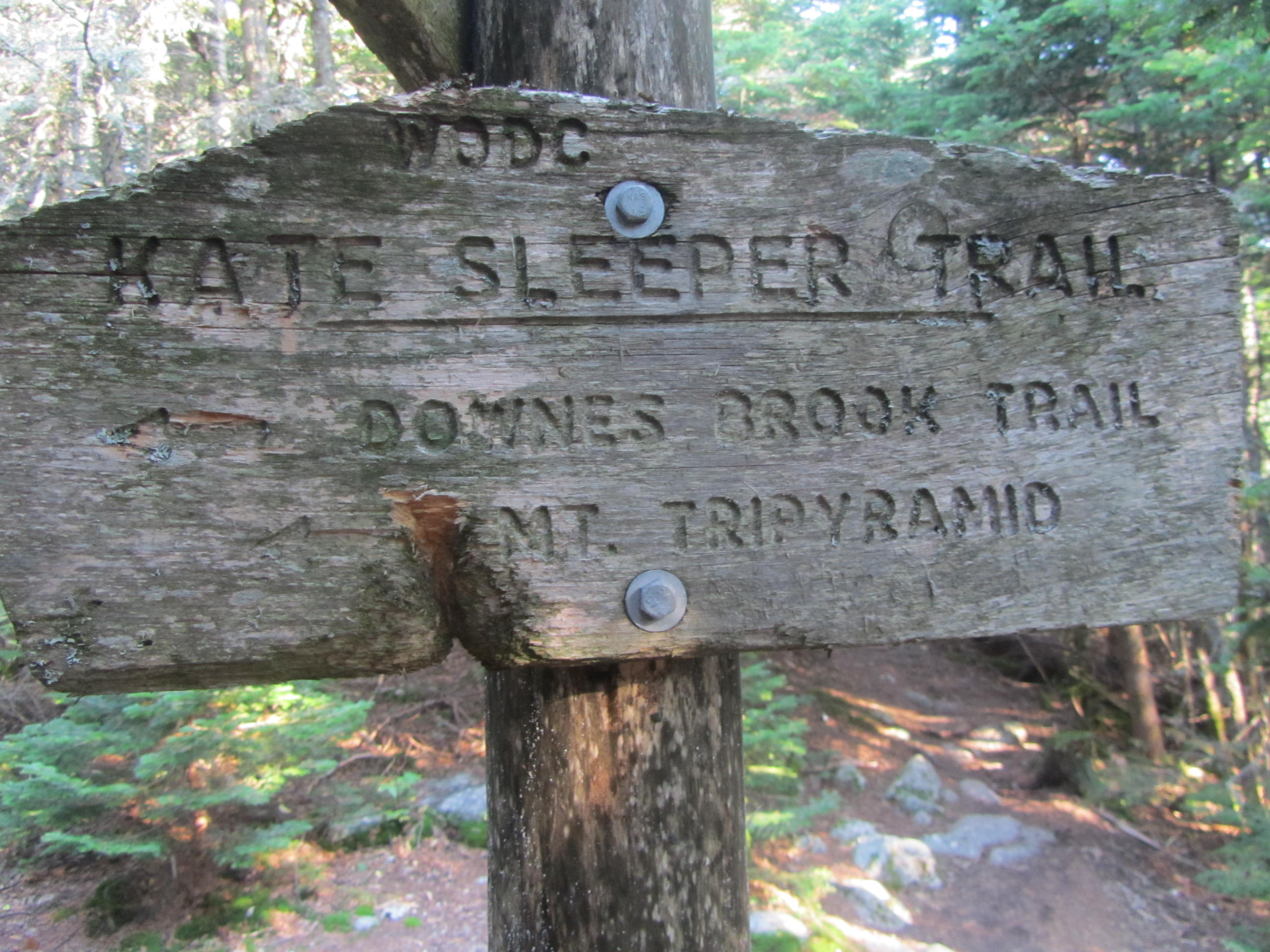
My next trail was the Kate Sleeper Trail, which sits just a couple tenths of a mile below Whiteface. Before setting off on the Sleeper Trail, I headed a short distance beyond the junction to a large, open rock ledge that provided pretty impressive views toward the south and east.
 |
View from ledges just south
of Whiteface |
 |
| Closeup of the lakes |
Back on the Sleeper Trail, I continued west toward the Tripyramids. Compared to the trail between Passaconway and Whiteface, the Sleeper Trail appeared far less used. After an initial descent, the Sleeper Trail climbs modestly toward East and West Sleeper Mountains. Along the way the trail travels through wet areas as well as brushy vegetation. The brushy vegetation consists of thorny raspberries which are quite scratchy on the legs. I was surprised to see a few ripe berries on the plants this late in the season.
 |
| Start of the Sleeper Trail |
 |
| Late season berries |
I took an unmarked side trail that led a short distance to 3,840' East Sleeper Mountain. East Sleeper stands high enough to rank as number 86 on New England's 100 Highest List. Despite this designation and elevation, the summit is viewless and the short spur to it brushy and scratchy. Not far beyond East Sleeper, the Sleeper Trail climbs over the slightly higher, 3,881' West Sleeper Mountain. Despite its higher elevation, West Sleeper doesn't have enough prominence to be a ranked peak. West Sleeper offers nothing in the way of views.
 |
| Lackluster summit of East Sleeper |
 |
| Open trail between the Sleepers |
Beyond West Sleeper, the Sleeper Trail drops as it approaches the South Tripyramid. Near its end, the trail dumps out onto the South Tripyramid Slide and the Mt. Tripyramid Trail. The trail climbs steeply up the slide following blazes and cairns. Nice views from the slide make the challenging section worth the effort. The Mt. Tripyraid Trail follows a popular loop. Since it was a nice Saturday morning, I saw a steady flow of people the rest of the day.
 |
| Sandwich Mountain |
 |
| South Slide |
 |
| View hiking up the slide |
 |
| Waterville Valley Ski Area on Tecumseh |
A short distance up the slide ends at the unranked summit of 4,090' South Tripyramid. After a short drop into a col, the trail climbed to the 4,140' summit of Middle Tripyramid. A small window from Middle Tripyramid looked toward Passaconway. Another brief descent into a col followed before climbing my last peak of my trip, 4,180' summit of North Tripyramid.
 |
| Looking down the slide |
 |
| At the top of the slide |
 |
| One last look toward the lakes |
By the time I reached North Tripyramid it was well into the morning. The summit was teaming with over a dozen people, including a large group in military uniform. If there were views near the summit I didn't see them. I ate a quick snack and left the summit quickly, not wanting to linger at a high point in the woods with a bunch of strangers.
There are two trails descending North Tripyramid toward Waterville Valley. The Mt. Tripyramid Trail descends a steep slide requiring scrambling. The other takes a the more gradual Scaur Ridge Trail. Despite potential views on the slide, it's used almost exclusively for climbing not descending due to steep, slabby pitches. I chose to descend on the Scaur Ridge Trail. The Scaur Ridge Trail offers little in the way of views, but is the preferred descent and was pretty easy.
After the Scaur Ridge Trail, I reached the Livermore Trail. Despite being called a trail, the Livermore trail is a dirt road. I followed it about 3.5 miles to its end near Waterville Valley. Since it is a dirt road, and nearly all downhill, the hiking along it goes by quickly. It follows streams most of the way with a few nice cascades. There are options to diverge from the Livermore Trail onto the trails near Waterville Valley. I didn't use these trails, but they may provide a more scenic option.
 |
| End of the Scaur Ridge Trail |
 |
| Livermore Trail |
 |
| Pretty falls along the Livermore Trail |
At the end of the Livermore Trail, I reached a road. A brief, couple minute walk brought me to a local bike trail called the Pipeline Trail. The Pipeline Trail traveled the last .6 miles of my hike to the parking lot at Waterville Valley Ski Area and my van. I finished my hike around 115PM. Before heading off from the trailhead, I splashed down my legs and feet in the creek near the trailhead and changed into a much less smelly set of clothes for the nearly five hour drive home.
 |
Final connection back to the beginning
of my hike |
Afterward
All said and done, my hike covered more than 81 miles (not including 1-2 miles in side trips) over four days. I climbed 11 4,000' peaks, a ranked peak of the New England 100 Highest, and a couple of additional unranked mountains. Over the course of the hike, I climbed more than 21,000 vertical feet.
 |
| Grey jay |
Even though I had to eliminate a ten mile stretch of trail from my original plans due to time, I managed to have a pretty good trip. I still accomplished my goal to cover new terrain that I haven't visited before while climbing as many peaks along the way as I could manage. I also enjoy planning my own route on trips like this. This route worked out pretty well.
 |
| Carrigain view toward Lafayette |
Other than the first five hours or so of this trip that saw mist and rain, the weather stayed dry the rest of the hike. The night were never too cool, staying 50F or above. The days were a little warm after the rain, climbing to the 80s in the valleys. For September, the days were on the hazy and humid side for New Hampshire. I heard some of the haze may be attributed to Western wildfires. Perhaps the biggest weather oddity was the lack of wind. Nearly the entire hike was dead calm, even the summits. This is unusual in the Whites.
Having backpacked quite a few miles in the Whites by this point, I knew what to expect for terrain and conditions. Other than the particularly muddy and brushy conditions on the Cedar Brook and Shoal Pond Trails, nothing really caught me by surprise. Living in the Adirondacks, I'm fairly used to those conditions.
 |
| One last shot with my hiking partner |
If you enjoyed this post, check out and "LIKE" Tomcat's Outdoor Adventures on
Facebook where I post photos more often and revisit past adventures.